MyTopo
Morehouseville New York US Topo Map
Couldn't load pickup availability
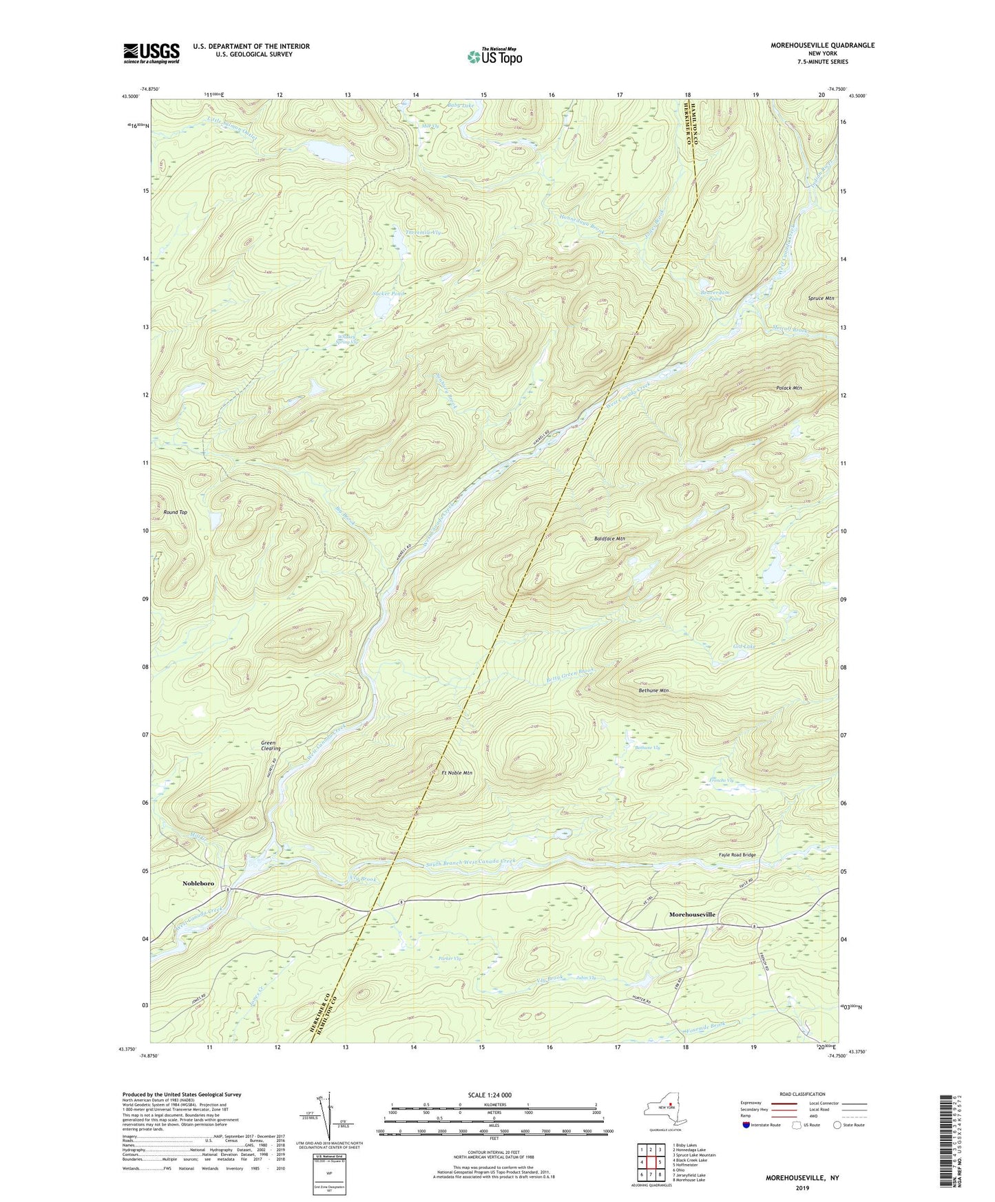
2023 topographic map quadrangle Morehouseville in the state of New York. Scale: 1:24000. Based on the newly updated USGS 7.5' US Topo map series, this map is in the following counties: Herkimer, Hamilton. The map contains contour data, water features, and other items you are used to seeing on USGS maps, but also has updated roads and other features. This is the next generation of topographic maps. Printed on high-quality waterproof paper with UV fade-resistant inks.
Quads adjacent to this one:
West: Black Creek Lake
Northwest: Bisby Lakes
North: Honnedaga Lake
Northeast: Spruce Lake Mountain
East: Hoffmeister
Southeast: Morehouse Lake
South: Jerseyfield Lake
Southwest: Ohio
This map covers the same area as the classic USGS quad with code k43074d7.
Contains the following named places: Baby Lake, Baldface Mountain, Beaverdam Pond, Bethune Mountain, Bethune Vly, Betty Green Brook, Big Brook, Fayle Road Bridge, Fort Noble Mountain, Frenchs Vly, Gid Lake, Green Clearing, Honnedaga Brook, Indian River, Jones Brook, Jubin Vly, Little Salmon Lake, Metcalf Brook, Mile Vly, Mill Creek, Morehouseville, Nobleboro, Parker Vly, Polack Mountain, Round Top, Seabury Brook, South Branch West Canada Creek, Sucker Pond, Threemile Vly, Vly Brook, Whiskey Spring Vly