MyTopo
Blue Ridge New York US Topo Map
Couldn't load pickup availability
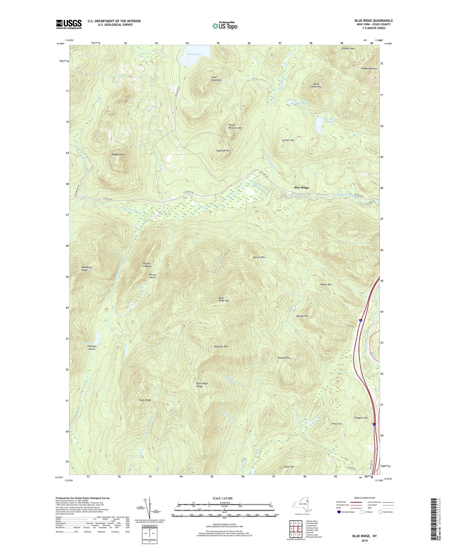
2019 topographic map quadrangle Blue Ridge in the state of New York. Scale: 1:24000. Based on the newly updated USGS 7.5' US Topo map series, this map is in the following counties: Essex. The map contains contour data, water features, and other items you are used to seeing on USGS maps, but also has updated roads and other features. This is the next generation of topographic maps. Printed on high-quality waterproof paper with UV fade-resistant inks.
Quads adjacent to this one:
West: Cheney Pond
Northwest: Mount Marcy
North: Dix Mountain
Northeast: Underwood
East: Paradox Lake
Southeast: Pharaoh Mountain
South: Schroon Lake
Southwest: Minerva
Contains the following named places: Aber Brook, Big Marsh, Big Marsh Pond, Blue Ridge, Blue Ridge Mountain, Blue Ridge Range, Clear Pond, Clear Pond Mountain, Dirgylot Hill, Hoffman Mountain, Hoffman Notch, Hoffman Notch Brook, Hornet Cobbles, Hornet Notch, Jones Hill, LeClair Hill, Little Marsh Pond, Marsh Pond Mountain, Niagara Brook, Nippletop Mountain, Peaked Hills, Ragged Mountain, Sand Pond Brook, Saywood Hill, Smith Hill, Spruce Mountain, Squaw Mountain, Texas Ridge, The Gulf Brook, Three Brothers Mountain, Wyman Hill