MyTopo
Brandreth Lake New York US Topo Map
Couldn't load pickup availability
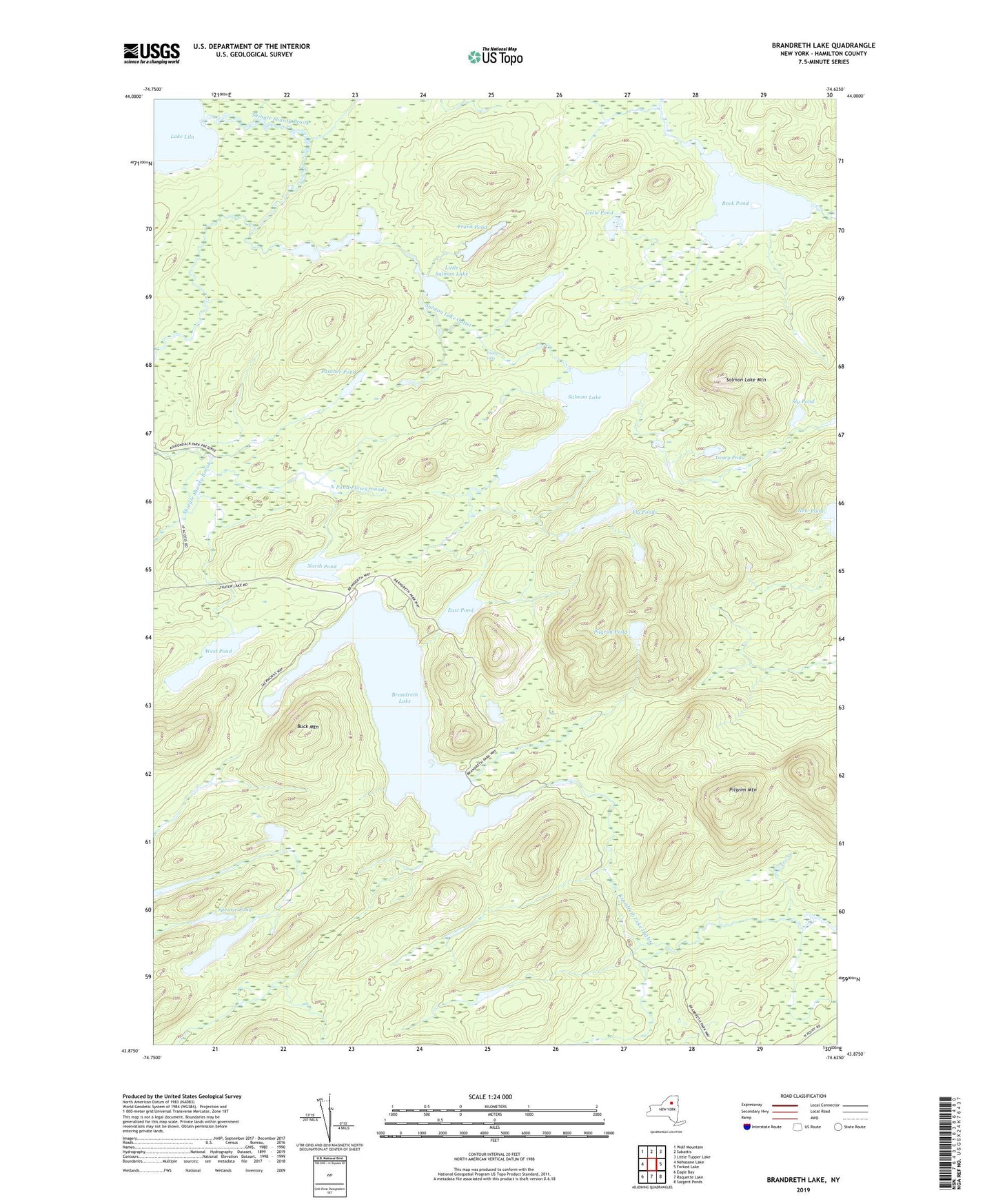
2019 topographic map quadrangle Brandreth Lake in the state of New York. Scale: 1:24000. Based on the newly updated USGS 7.5' US Topo map series, this map is in the following counties: Hamilton. The map contains contour data, water features, and other items you are used to seeing on USGS maps, but also has updated roads and other features. This is the next generation of topographic maps. Printed on high-quality waterproof paper with UV fade-resistant inks.
Quads adjacent to this one:
West: Nehasane Lake
Northwest: Wolf Mountain
North: Sabattis
Northeast: Little Tupper Lake
East: Forked Lake
Southeast: Sargent Ponds
South: Raquette Lake
Southwest: Eagle Bay
Contains the following named places: Brandreth Lake, Buck Mountain, East Pond, Fly Ponds, Frank Pond, Hardigan Pond, Lilypad Pond, Little Salmon Lake, Louie Pond, Mud Pond, Negrohead Mountain, North Pond, North Pond Flowgrounds, Panther Pond, Pilgrim Mountain, Pilgrim Pond, Punky Pond, Rock Pond, Salmon Lake, Salmon Lake Mountain, Salmon Lake Outlet, Shingle Shanty Brook, Sly Pond, South Pond, Spearie Pond, Touey Falls, Touey Pond, West Pond