MyTopo
Byron New York US Topo Map
Couldn't load pickup availability
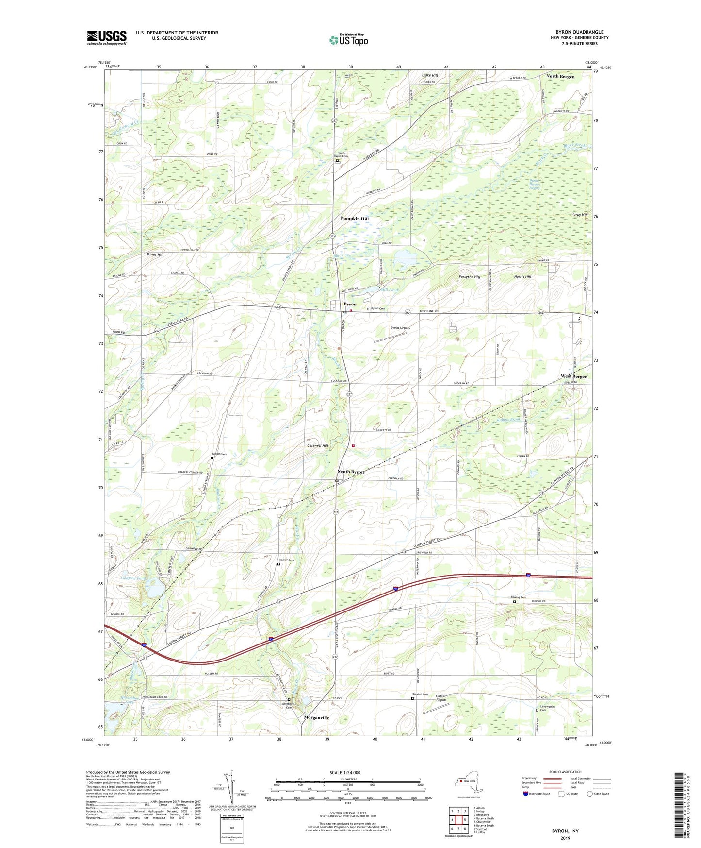
2023 topographic map quadrangle Byron in the state of New York. Scale: 1:24000. Based on the newly updated USGS 7.5' US Topo map series, this map is in the following counties: Genesee. The map contains contour data, water features, and other items you are used to seeing on USGS maps, but also has updated roads and other features. This is the next generation of topographic maps. Printed on high-quality waterproof paper with UV fade-resistant inks.
Quads adjacent to this one:
West: Batavia North
Northwest: Albion
North: Holley
Northeast: Brockport
East: Churchville
Southeast: Le Roy
South: Stafford
Southwest: Batavia South
This map covers the same area as the classic USGS quad with code o43078a1.
Contains the following named places: Bethel Baptist Church of Bergen, Big O Farms, Bigelow Creek, Byron, Byron - Bergen Elementary School, Byron - Bergen High School, Byron - Bergen Middle School, Byron Airpark, Byron Cemetery, Byron Fire Department, Byron Post Office, Byron Presbyterian Church, Byron-Bergen Swamp, Casswell Hill, Forsythe Hill, Godfrey Pond, Harris Hill, Horseshoe Lake, Langworthy Cemetery, Lidke Hill, Mill Pond, Morganville, Morganville Cemetery, Morganville United Church of Christ, North Bergen, North Byron Cemetery, Pumpkin Hill, Randall Cemetery, Schafer Potato Farms, School Number 1, School Number 2, School Number 3, Sodom Cemetery, South Byron, South Byron Post Office, South Byron Volunteer Fire Company, Southwoods Recreational Vehicle Resort, Spring Creek, Stafford Airport, Thwing Cemetery, Tower Hill, Town of Byron, Walker Cemetery, West Bergen, ZIP Code: 14422