MyTopo
Chateaugay New York US Topo Map
Couldn't load pickup availability
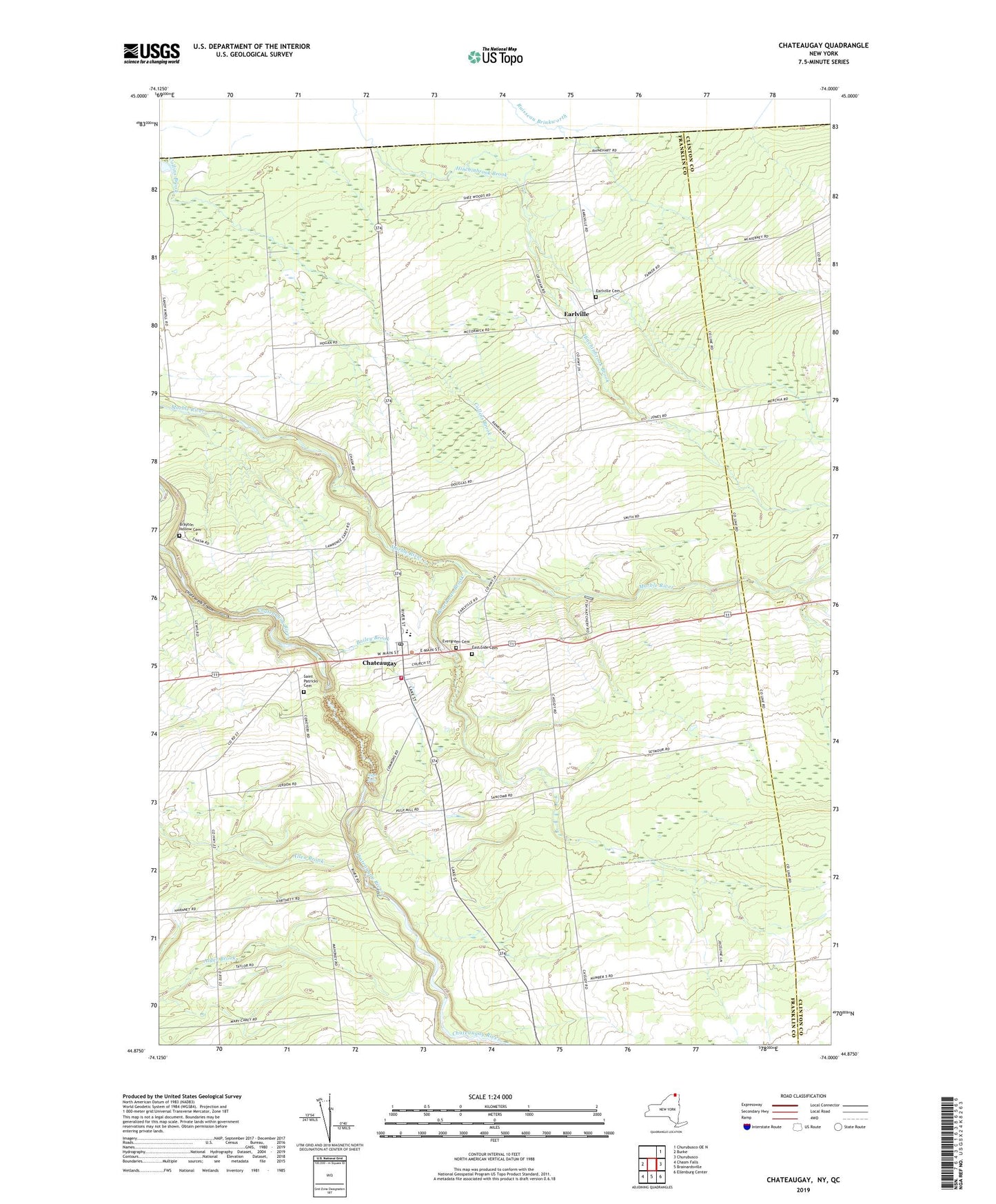
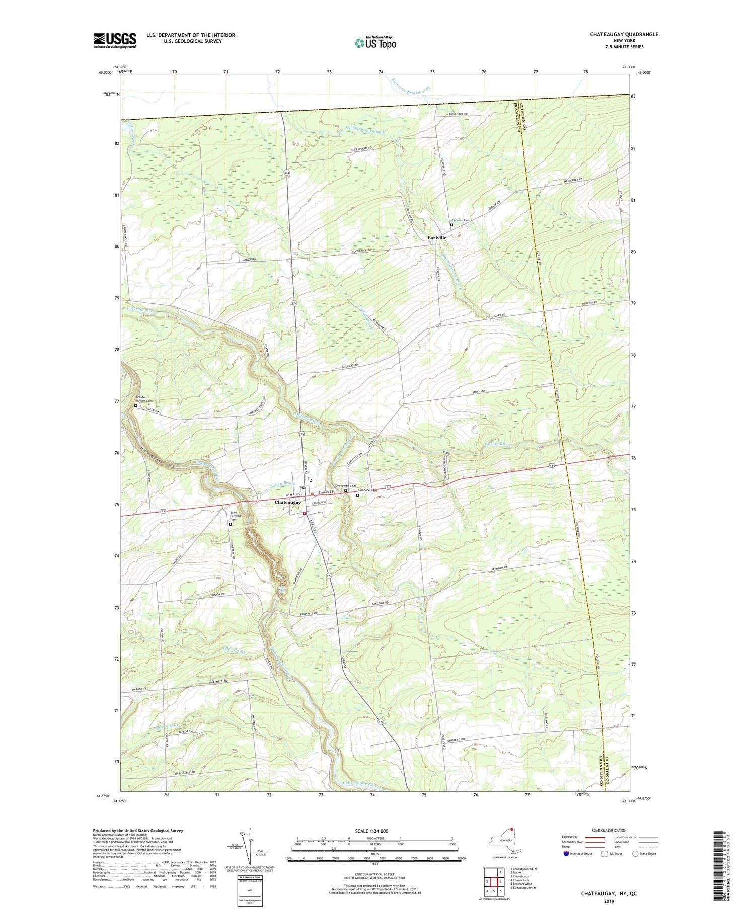
2019 topographic map quadrangle Chateaugay in the state of New York. Scale: 1:24000. Based on the newly updated USGS 7.5' US Topo map series, this map is in the following counties: Franklin, Clinton. The map contains contour data, water features, and other items you are used to seeing on USGS maps, but also has updated roads and other features. This is the next generation of topographic maps. Printed on high-quality waterproof paper with UV fade-resistant inks.
Quads adjacent to this one:
West: Burke
Northeast: Churubusco OE N
East: Churubusco
Southeast: Ellenburg Center
South: Brainardsville
Southwest: Chasm Falls
Contains the following named places: Bailey Brook, Boardman Brook, Brayton Hollow Cemetery, Chateau Hotel, Chateaugay, Chateaugay Central School, Chateaugay Chasm, Chateaugay Correctional Facility, Chateaugay Fire Department, Chateaugay High School, Chateaugay Memorial Library, Chateaugay Park, Chateaugay Port of Entry, Chateaugay Post Office, Chateaugay State Fish Hatchery, Chateaugay Town Hall, Chateaugay Village Wastewater Treatment Plant, Dry Brook, Earlville, Earlville Cemetery, East Side Cemetery, Evergreen Cemetery, First Methodist Church of Chateaugay, First Presbyterian Church, High Falls, High Falls Park Campground, Irish School, Saint Patricks Cemetery, Saint Patrick's Roman Catholic Church, School Number 12, School Number 13, School Number 14, School Number 16, School Number 17, School Number 2, School Number 3, School Number 4, School Number 5, School Number 7, School Number 8, School Number 9, Town of Chateaugay, Village of Chateaugay, ZIP Code: 12920