MyTopo
Churubusco New York US Topo Map
Couldn't load pickup availability
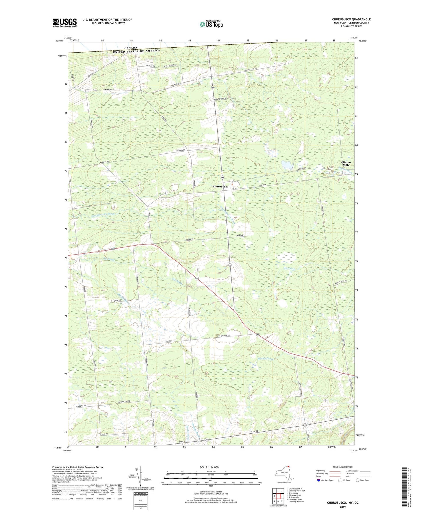
2023 topographic map quadrangle Churubusco in the state of New York. Scale: 1:24000. Based on the newly updated USGS 7.5' US Topo map series, this map is in the following counties: Clinton. The map contains contour data, water features, and other items you are used to seeing on USGS maps, but also has updated roads and other features. This is the next generation of topographic maps. Printed on high-quality waterproof paper with UV fade-resistant inks.
Quads adjacent to this one:
West: Chateaugay
North: Churubusco OE N
Northeast: Ellenburg Depot OE N
East: Ellenburg Depot
Southeast: Ellenburg Mountain
South: Ellenburg Center
Southwest: Brainardsville
This map covers the same area as the classic USGS quad with code o44073h8.
Contains the following named places: Boomhower School, Churubusco, Churubusco Post Office, Clinton Mills, Cold Spring School, Fahey School, Liberty Pole School, Nichols School, Town of Clinton, Whalen School, ZIP Code: 12923