MyTopo
Ellenburg Center New York US Topo Map
Couldn't load pickup availability
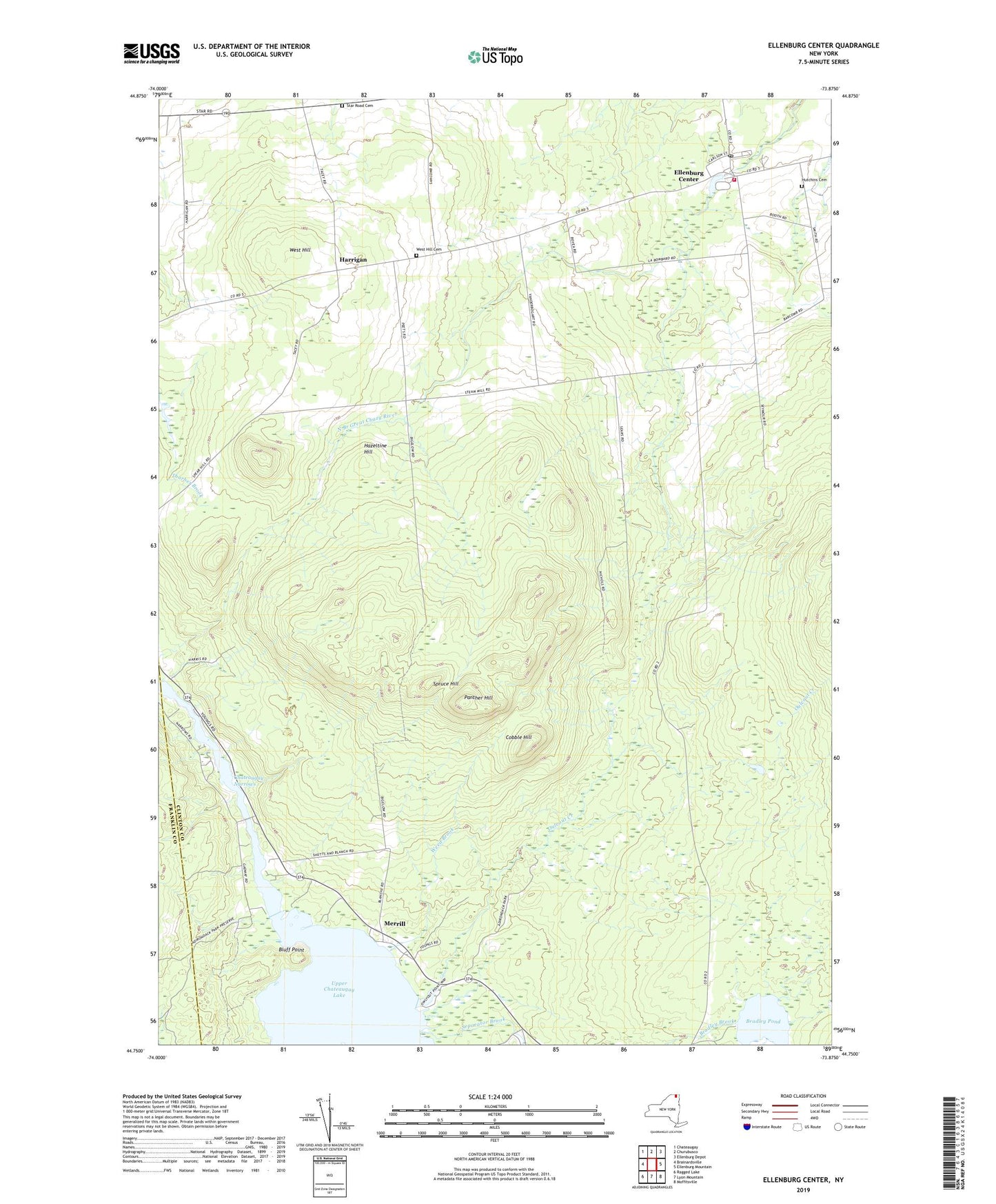
2023 topographic map quadrangle Ellenburg Center in the state of New York. Scale: 1:24000. Based on the newly updated USGS 7.5' US Topo map series, this map is in the following counties: Clinton, Franklin. The map contains contour data, water features, and other items you are used to seeing on USGS maps, but also has updated roads and other features. This is the next generation of topographic maps. Printed on high-quality waterproof paper with UV fade-resistant inks.
Quads adjacent to this one:
West: Brainardsville
Northwest: Chateaugay
North: Churubusco
Northeast: Ellenburg Depot
East: Ellenburg Mountain
Southeast: Moffitsville
South: Lyon Mountain
Southwest: Ragged Lake
This map covers the same area as the classic USGS quad with code o44073g8.
Contains the following named places: Barrow School, Bell School, Bluff Point, Bradley Pond, Chateaugay Narrows, Cobble Hill, Ellenburg Center, Ellenburg Center Fire Department, Ellenburg Center Post Office, Gregory School, Hammond School, Harrigan, Hazeltine Hill, Hogan School, Hutchins Cemetery, Merrill, Moffitt Island, Ouleout Creek, Panther Hill, Separator Brook, Spruce Hill, Star, Star Road Cemetery, Steam Mill School, Town of Ellenburg, Weed Brook, West Hill, West Hill Cemetery, West Hill School, ZIP Code: 12955