MyTopo
Chippewa Bay New York US Topo Map
Couldn't load pickup availability
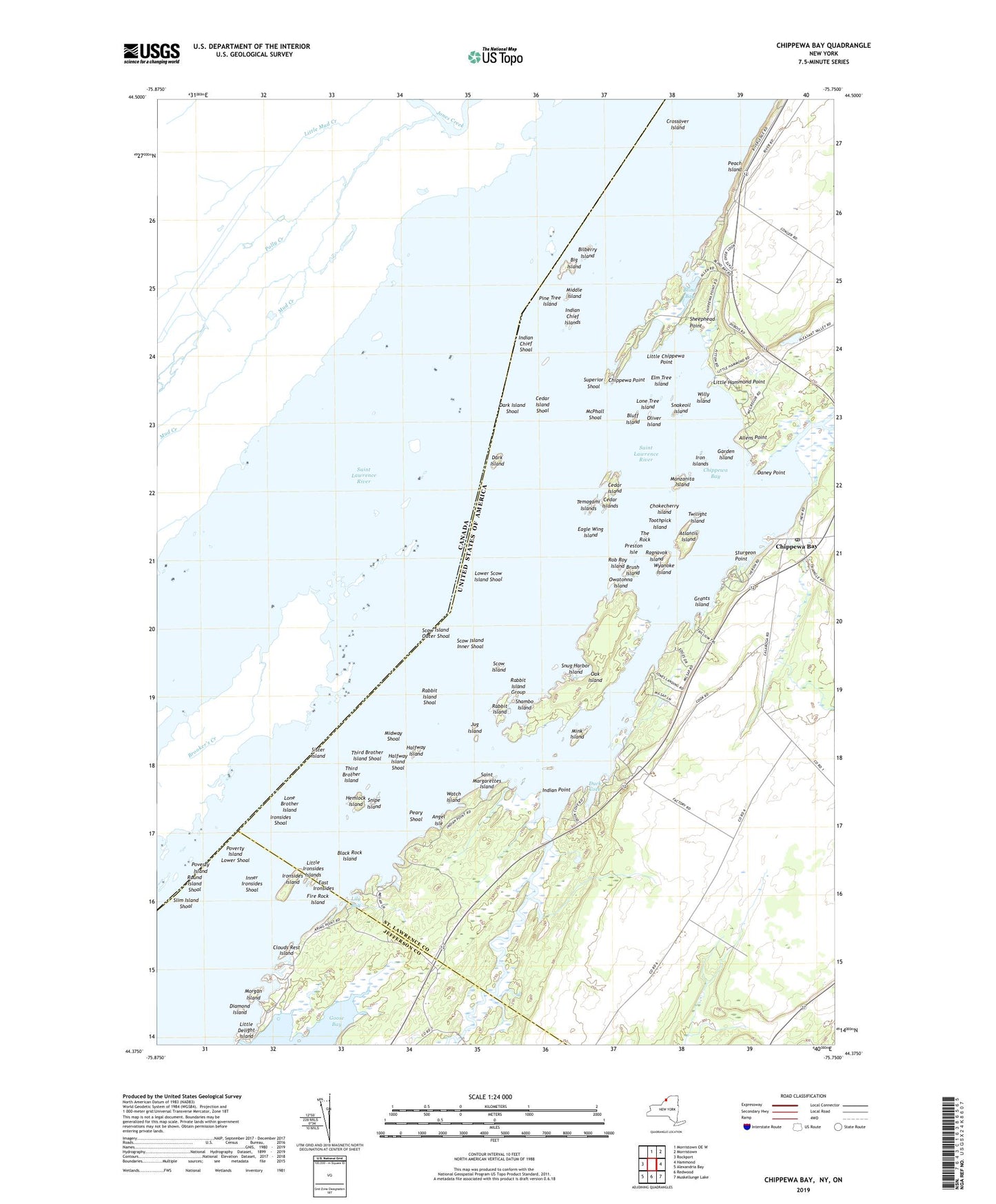
2023 topographic map quadrangle Chippewa Bay in the state of New York. Scale: 1:24000. Based on the newly updated USGS 7.5' US Topo map series, this map is in the following counties: St. Lawrence, Jefferson. The map contains contour data, water features, and other items you are used to seeing on USGS maps, but also has updated roads and other features. This is the next generation of topographic maps. Printed on high-quality waterproof paper with UV fade-resistant inks.
Quads adjacent to this one:
West: Rockport
North: Morristown OE W
Northeast: Morristown
East: Hammond
Southeast: Muskellunge Lake
South: Redwood
Southwest: Alexandria Bay
This map covers the same area as the classic USGS quad with code o44075d7.
Contains the following named places: Allens Point, Angel Isle, Atlantis Island, Big Island, Bilberry Island, Black Rock Island, Blind Bay, Bluff Island, Brush Island, Cedar Island, Cedar Island Shoal, Cedar Island State Park, Cedar Islands, Chippewa Bay, Chippewa Bay Post Office, Chippewa Creek, Chippewa Point, Chippewa Yacht Club, Chokecherry Island, Clouds Rest Island, Crooked Creek, Crossover Island, Daney Point, Dark Island, Dark Island Shoal, Denmor Farms, Diamond Island, Duck Cove, Eagle Wing Island, East Ironsides, Elm Tree Island, Fire Rock Island, Garden Island, Grants Island, Halfway Island, Halfway Island Shoal, Hemlock Island, Indian Chief Islands, Indian Chief Shoal, Indian Point, Inner Ironsides Shoal, Iron Islands, Ironsides Island, Ironsides Shoal, Jug Island, Kring Point State Park, Lily Bay, Little Chippewa Point, Little Delight Island, Little Hammond Point, Little Ironsides Islands, Lone Brother Island, Lone Tree Island, Lower Scow Island Shoal, Manzanita Island, McPhall Shoal, Middle Island, Midway Shoal, Mink Island, Morgan Island, Oak Island, Oliver Island, Owatonna Island, Peach Island, Peary Shoal, Pine Tree Island, Poverty Island, Poverty Island Lower Shoal, Preston Isle, Rabbit Island, Rabbit Island Group, Rabbit Island Shoal, Ragnavok Island, Rob Roy Island, Round Island Shoal, Saint Margarettes Island, Schermerhorn Landing, School Number 6, Scow Island, Scow Island Inner Shoal, Scow Island Outer Shoal, Shambo Island, Sheephead Point, Sister Island, Sister Island Light, Slim Island Shoal, Snake Oil Island, Snakeoil Island, Snipe Island, Snug Harbor Island, Sturgeon Point, Superior Shoal, Temagami Islands, The Rock, Third Brother Island, Third Brother Island Shoal, Third Brother Lighthouse, Toothpick Island, Twilight Island, Watch Island, Willy Island, Wyanoke Island, ZIP Code: 13623