MyTopo
Morristown New York US Topo Map
Couldn't load pickup availability
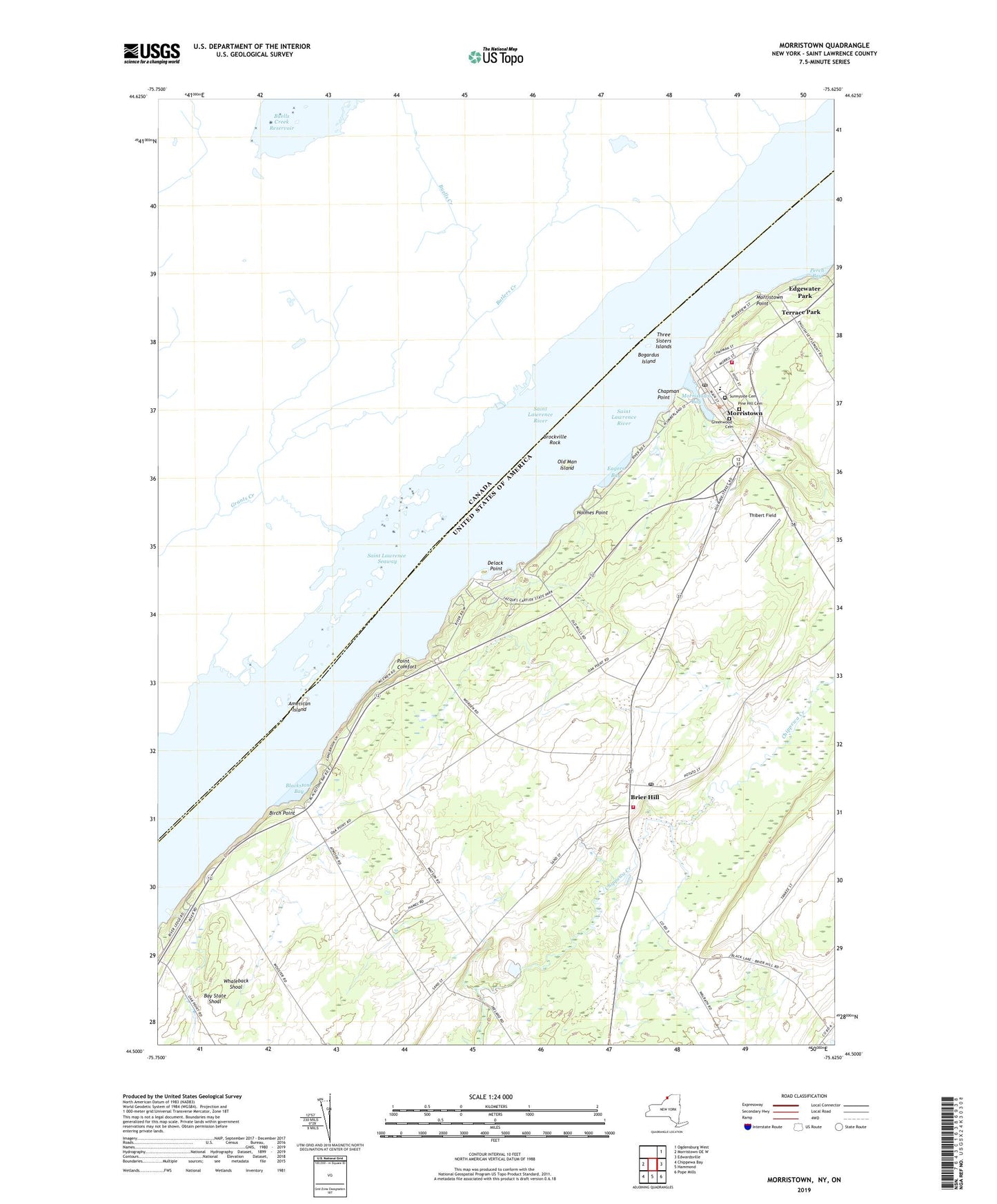
2023 topographic map quadrangle Morristown in the state of New York. Scale: 1:24000. Based on the newly updated USGS 7.5' US Topo map series, this map is in the following counties: St. Lawrence. The map contains contour data, water features, and other items you are used to seeing on USGS maps, but also has updated roads and other features. This is the next generation of topographic maps. Printed on high-quality waterproof paper with UV fade-resistant inks.
Quads adjacent to this one:
West: Morristown OE W
Northeast: Ogdensburg West
East: Edwardsville
Southeast: Pope Mills
South: Hammond
Southwest: Chippewa Bay
This map covers the same area as the classic USGS quad with code o44075e6.
Contains the following named places: American Island, Bay State Shoal, Birch Point, Blackstone Bay, Bogardus Island, Brier Hill, Brier Hill Fire Department, Brier Hill Post Office, Brier Hill Station, Brockville Rock, Central School, Chapman Point, Chippewa Station Church, Delack Point, Eagers Bay, Edgewater Park, Greenwood Cemetery, Halls Dock, Holmes Point, Jacques Cartier State Park, Louce Creek, Morristown, Morristown Bay, Morristown Census Designated Place, Morristown Fire Department, Morristown Point, Morristown Post Office, Morristown Public Library, Oak Point Shoal, Old Man Island, Perch Bay, Pine Hill Cemetery, Point Comfort, Saint John's Church, Saint Johns School, School Number 11, School Number 14, School Number 4, School Number 9, Sunnyside Cemetery, Terrace Park, Thibert Field, Three Sisters Islands, Town of Morristown, Village of Morristown, Whaleback Shoal, Wright's Marina, ZIP Codes: 13614, 13664