MyTopo
Hammond New York US Topo Map
Couldn't load pickup availability
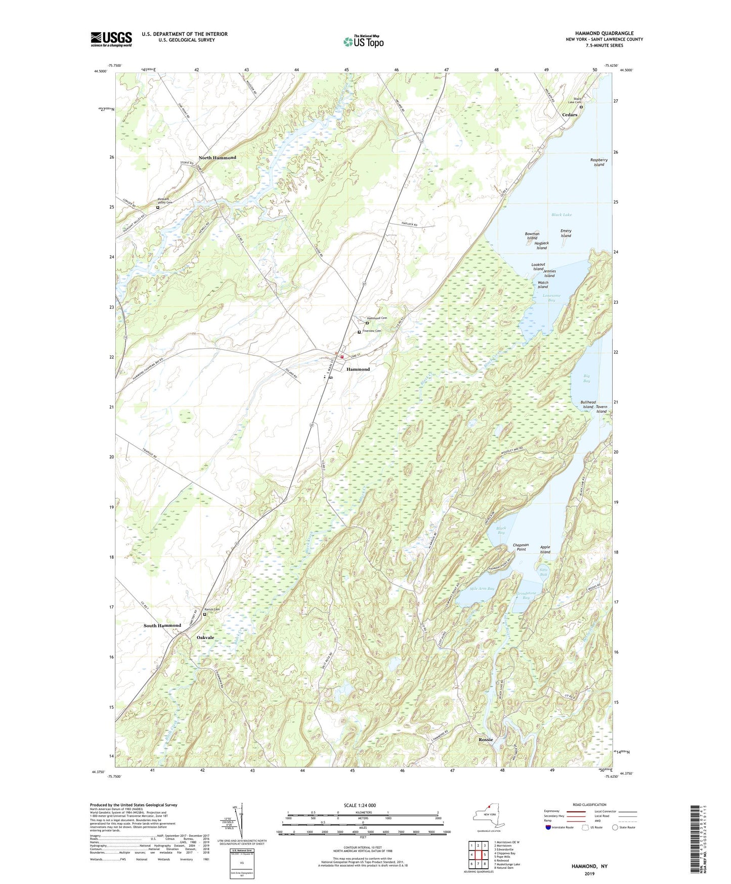
2023 topographic map quadrangle Hammond in the state of New York. Scale: 1:24000. Based on the newly updated USGS 7.5' US Topo map series, this map is in the following counties: St. Lawrence. The map contains contour data, water features, and other items you are used to seeing on USGS maps, but also has updated roads and other features. This is the next generation of topographic maps. Printed on high-quality waterproof paper with UV fade-resistant inks.
Quads adjacent to this one:
West: Chippewa Bay
Northwest: Morristown OE W
North: Morristown
Northeast: Edwardsville
East: Pope Mills
Southeast: Natural Dam
South: Muskellunge Lake
Southwest: Redwood
This map covers the same area as the classic USGS quad with code o44075d6.
Contains the following named places: Apple Island, Back Bay Campground, Big Bay, Black Bay, Black Creek, Black Lake, Black Lake Cemetery, Bostwick Creek, Bowman Island, Bullhead Island, Cedars, Central School, Chapman Point, Demick Farms, Elwood Point, Emery Island, Fineview Cemetery, Grass Creek, Grindstone Bay, Hammond, Hammond Airport, Hammond Cemetery, Hammond Fire and Rescue Department, Hammond Free Library, Hammond Post Office, Hogback Island, Indian River, Jennies Island, Lonesome Bay, Lookout Island, Martin Brothers Farms, McLear's Cottage Colony and Campground, Mile Arm Bay, Mitchell Farms, North Hammond, Oakvale, Pitcher Farms, Pleasant Valley Cemetery, Rarick Cemetery, Raspberry Island, Rossie, Sitts Bay, South Hammond, Tavern Island, Town of Hammond, Village of Hammond, Watch Island, ZIP Code: 13646