MyTopo
Conesus New York US Topo Map
Couldn't load pickup availability
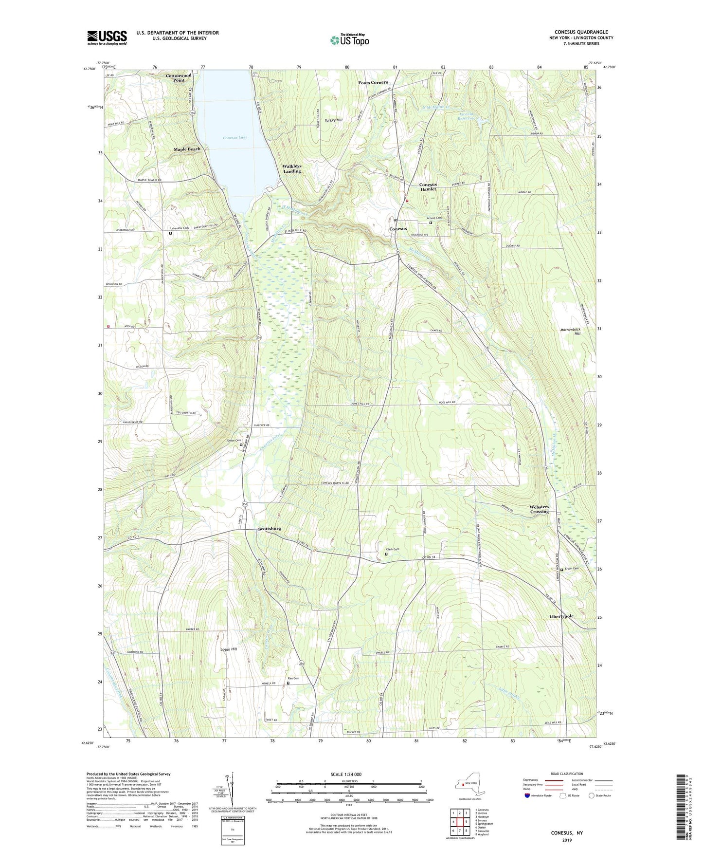
2023 topographic map quadrangle Conesus in the state of New York. Scale: 1:24000. Based on the newly updated USGS 7.5' US Topo map series, this map is in the following counties: Livingston. The map contains contour data, water features, and other items you are used to seeing on USGS maps, but also has updated roads and other features. This is the next generation of topographic maps. Printed on high-quality waterproof paper with UV fade-resistant inks.
Quads adjacent to this one:
West: Sonyea
Northwest: Geneseo
North: Livonia
Northeast: Honeoye
East: Springwater
Southeast: Wayland
South: Dansville
Southwest: Ossian
This map covers the same area as the classic USGS quad with code o42077f6.
Contains the following named places: All Western Evergreen Nursery, Arnold Cemetery, Clark Cemetery, Conesus, Conesus Census Designated Place, Conesus Golf Club, Conesus Inlet, Conesus Lake Campground, Conesus Post Office, Conesus Volunteer Fire Department, Erwin Cemetery, Foots Corners, Gray Corners, Groveland Fire Department Station 2, Lakeview Cemetery, Libertypole, Livonia Reservoir, Logan Hill, Maple Beach, McMillan Creek, North McMillan Creek, Rau Cemetery, Saint Michaels Mission, School Number 1, School Number 2, School Number 3, School Number 4, School Number 5, School Number 7, School Number 9, Scottsburg, Scottsburg Census Designated Place, Southern Shores Campground, Town of Conesus, Town of Sparta, Turkey Hill, Union Cemetery, Union Corners, Walkleys Landing, Webster Crossing United Methodist Church, Websters Crossing, Websters Crossing Census Designated Place, ZIP Codes: 14435, 14545