MyTopo
Wayland New York US Topo Map
Couldn't load pickup availability
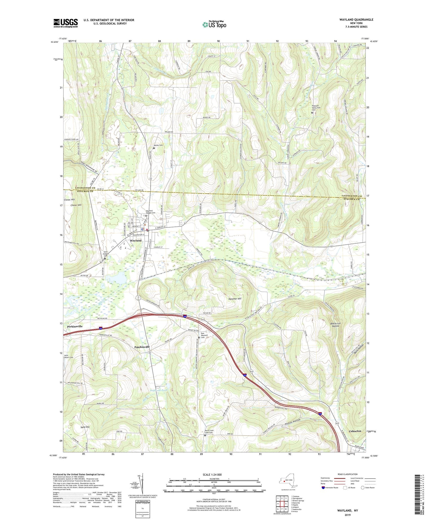
2023 topographic map quadrangle Wayland in the state of New York. Scale: 1:24000. Based on the newly updated USGS 7.5' US Topo map series, this map is in the following counties: Steuben, Livingston. The map contains contour data, water features, and other items you are used to seeing on USGS maps, but also has updated roads and other features. This is the next generation of topographic maps. Printed on high-quality waterproof paper with UV fade-resistant inks.
Quads adjacent to this one:
West: Dansville
Northwest: Conesus
North: Springwater
Northeast: Bristol Springs
East: Naples
Southeast: Avoca
South: Haskinville
Southwest: Arkport
This map covers the same area as the classic USGS quad with code o42077e5.
Contains the following named places: Ashley Cemetery, Blackcrick Hollow, Bowles Corners, Clover Hill, Cohocton, Cohocton Assembly of God, Davis Hollow, Daybrook Pond, East Wayland Cemetery, Hemmer Hill, Hinkle Hollow, Holy Family Catholic Community, Lighthouse Wesleyan Church, Moon Hollow, North Loon Lake Cemetery, North Loon Lake Church, Pardee Hollow, Patchinville, Pfaff Hollow, Pleasant Valley East Cemetery, Punky Hollow, Saint Josephs Cemetery, Saint Paul's Lutheran Church, Saint Paul's United Church of Christ, Sand Hill, School Number 1, School Number 10, School Number 11, School Number 12, School Number 14, School Number 15, School Number 17, School Number 18, School Number 2, School Number 20, School Number 6, School Number 8, School Number 9, Seventh Day Adventist Church, Showboat Mobile Home Park, Town of Wayland, Victory Park, Village of Wayland, Wayland, Wayland - Cohocton High School, Wayland - Cohocton Middle School, Wayland Elementary School, Wayland Fire Department, Wayland Free Library, Wayland Post Office, Wayland Village Cemetery, Wayland Village Wastewater Treatment Plant, ZIP Code: 14572