MyTopo
Cuyler New York US Topo Map
Couldn't load pickup availability
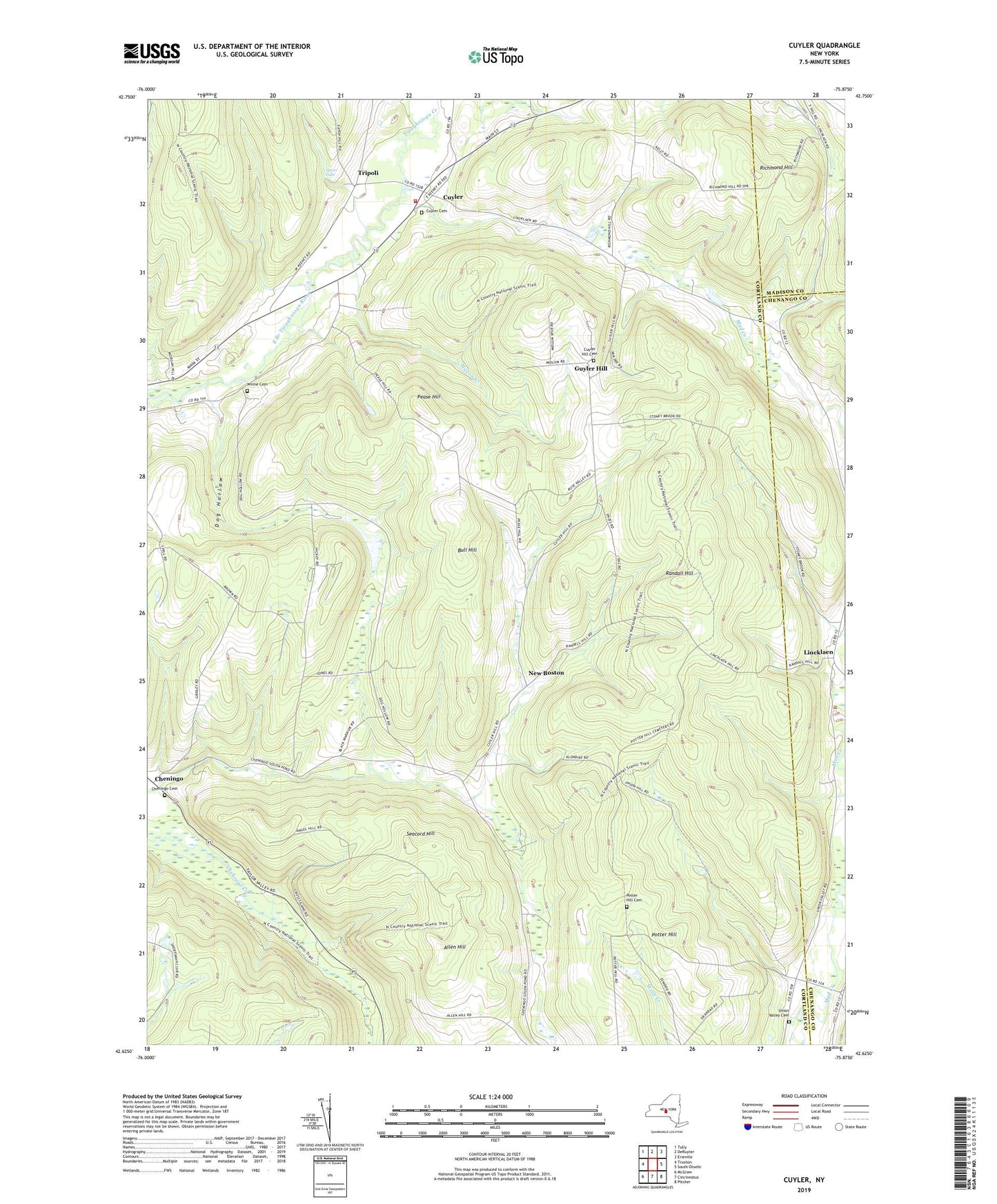
2019 topographic map quadrangle Cuyler in the state of New York. Scale: 1:24000. Based on the newly updated USGS 7.5' US Topo map series, this map is in the following counties: Cortland, Chenango, Madison. The map contains contour data, water features, and other items you are used to seeing on USGS maps, but also has updated roads and other features. This is the next generation of topographic maps. Printed on high-quality waterproof paper with UV fade-resistant inks.
Quads adjacent to this one:
West: Truxton
Northwest: Tully
North: DeRuyter
Northeast: Erieville
East: South Otselic
Southeast: Pitcher
South: Cincinnatus
Southwest: McGraw
Contains the following named places: Allen Hill, Black Warrior School, Bull Hill, Cheningo, Cheningo Cemetery, Cuyler, Cuyler Cemetery, Cuyler Fire Department, Cuyler Hill Cemetery, Cuyler Volunteer Fire Department Station 2, Dog Hollow, Dog Hollow School, Forest Lake Campground, Frosty Morning Farm, Guyler Hill, Lincklaen, Maxon Creek, New Boston, Pease Hill, Potter Hill, Potter Hill Cemetery, Randall Hill, Red School, Richmond Hill, School Number 1, School Number 14, School Number 4, School Number 7, School Number 8, Seacord Hill, Spicer Falls, Tioughnioga Creek, Town of Cuyler, Tripoli, Union Valley, Union Valley Cemetery, West Branch Tioughnioga Creek, Winne Cemetery, ZIP Code: 13158