MyTopo
Duanesburg New York US Topo Map
Couldn't load pickup availability
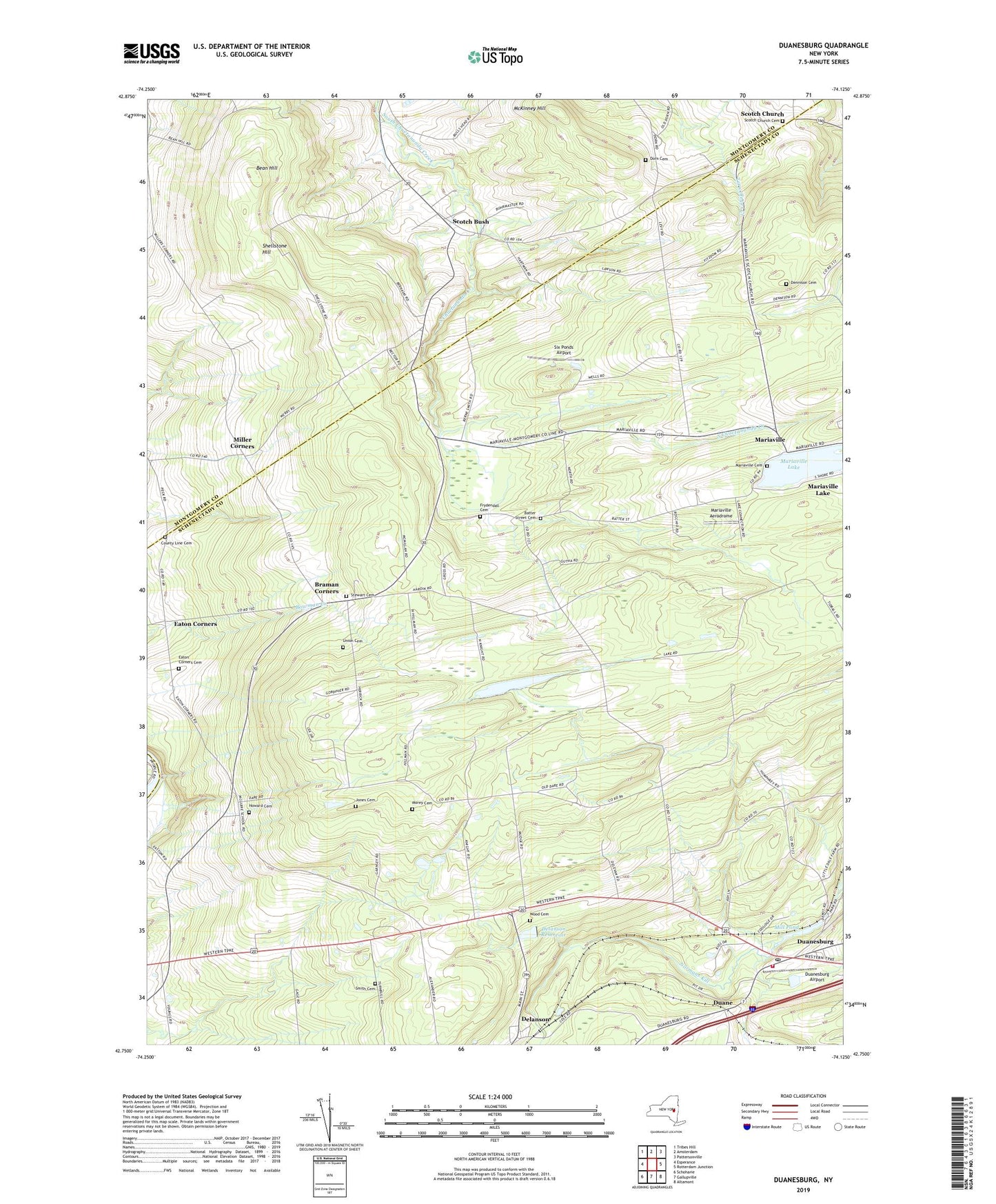
2019 topographic map quadrangle Duanesburg in the state of New York. Scale: 1:24000. Based on the newly updated USGS 7.5' US Topo map series, this map is in the following counties: Schenectady, Montgomery, Schoharie. The map contains contour data, water features, and other items you are used to seeing on USGS maps, but also has updated roads and other features. This is the next generation of topographic maps. Printed on high-quality waterproof paper with UV fade-resistant inks.
Quads adjacent to this one:
West: Esperance
Northwest: Tribes Hill
North: Amsterdam
Northeast: Pattersonville
East: Rotterdam Junction
Southeast: Altamont
South: Gallupville
Southwest: Schoharie
Contains the following named places: Batter Street Cemetery, Bean Hill, Braman Corners, County Line Cemetery, Delanson Reservoir, Dennison Cemetery, Dorn Cemetery, Duane, Duane Mansion, Duanesburg, Duanesburg Airport, Duanesburg Census Designated Place, Duanesburg Churches, Duanesburg Florida Baptist Church, Duanesburg Post Office, Duanesburg Town Hall, Duanesburg Volunteer Ambulance Corps, Duanesburg Volunteer Fire Department, Duanespurg Reservoir, Eaton Corners, Eaton Corners Cemetery, Falling Leaf Farm, Frydendall Cemetery, Howard Cemetery, Jones Cemetery, Mariaville, Mariaville Aerodrome, Mariaville Cemetery, Mariaville Elementary School, Mariaville Lake, Mariaville Lake Census Designated Place, McKinney Hill, Merry Hill Farm, Mill Pond, Miller Corners, Morey Cemetery, Our Lady of Fatima Church, Priddle Camp, Rulison Honey Farm, Scotch Bush, Scotch Church, Scotch Church Cemetery, Scotch Ridge Berry Farm, Shellstone Hill, Six Ponds Airport, Smith Cemetery, Stewart Cemetery, Town of Duanesburg, Union Cemetery, Wood Cemetery, ZIP Codes: 12053, 12137