MyTopo
Altamont New York US Topo Map
Couldn't load pickup availability
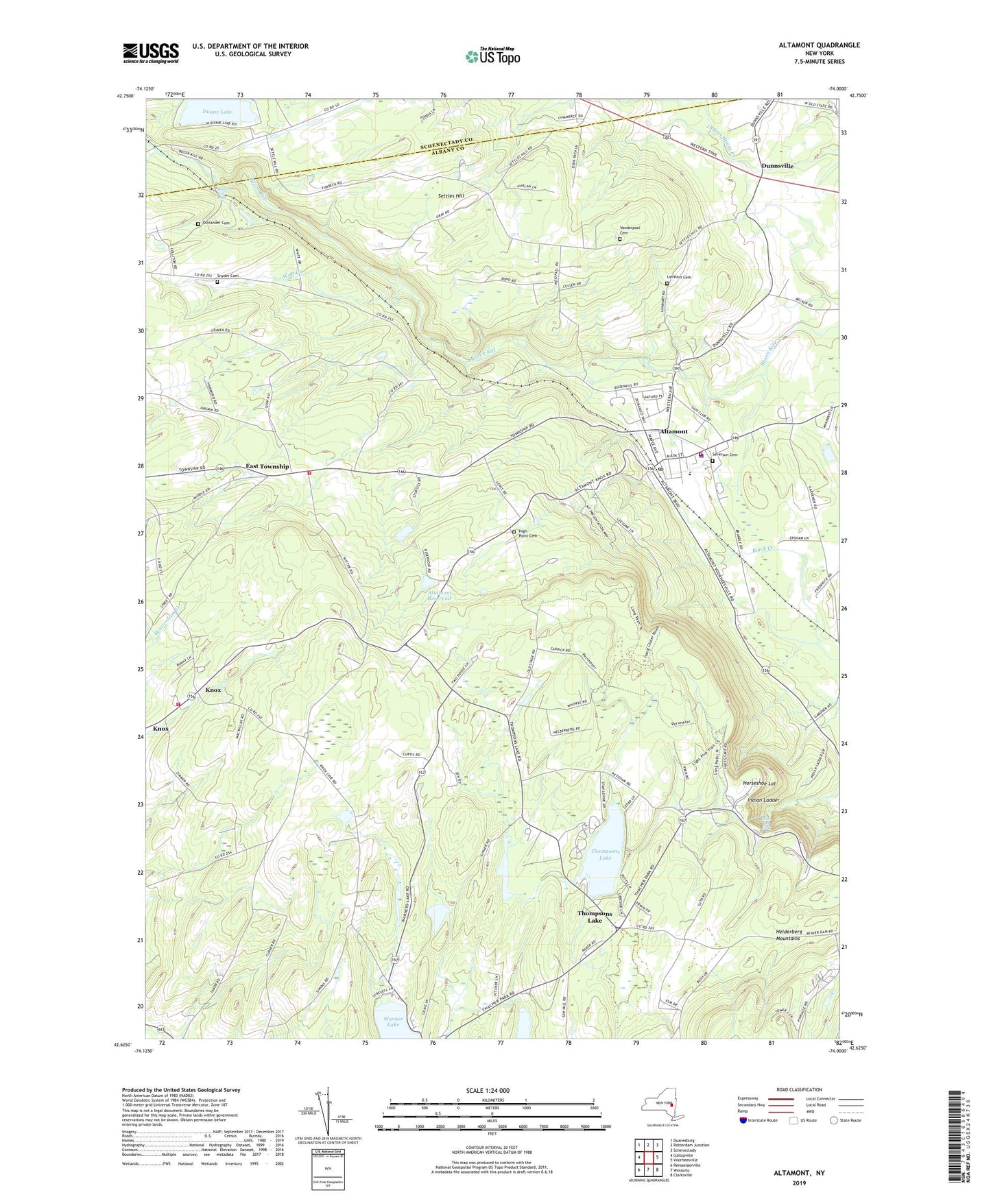
2023 topographic map quadrangle Altamont in the state of New York. Scale: 1:24000. Based on the newly updated USGS 7.5' US Topo map series, this map is in the following counties: Albany, Schenectady. The map contains contour data, water features, and other items you are used to seeing on USGS maps, but also has updated roads and other features. This is the next generation of topographic maps. Printed on high-quality waterproof paper with UV fade-resistant inks.
Quads adjacent to this one:
West: Gallupville
Northwest: Duanesburg
North: Rotterdam Junction
Northeast: Schenectady
East: Voorheesville
Southeast: Clarksville
South: Westerlo
Southwest: Rensselaerville
This map covers the same area as the classic USGS quad with code o42074f1.
Contains the following named places: Altamont, Altamont Elementary School, Altamont Fire Department, Altamont Orchards, Altamont Post Office, Altamont Rescue Squad, Altamont Reservoir, Bozen Kill Falls, Camp Altamont, Camp Pinnacle, Cobb Memorial School, Colliton School, Duane Lake, Dunnsville, East Township, High Point Cemetery, Horseshoe Lot, Indian Ladder, Knox, Knox Fire District 16 Station 1, Knox Fire District 16 Station 2, Lainhart Cemetery, Lasalette Seminary, Mine Lot Falls, Noch Fiernan Farm, Ostrander Cemetery, Rolling Acres, School Number 12, School Number 13, School Number 2, School Number 5, Settles Hill, Settles Hill School, Severson Cemetery, Snyder Cemetery, Thacher State Park, Thompsons Lake, Town of Knox, Vanderpool Cemetery, Village of Altamont, Warners Lake, WMHT-FM (Schenectady), WMHT-TV (Schenectady), WMHX-TV (Schenectady), Wolf Creek, WPYX-FM (Albany), WSHZ-FM (Rotterdam), WVCR-FM (Loudonville), ZIP Code: 12009