MyTopo
Alcove New York US Topo Map
Couldn't load pickup availability
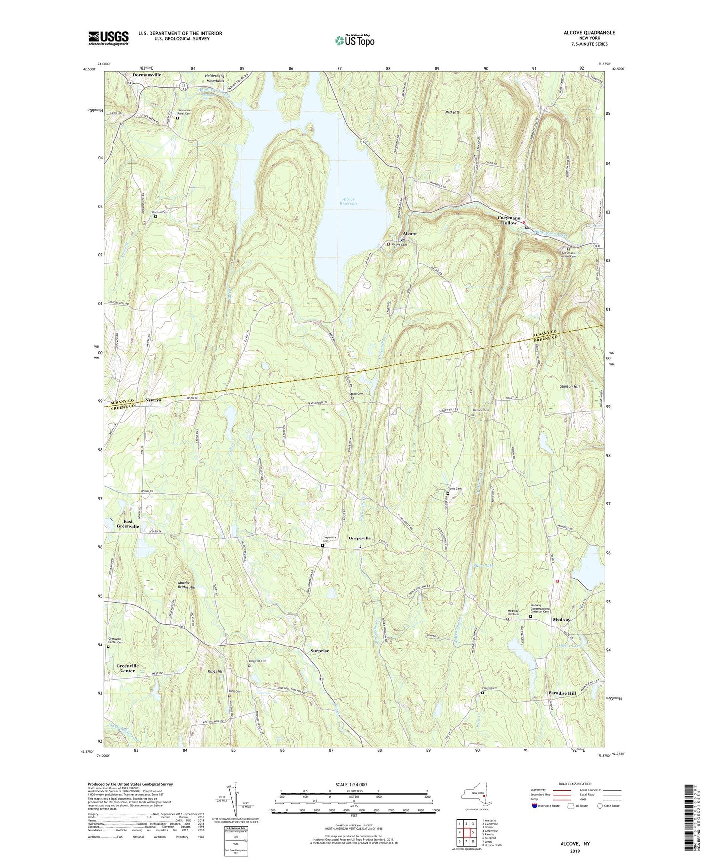
2023 topographic map quadrangle Alcove in the state of New York. Scale: 1:24000. Based on the newly updated USGS 7.5' US Topo map series, this map is in the following counties: Greene, Albany. The map contains contour data, water features, and other items you are used to seeing on USGS maps, but also has updated roads and other features. This is the next generation of topographic maps. Printed on high-quality waterproof paper with UV fade-resistant inks.
Quads adjacent to this one:
West: Greenville
Northwest: Westerlo
North: Clarksville
Northeast: Delmar
East: Ravena
Southeast: Hudson North
South: Leeds
Southwest: Freehold
This map covers the same area as the classic USGS quad with code o42073d8.
Contains the following named places: Alcove, Alcove Cemetery, Alcove Post Office, Alcove Reservoir, Beaver Dam Lake, Butler School, Coeymans Hollow, Coeymans Hollow Cemetery, Coeymans Hollow Post Office, Coeymans Hollow Volunteer Fire Department, Cole Hollow, Dickinson Falls, Dormansville, East Greenville, Grapeville, Grapeville Cemetery, Grapeville Christian School, Greenville Center Cemetery, Gulf Creek, Hannacroix Rural Cemetery, Hillside Cemetery, Indian Fields, Indian Fields Cemetery, King Cemetery, King Hill, King Hill Cemetery, Medway, Medway Congregational Christian Cemetery, Medway Grapeville Volunteer Fire Company, Medway Hill Cemetery, Mirror Lake, Mossy Hill Quarry, Mud Hill, Murder Bridge Hill, Newrys, Paradise Hill, Powell Cemetery, Ravena Reservoir, Rocking R Farm, Sanfords Corners, School Number 10, School Number 12, School Number 13, School Number 15, School Number 6, School Number 7, Silver Creek, Silver Lake, Staco Cemetery, Staco School, Stanton Cemetery, Stanton Hill, Surprise, The Church of Jesus Christ of Latter Day Saints, Town of Coeymans, Travis Cemetery, ZIP Codes: 12007, 12042, 12087, 12176