MyTopo
Greenville New York US Topo Map
Couldn't load pickup availability
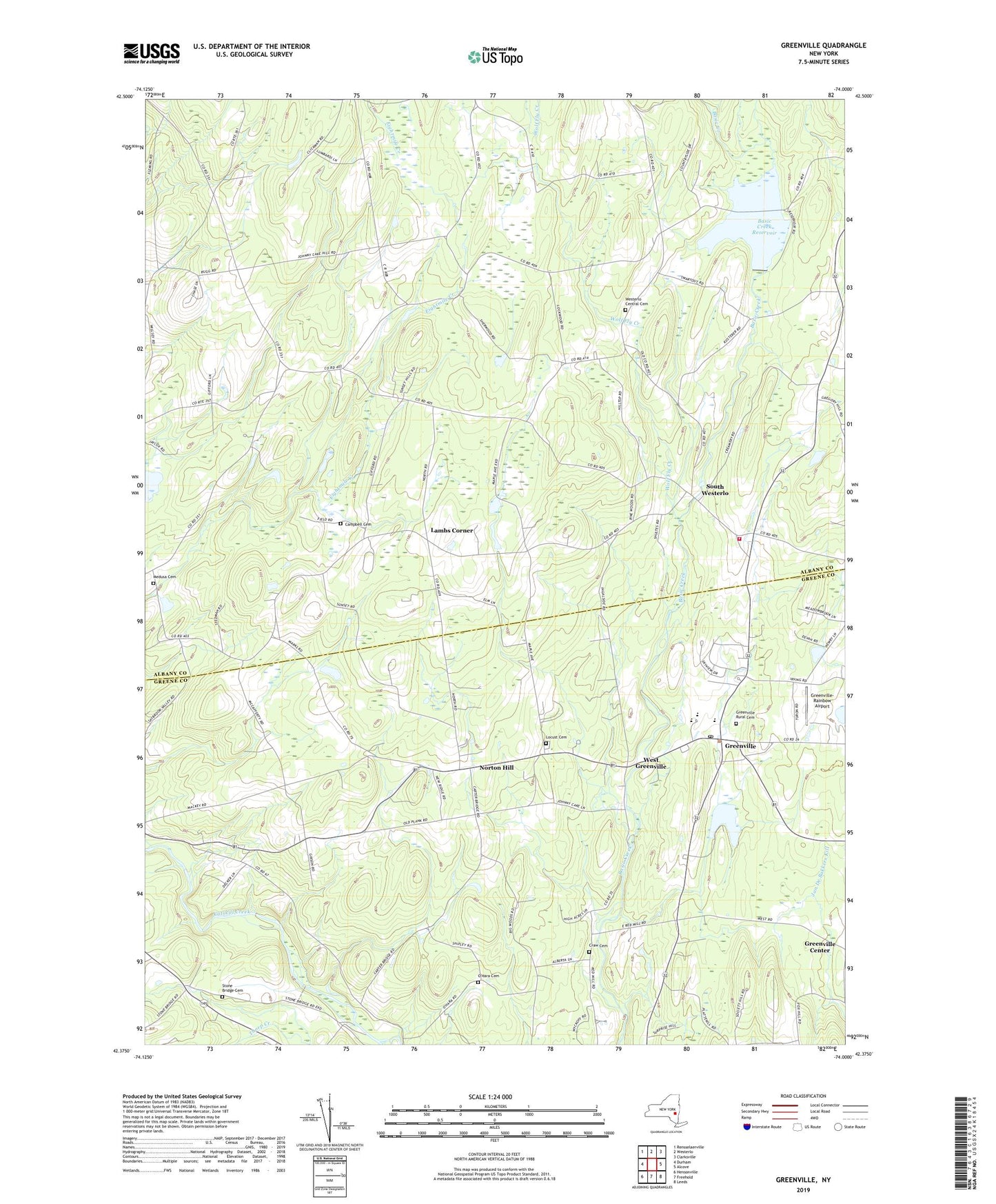
2023 topographic map quadrangle Greenville in the state of New York. Scale: 1:24000. Based on the newly updated USGS 7.5' US Topo map series, this map is in the following counties: Albany, Greene. The map contains contour data, water features, and other items you are used to seeing on USGS maps, but also has updated roads and other features. This is the next generation of topographic maps. Printed on high-quality waterproof paper with UV fade-resistant inks.
Quads adjacent to this one:
West: Durham
Northwest: Rensselaerville
North: Westerlo
Northeast: Clarksville
East: Alcove
Southeast: Leeds
South: Freehold
Southwest: Hensonville
This map covers the same area as the classic USGS quad with code o42074d1.
Contains the following named places: Basic Creek Reservoir, Campbell Cemetery, Christ Episcopal Church, Craw Cemetery, Greenville, Greenville Census Designated Place, Greenville Center, Greenville Drive-In, Greenville High School, Greenville Middle School, Greenville Post Office, Greenville Public Library, Greenville Rural Cemetery, Greenville Volunteer Fire Company, Greenville-Rainbow Airport, Kingdom Hall of Jehovahs Witnesses, Lambs Corner, Locust Cemetery, Medusa Cemetery, Medusa Census Designated Place, Norton Hill, O'Hara Cemetery, O'Hara Corners, Saint John the Baptist Church, School Number 3, School Number 5, Scott M Ellis Elementary School, Smith Corner, South Westerlo, Stone Bridge Cemetery, Town of Greenville, Town of Westerlo, Tschinkel Farm, United Methodist Church of Greenville, West Greenville, Westerlo Central Cemetery, Westerlo Rescue Squad, Westerlo Volunteer Fire Company Station 2, Wolf Fly Creek, ZIP Codes: 12083, 12423