MyTopo
South Edwards New York US Topo Map
Couldn't load pickup availability
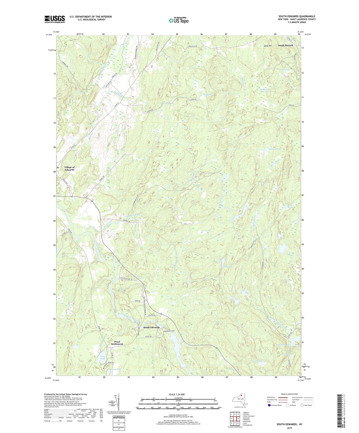
2023 topographic map quadrangle South Edwards in the state of New York. Scale: 1:24000. Based on the newly updated USGS 7.5' US Topo map series, this map is in the following counties: St. Lawrence. The map contains contour data, water features, and other items you are used to seeing on USGS maps, but also has updated roads and other features. This is the next generation of topographic maps. Printed on high-quality waterproof paper with UV fade-resistant inks.
Quads adjacent to this one:
West: Edwards
Northwest: Bigelow
North: Hermon
Northeast: West Pierrepont
East: Degrasse
Southeast: Oswegatchie
South: Fine
Southwest: Harrisville
This map covers the same area as the classic USGS quad with code o44075c2.
Contains the following named places: Birch Brook, Carr Pond, Cedar Lake Stream, Dana Hill, Edwards - Knox Elementary School, Edwards - Knox Junior - Senior High School, Edwards Post Office, Gotham Family Farm, Hall Lake, Hepburn Library of Edwards, Jones Pond, Little Lake, Mill Brook, Mud Pond, New Beginnings Assembly of God, Paddy Brown Brook, Partlow Pond, Pond Settlement, Smith Pond, South Edwards, South Russell, Stammer Creek, Stammer Creek State Forest, Stockwell Pond, Trout Lake State Forest, Warden Pond, ZIP Code: 13639