MyTopo
Edwards New York US Topo Map
Couldn't load pickup availability
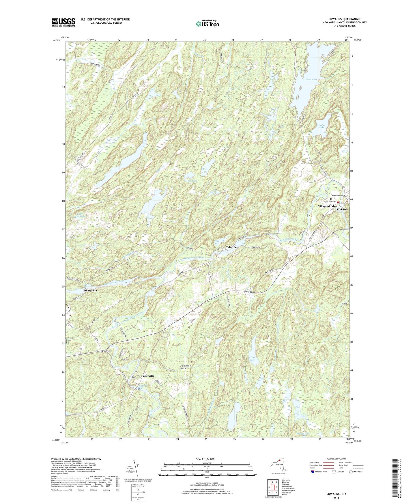
2023 topographic map quadrangle Edwards in the state of New York. Scale: 1:24000. Based on the newly updated USGS 7.5' US Topo map series, this map is in the following counties: St. Lawrence. The map contains contour data, water features, and other items you are used to seeing on USGS maps, but also has updated roads and other features. This is the next generation of topographic maps. Printed on high-quality waterproof paper with UV fade-resistant inks.
Quads adjacent to this one:
West: Gouverneur
Northwest: Richville
North: Bigelow
Northeast: Hermon
East: South Edwards
Southeast: Fine
South: Harrisville
Southwest: Lake Bonaparte
This map covers the same area as the classic USGS quad with code o44075c3.
Contains the following named places: Bennett Brook, Bonner Lake, Cedar Lake, Chub Lake, Clear Lake, Edwards, Edwards Census Designated Place, Edwards Volunteer Fire Department, Emeryville, Emeryville Falls, Fairview Cemetery, Fullerville, Fullerville Church, Fullerville Falls, Fullerville Sands, Gulf Cemetery, Hall Creek, Hazleton Falls, Huckleberry Lake, Little Mud Pond, Moon Lake, Mott Creek, Pork Creek, Riverside Cemetery, Talcville, Town of Edwards, Trout Lake, Village of Edwards, West Branch Oswegatchie River, Wolf Lake, ZIP Code: 13635