
MyTopo
Hensonville New York US Topo Map
Couldn't load pickup availability
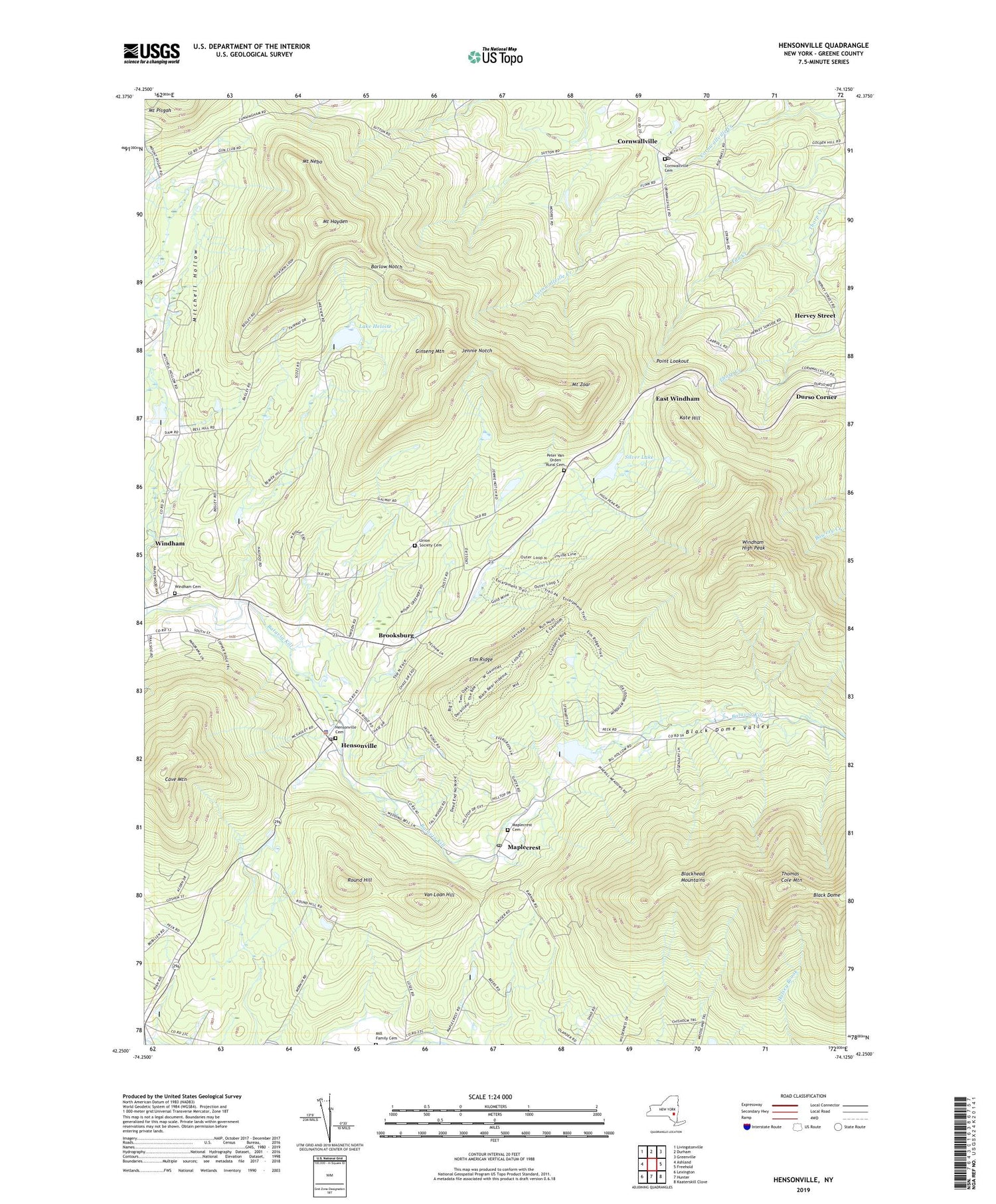
2019 topographic map quadrangle Hensonville in the state of New York. Scale: 1:24000. Based on the newly updated USGS 7.5' US Topo map series, this map is in the following counties: Greene. The map contains contour data, water features, and other items you are used to seeing on USGS maps, but also has updated roads and other features. This is the next generation of topographic maps. Printed on high-quality waterproof paper with UV fade-resistant inks.
Quads adjacent to this one:
West: Ashland
Northwest: Livingstonville
North: Durham
Northeast: Greenville
East: Freehold
Southeast: Kaaterskill Clove
South: Hunter
Southwest: Lexington
Contains the following named places: Barlow Notch, Beecher Corners, Black Dome Valley, Blackhead Mountains, Brooksburg, Catskill Mountains, Cave Mountain, Cornwallville, Cornwallville Cemetery, Cornwallville Methodist Episcopal Church, Cornwallville Post Office, Durso Corner, East Windham, Elm Ridge, Fall Creek, Free Methodist Church, Ginseng Mountain, Hensonville, Hensonville Cemetery, Hensonville Post Office, Hervey Street, Jennie Notch, Kate Hill, Lake Heloise, Maplecrest, Maplecrest Cemetery, Maplecrest Post Office, Mill Family Cemetery, Mitchell Hollow Mission Church, Mount Hayden, Mount Nebo, Mount Zoar, Peter Van Orden Rural Cemetery, Point Lookout, Round Hill, Saint Theresa's Church, Silver Lake, Thomas Cole Mountain, Town of Windham, Union Society Cemetery, Van Loan Hill, Windham Cemetery, Windham Census Designated Place, Windham High Peak, ZIP Codes: 12418, 12439, 12454


