MyTopo
Hobart New York US Topo Map
Couldn't load pickup availability
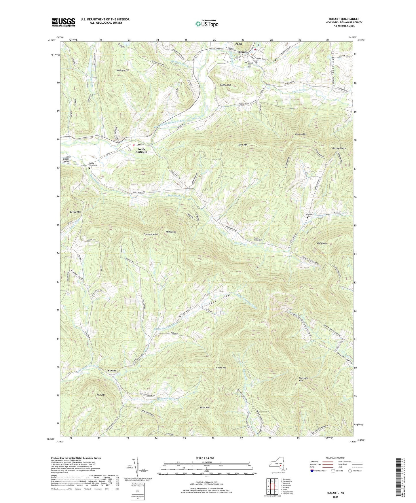
2019 topographic map quadrangle Hobart in the state of New York. Scale: 1:24000. Based on the newly updated USGS 7.5' US Topo map series, this map is in the following counties: Delaware. The map contains contour data, water features, and other items you are used to seeing on USGS maps, but also has updated roads and other features. This is the next generation of topographic maps. Printed on high-quality waterproof paper with UV fade-resistant inks.
Quads adjacent to this one:
West: Bloomville
Northwest: Davenport
North: Harpersfield
Northeast: Stamford
East: Roxbury
Southeast: Fleischmanns
South: Margaretville
Southwest: Andes
Contains the following named places: Allen Residential Center, Betty Brook, Bovina, Bovina Mountain, Burnt Hill, Carmans Notch, Cowan Mountain, Crescent Hollow, Foote Hollow, Good Shepherd Chapel, Griffin Hill, Hand-In-Hand Farm, Hobart, Hobart Fire Department, Hobart Post Office, Hobart United Methodist Church, Lake Brook, Locust Hill Cemetery, Lyon Mountain, McMurdy Brook, McMurdy Hill, Mill Mountain, Mount Warren, Mountain Brook, Narrow Notch, Old Clump, Plattekill Mountain, Relay Cemetery, Roses Brook Cemetery, Round Top, School Number 3, School Number 4, Schuman Farms, South Kortright, South Kortright Central School, South Kortright Volunteer Fire Department, Stone Tavern Farm, Thompson Hollow School, Top Of The Hill Nurseries, Town Brook, Town of Stamford, Township Valley, Valley View Cemetery, Village of Hobart, ZIP Code: 13788