MyTopo
Honnedaga Lake New York US Topo Map
Couldn't load pickup availability
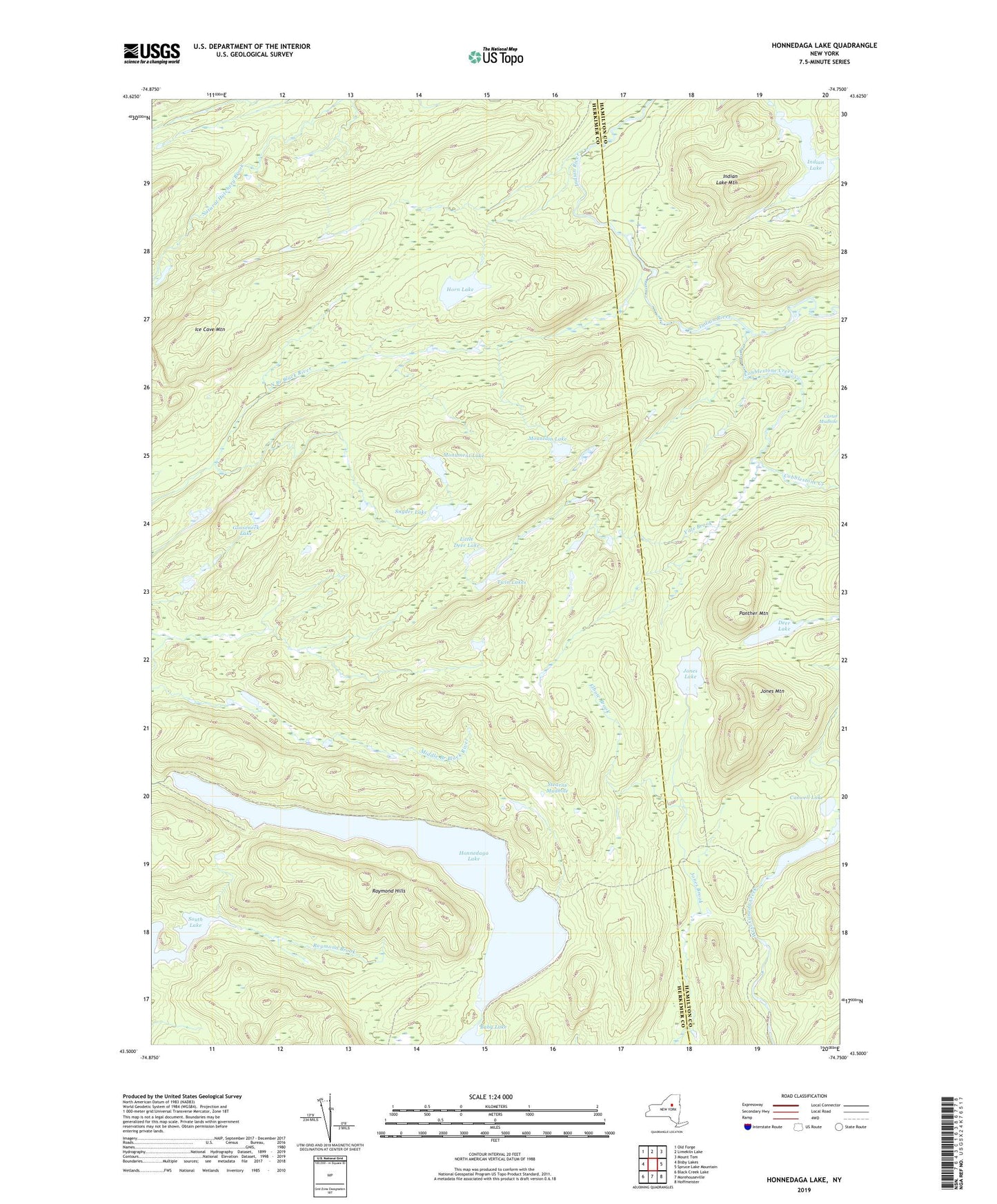
2019 topographic map quadrangle Honnedaga Lake in the state of New York. Scale: 1:24000. Based on the newly updated USGS 7.5' US Topo map series, this map is in the following counties: Herkimer, Hamilton. The map contains contour data, water features, and other items you are used to seeing on USGS maps, but also has updated roads and other features. This is the next generation of topographic maps. Printed on high-quality waterproof paper with UV fade-resistant inks.
Quads adjacent to this one:
West: Bisby Lakes
Northwest: Old Forge
North: Limekiln Lake
Northeast: Mount Tom
East: Spruce Lake Mountain
Southeast: Hoffmeister
South: Morehouseville
Southwest: Black Creek Lake
Contains the following named places: Cahans Farm, Caswell Lake, Cobblestone Creek, Deer Lake, Elbow Brook, First Stillwater, Forest Lodge, Gooseneck Lake, Herkimer Landing, Honnedaga Lake, Horn Lake, Ice Cave Mountain, Indian Lake, Indian Lake Mountain, Jones Lake, Jones Mountain, Little Deer Lake, Monument Lake, Mountain Lake, Muskrat Creek, Panther Mountain, Raymond Brook, Raymond Hills, Second Stillwater, Snyder Lake, Stearns Mudhole, Stillwater, Swanson Dam, Twin Lakes, Yale Brook