MyTopo
Spruce Lake Mountain New York US Topo Map
Couldn't load pickup availability
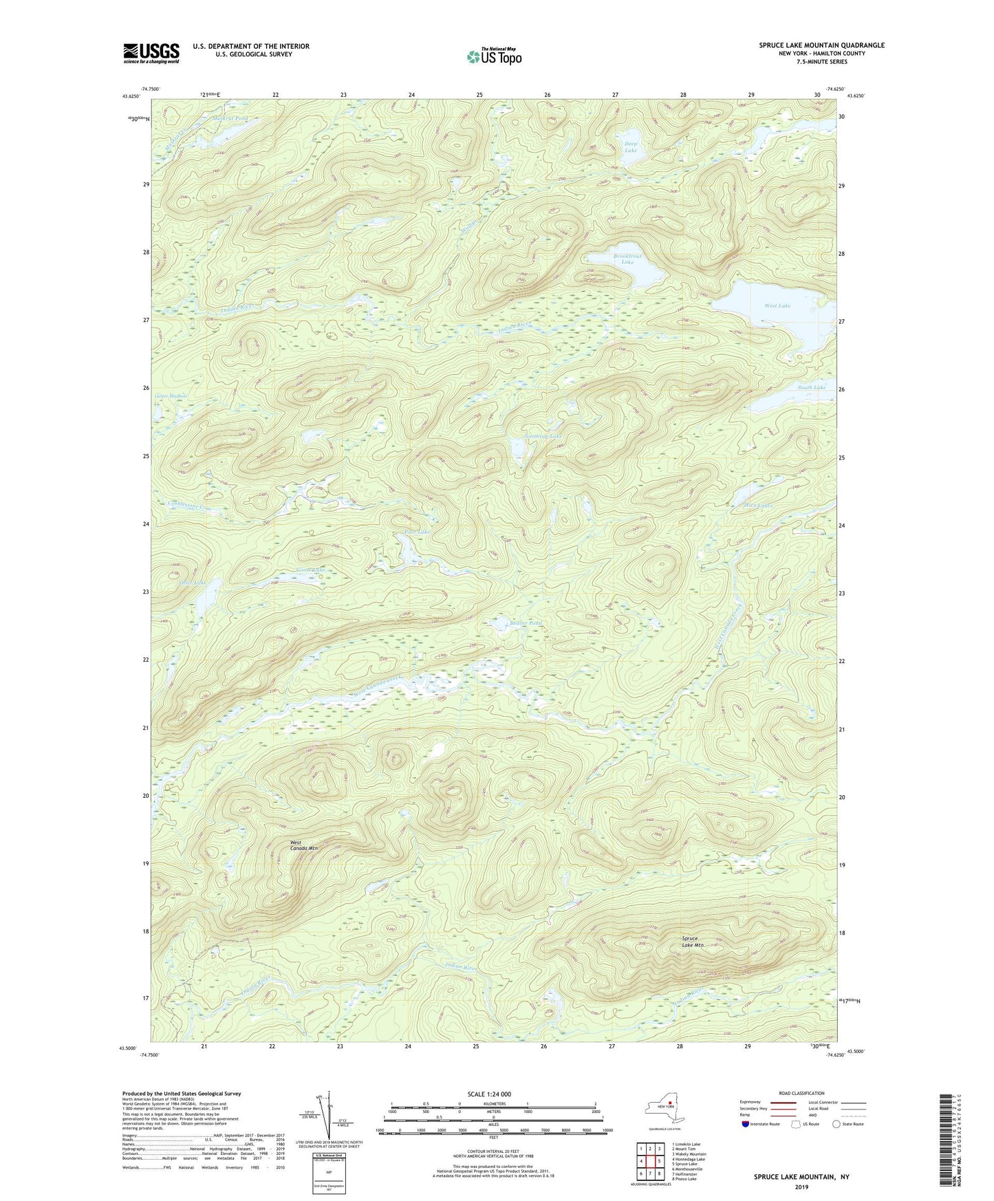
2023 topographic map quadrangle Spruce Lake Mountain in the state of New York. Scale: 1:24000. Based on the newly updated USGS 7.5' US Topo map series, this map is in the following counties: Hamilton. The map contains contour data, water features, and other items you are used to seeing on USGS maps, but also has updated roads and other features. This is the next generation of topographic maps. Printed on high-quality waterproof paper with UV fade-resistant inks.
Quads adjacent to this one:
West: Honnedaga Lake
Northwest: Limekiln Lake
North: Mount Tom
Northeast: Wakely Mountain
East: Spruce Lake
Southeast: Piseco Lake
South: Hoffmeister
Southwest: Morehouseville
Contains the following named places: Beaver Pond, Brooktrout Lake, Carter Mudhole, Deep Lake, Goose Lake, Mica Lakes, Millers Camp, Mitchell Dam, Muskrat Pond, Northrup Lake, Otter Lake, Poor Lake, Second Stillwater, South Lake, Spruce Lake Mountain, Twin Lakes, West Canada Mountain, West Lake, Wolf Creek