MyTopo
Kunjamuk River New York US Topo Map
Couldn't load pickup availability
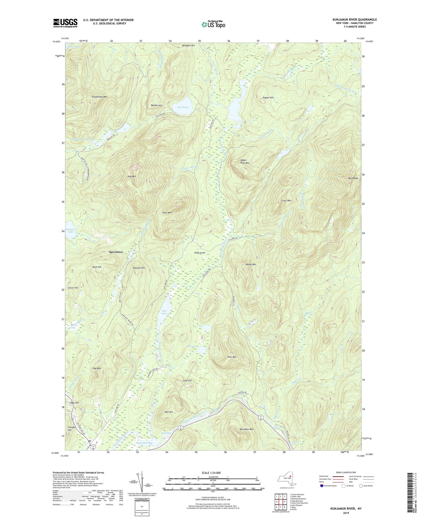
2019 topographic map quadrangle Kunjamuk River in the state of New York. Scale: 1:24000. Based on the newly updated USGS 7.5' US Topo map series, this map is in the following counties: Hamilton. The map contains contour data, water features, and other items you are used to seeing on USGS maps, but also has updated roads and other features. This is the next generation of topographic maps. Printed on high-quality waterproof paper with UV fade-resistant inks.
Quads adjacent to this one:
West: Page Mountain
Northwest: Snowy Mountain
North: Indian Lake
Northeast: Bullhead Mountain
East: South Pond Mountain
Southeast: Griffin
South: Wells
Southwest: Lake Pleasant
Contains the following named places: Austin Falls, Belden Hill, Big Range, Burnham Mountain, Cave Hill, Christine Falls, Cisco Brook, Cross Mountain, Duck Bay, Dug Mountain, Dug Mountain Ponds, East Branch Kunjamuk River, East Mountain, Elm Lake, Floodwood Mountain, Fly Creek, Grace United Methodist Church, Hayes Creek, Kunjamuk Bay, Kunjamuk River, Lake Pleasant School, Long Level, Mossy Mountain, Oak Mountain, Owl Pond, Page Hill, Pasture Hill, Pine Lakes, Pine Mountain, Pine Point Brook, Poplar Hill, Rift Hill, Robbs Creek, Shingle Brook, Silver Brook, Speculator Post Office, The Rifts, Upper Pine Lakes, Upper Pine Mountain, Village of Speculator, Whitaker Lake, Wolf Hill, ZIP Code: 12164