MyTopo
Lake Pleasant New York US Topo Map
Couldn't load pickup availability
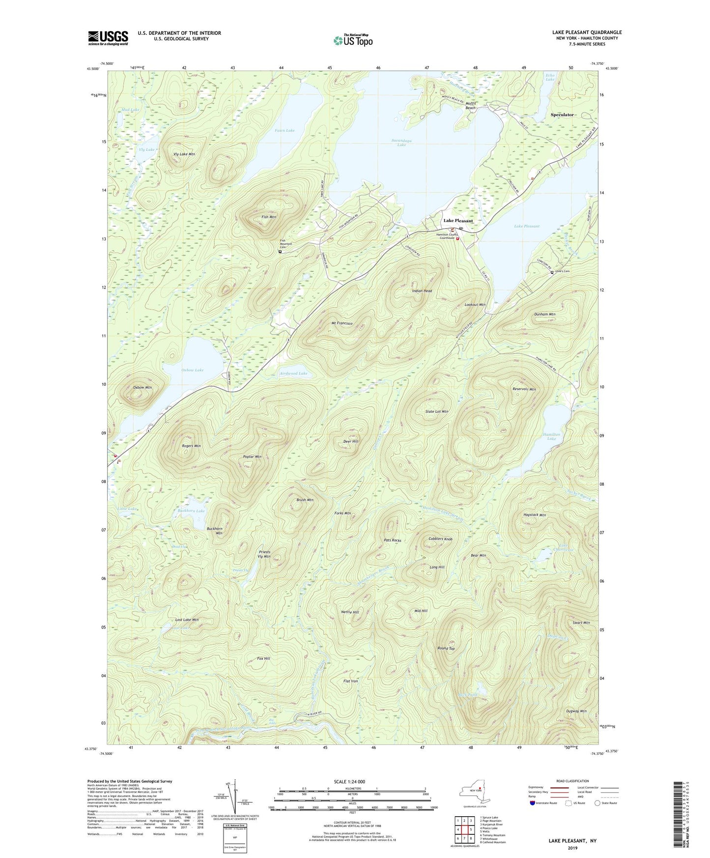
2023 topographic map quadrangle Lake Pleasant in the state of New York. Scale: 1:24000. Based on the newly updated USGS 7.5' US Topo map series, this map is in the following counties: Hamilton. The map contains contour data, water features, and other items you are used to seeing on USGS maps, but also has updated roads and other features. This is the next generation of topographic maps. Printed on high-quality waterproof paper with UV fade-resistant inks.
Quads adjacent to this one:
West: Piseco Lake
Northwest: Spruce Lake
North: Page Mountain
Northeast: Kunjamuk River
East: Wells
Southeast: Cathead Mountain
South: Whitehouse
Southwest: Tomany Mountain
Contains the following named places: Adirondack Bible Chapel, Airdwood Lake, Bear Mountain, Big Eddy, Brush Mountain, Buck Pond, Buckhorn Lake, Buckhorn Mountain, Camp Agaming, Cobblers Knob, Cold Brook, Dead Vly, Deer Hill, Dugway Mountain, Dunham Mountain, Echo Lake, Fawn Lake, Fish Mountain, Fish Mountain Cemetery, Flat Iron, Forks Mountain, Fox Hill, Gallop Creek, Hamilton Golf Course, Hamilton Lake, Hamilton Lake Stream, Hatchery Brook, Haystack Mountain, Indian Head, Lake Chartreuse, Lake Pleasant, Lake Pleasant Golf Course, Lake Pleasant Methodist Church, Lake Pleasant Post Office, Lake Pleasant Town Hall, Lake Pleasant Volunteer Fire Department, Little Lake, Long Hill, Lookout Mountain, Lost Lake, Lost Lake Mountain, Love's Cemetery, Middle Hill, Moffit Beach, Mount Francisco, Mud Lake, Nettle Hill, Oxbow Lake, Oxbow Mountain, Pats Rocks, Piseco School, Piseco Volunteer Fire Department, Poplar Mountain, Priests Vly, Priests Vly Mountain, Reservoir Mountain, Rogers Mountain, Round Top, Sacandaga Camp, Sacandaga Lake, Saint James Church, Shamberger Brook, State Lot Mountain, Sucker Brook, Swart Mountain, Vly Lake, Vly Lake Mountain