MyTopo
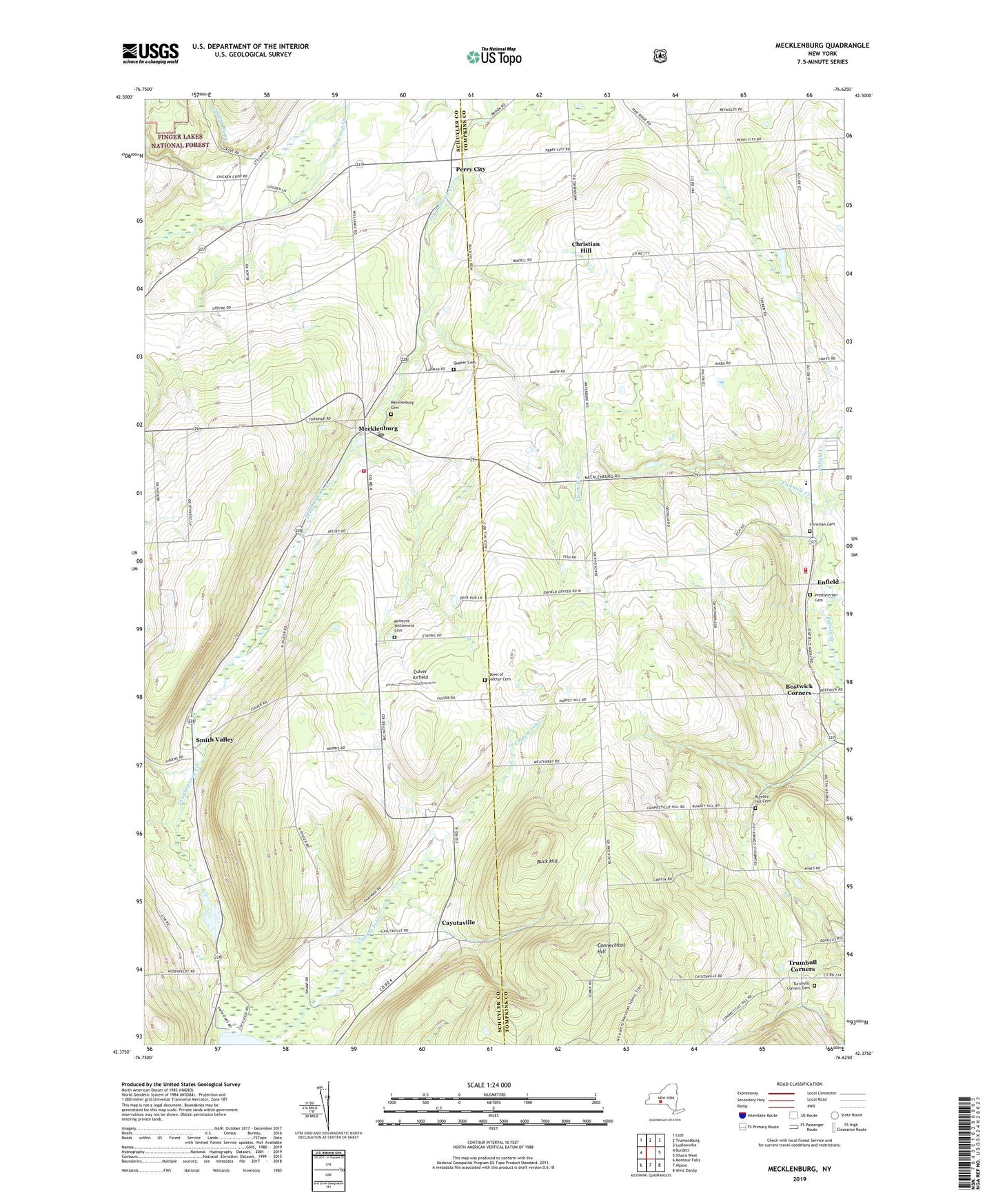
Mecklenburg New York US Topo Map
Couldn't load pickup availability
Also explore the Mecklenburg Forest Service Topo of this same quad for updated USFS data
2023 topographic map quadrangle Mecklenburg in the state of New York. Scale: 1:24000. Based on the newly updated USGS 7.5' US Topo map series, this map is in the following counties: Tompkins, Schuyler. The map contains contour data, water features, and other items you are used to seeing on USGS maps, but also has updated roads and other features. This is the next generation of topographic maps. Printed on high-quality waterproof paper with UV fade-resistant inks.
Quads adjacent to this one:
West: Burdett
Northwest: Lodi
North: Trumansburg
Northeast: Ludlowville
East: Ithaca West
Southeast: West Danby
South: Alpine
Southwest: Montour Falls
This map covers the same area as the classic USGS quad with code o42076d6.
Contains the following named places: Bergen Farms, Black Oaks Corners, Bostwick Corners, Buck Hill, Cayuta Inlet, Cayutaville, Christian Cemetery, Christian Hill, Connecticut Hill, Culver Airfield, Enfield, Enfield School, Enfield Town Hall, Enfield United Methodist Church, Enfield Volunteer Fire Company, First Baptist Church of Enfield, Fivemile Creek, Grange Hall, Hector Land Use Area, Hencoop Creek, McIntyre Settlement Cemetery, Mecklenburg, Mecklenburg Cemetery, Mecklenburg Post Office, Mecklenburg United Methodist Church, Mecklenburg Volunteer Fire Department, Millers Corners, Perry City, Presbyterian Cemetery, Quaker Cemetery, Rumsey Hill Cemetery, Sandy Creek Mobile Home Park, Smith Valley, Town of Enfield, Town of Hector Cemetery, Trumbull Corners, Trumbulls Corners Cemetery, Trumbulls Corners Community Church, Willis Airport, WQNY-FM (Ithaca)