MyTopo
Mount Adams New York US Topo Map
Couldn't load pickup availability
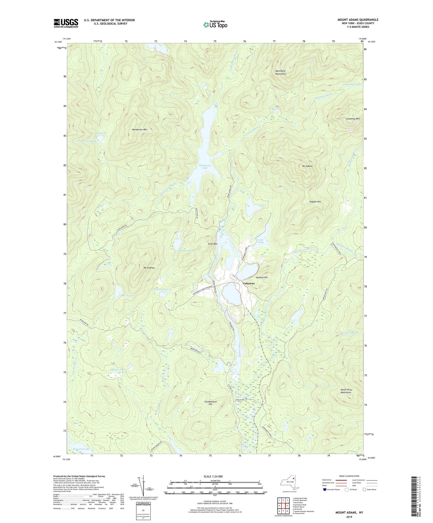
2019 topographic map quadrangle Mount Adams in the state of New York. Scale: 1:24000. Based on the newly updated USGS 7.5' US Topo map series, this map is in the following counties: Essex. The map contains contour data, water features, and other items you are used to seeing on USGS maps, but also has updated roads and other features. This is the next generation of topographic maps. Printed on high-quality waterproof paper with UV fade-resistant inks.
Quads adjacent to this one:
West: Santanoni Peak
Northwest: Ampersand Lake
North: Street Mountain
Northeast: North Elba
East: Mount Marcy
Southeast: Cheney Pond
South: Vanderwhacker Mountain
Southwest: Newcomb
Contains the following named places: Beaver Pond, Bradley Pond, Calamity Brook, Calamity Mountain, Calamity Pond, Cheney Pond, Echo Mountain, Guideboard Hill, Harkness Lake, Henderson Lake, Henderson Mountain, Indian Pass Brook, Lake Andrew, Lake Jimmy, Lake Sally, Le Claire Brook, LeClaire Brook, Lower Duck Hole, Lower Twin Brook, Mount Adams, Mount Andrew, North River Mountains, Old Mac Intyre Furnace, Opalescent River, Popple Hill, Sanford Hill, Sanford Lake, Santanoni Brook, Tahawus, Upper Twin Brook