MyTopo
Pope Mills New York US Topo Map
Couldn't load pickup availability
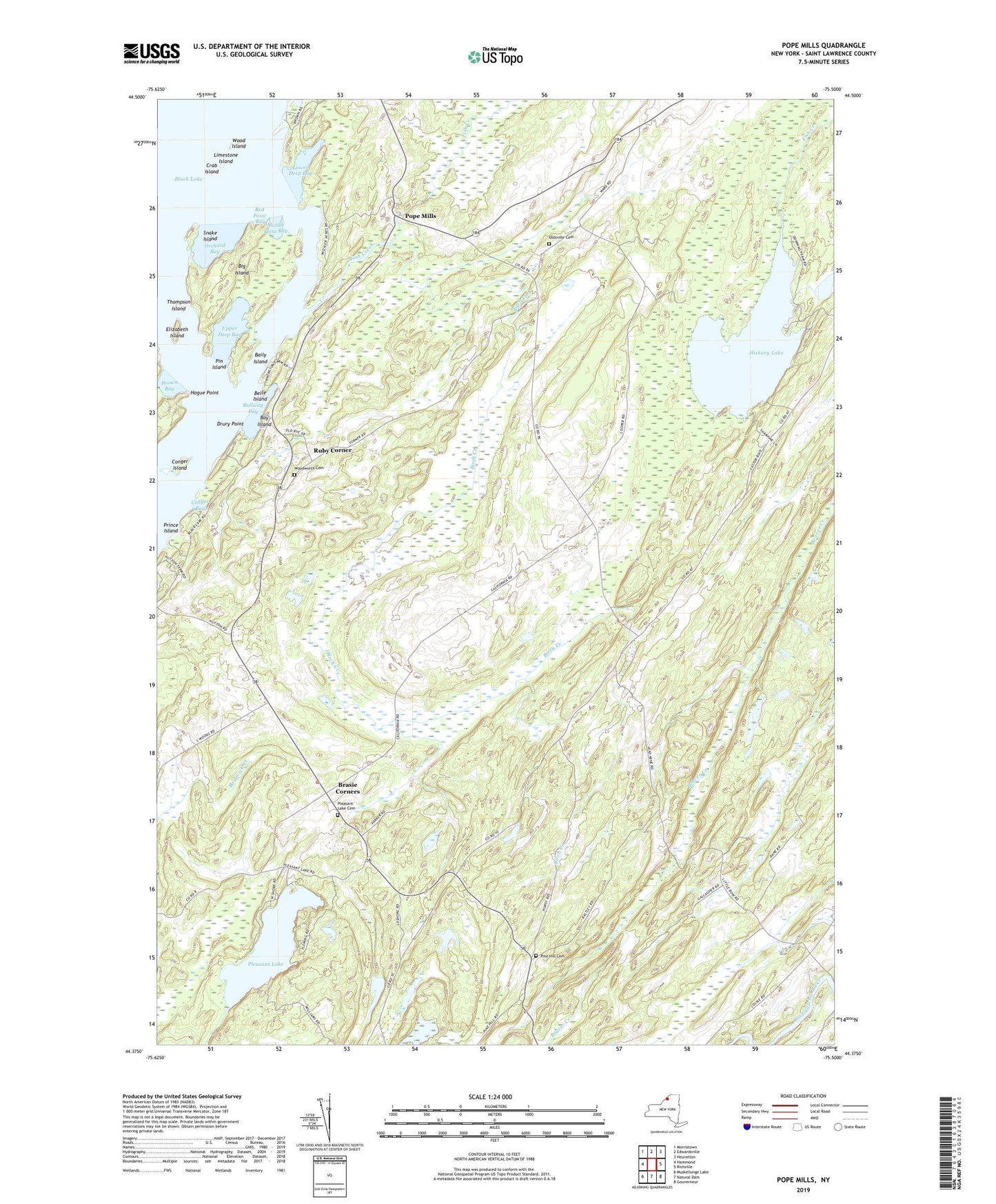
2023 topographic map quadrangle Pope Mills in the state of New York. Scale: 1:24000. Based on the newly updated USGS 7.5' US Topo map series, this map is in the following counties: St. Lawrence. The map contains contour data, water features, and other items you are used to seeing on USGS maps, but also has updated roads and other features. This is the next generation of topographic maps. Printed on high-quality waterproof paper with UV fade-resistant inks.
Quads adjacent to this one:
West: Hammond
Northwest: Morristown
North: Edwardsville
Northeast: Heuvelton
East: Richville
Southeast: Gouverneur
South: Natural Dam
Southwest: Muskellunge Lake
This map covers the same area as the classic USGS quad with code o44075d5.
Contains the following named places: Baily Island, Bay Island, Belle Island, Big Island, Bigelow School, Birch Creek, Brasie Corners, Brown Bay, California School, Conger Bay, Conger Island, Crab Island, Drury Point, Elizabeth Island, Farley School, Fish Creek, Griffith School, Hague Point, Harmar Farm, Hickory Lake, Hyde School, Limestone Island, Lower Deep Bay, Macomb Community Wesleyan Church, Middle Point Bay, Oak Ridge Farm, Oldsville Cemetery, Orchard Bay, Pierces Corners, Pin Island, Pine Hill Cemetery, Pine Hill School, Pleasant Lake, Pleasant Lake Cemetery, Pope Mills, Prince Island, Red Point Bay, Rollway Bay, Ruby Corner, Snake Island, South Woods School, Stark School, Stark School Corner, Thompson Island, Town of Macomb, Tulley Farm, Upper Deep Bay, Wood Island, Woodworth Cemetery