MyTopo
Raquette River New York US Topo Map
Couldn't load pickup availability
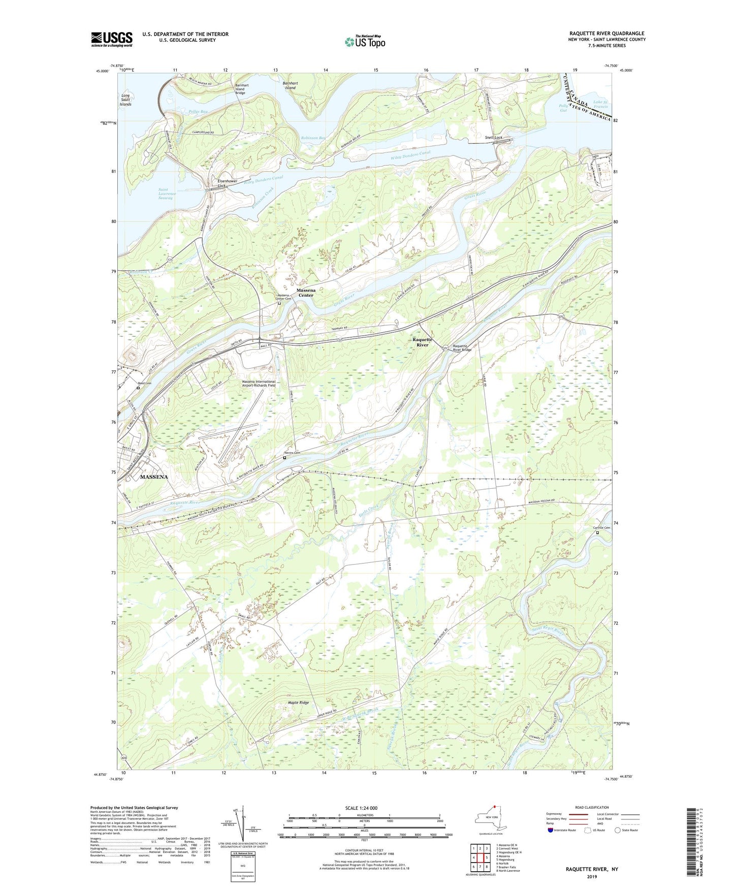
2023 topographic map quadrangle Raquette River in the state of New York. Scale: 1:24000. Based on the newly updated USGS 7.5' US Topo map series, this map is in the following counties: St. Lawrence. The map contains contour data, water features, and other items you are used to seeing on USGS maps, but also has updated roads and other features. This is the next generation of topographic maps. Printed on high-quality waterproof paper with UV fade-resistant inks.
Quads adjacent to this one:
West: Massena
Northwest: Massena OE N
Northeast: Hogansburg OE N
East: Hogansburg
Southeast: North Lawrence
South: Brasher Falls
Southwest: Norfolk
This map covers the same area as the classic USGS quad with code o44074h7.
Contains the following named places: Barnhart Island Bridge, Carville Cemetery, Dike Number Four, Dike Number Three, Earls Creek, Eisenhower Lock, Fox Hill Golf and Country Club, Grass River, Hawkins Point Lookout, Highland Nursing Home, Jefferson Elementary School, Kingdom Hall of Jehovahs Witnesses, Long Sault Dam, Long Sault Islands, Long Sault Lookout, Maple Ridge, Massena Center, Massena Center Cemetery, Massena International Airport-Richards Field, Massena Rescue Squad, Massena Village Wastewater Treatment Plant, Massena Volunteer Emergency Unit, Nevins Cemetery, Polly Gut, Pollys Bay, Pollys Creek, Raquette River, Raquette River Bridge, Reed Cemetery, Robinson Bay, Robinson Creek, RT Seaway Eisenhower Vessel Traffic Control, Saint Joseph Roman Catholic Church, Saint Josephs School, Saint Lawrence Center Shopping Center, Saint Lawrence State Forest Number 10, Saint Lawrence State Forest Number 6, Saint Lawrence State Park, School Number 10, School Number 11, School Number 12, School Number 13, School Number 15, School Number 17, School Number 2, School Number 3, School Number 6, School Number 7, Snell Lock, Squeak Brook, Sunset Drive-In, Town of Massena, Twin River School, West Branch Squeak Brook, Wiley Dondero Canal