MyTopo
Brasher Falls New York US Topo Map
Couldn't load pickup availability
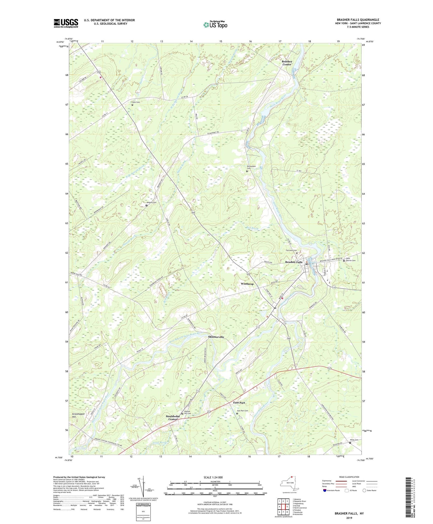
2023 topographic map quadrangle Brasher Falls in the state of New York. Scale: 1:24000. Based on the newly updated USGS 7.5' US Topo map series, this map is in the following counties: St. Lawrence. The map contains contour data, water features, and other items you are used to seeing on USGS maps, but also has updated roads and other features. This is the next generation of topographic maps. Printed on high-quality waterproof paper with UV fade-resistant inks.
Quads adjacent to this one:
West: Norfolk
Northwest: Massena
North: Raquette River
Northeast: Hogansburg
East: North Lawrence
Southeast: Nicholville
South: Parishville
Southwest: Potsdam
This map covers the same area as the classic USGS quad with code o44074g7.
Contains the following named places: Bell Brook, Brasher - Winthrop Volunteer Fire Department, Brasher Center, Brasher Falls, Brasher Falls Census Designated Place, Brasher Falls Post Office, Brasher Falls Sewer District 1 Sewage Treatment Plant, Brasher Falls-Winthrop Census Designated Place, East Part, East Part Cemetery, Fairview Cemetery, Grasshopper Hill, Holmes Hill Cemetery, Jenkins Cemetery, Kyle Cemetery, Meadowbrook Golf Course, Norfolk Volunteer Fire Department Station 3, Richardson Cemetery, Riverside Campground, Saint Lawrence Central School, Saint Lawrence Middle School, Saint Patrick Cemetery, Saint Patricks Church, School Number 1, School Number 10, School Number 13, School Number 16, School Number 2, School Number 23, School Number 8, Skinnerville, Stockholm Center, Tri Town Volunteer Rescue Squad, Trout Brook, Victory Baptist Church, West Branch Saint Regis River, Willis Cemetery, Winthrop, Winthrop Census Designated Place, Winthrop Post Office, ZIP Codes: 13613, 13697