
MyTopo
Prattsburg New York US Topo Map
Couldn't load pickup availability
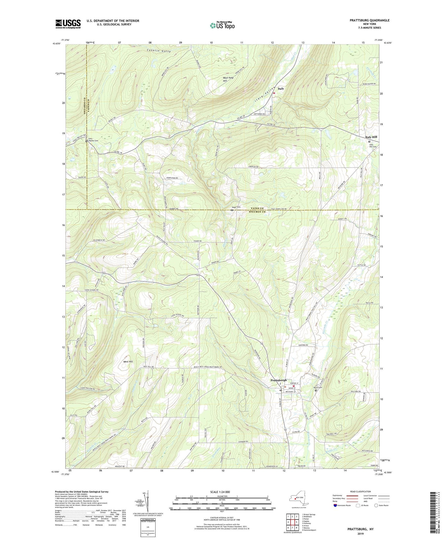
2023 topographic map quadrangle Prattsburg in the state of New York. Scale: 1:24000. Based on the newly updated USGS 7.5' US Topo map series, this map is in the following counties: Steuben, Yates, Ontario. The map contains contour data, water features, and other items you are used to seeing on USGS maps, but also has updated roads and other features. This is the next generation of topographic maps. Printed on high-quality waterproof paper with UV fade-resistant inks.
Quads adjacent to this one:
West: Naples
Northwest: Bristol Springs
North: Middlesex
Northeast: Potter
East: Pulteney
Southeast: Hammondsport
South: Rheims
Southwest: Avoca
This map covers the same area as the classic USGS quad with code o42077e3.
Contains the following named places: Daball Corners, High Tor Wildlife Management Area, Italy, Italy - Naples Cemetery, Italy Hill Baptist Church, Italy Hill Cemetery, Italy Naples Church, Mackenzie Family Farm, Maxfield Hose Company Station 3, Prattsburgh, Prattsburgh Baptist Church, Prattsburgh Census Designated Place, Prattsburgh Central School, Prattsburgh Free Library, Prattsburgh Post Office, Prattsburgh Protective Volunteer Fire Department, Prattsburgh United Methodist Church, Prattsburgh Volunteer Ambulance, Rural Cemetery, Saint Patrick's Church, School Number 10, School Number 4, Segar Cemetery, Segar Gully, Town of Italy, Town of Prattsburgh, West Hill, West Italy Hill, ZIP Code: 14873


