MyTopo
South Pond Mountain New York US Topo Map
Couldn't load pickup availability
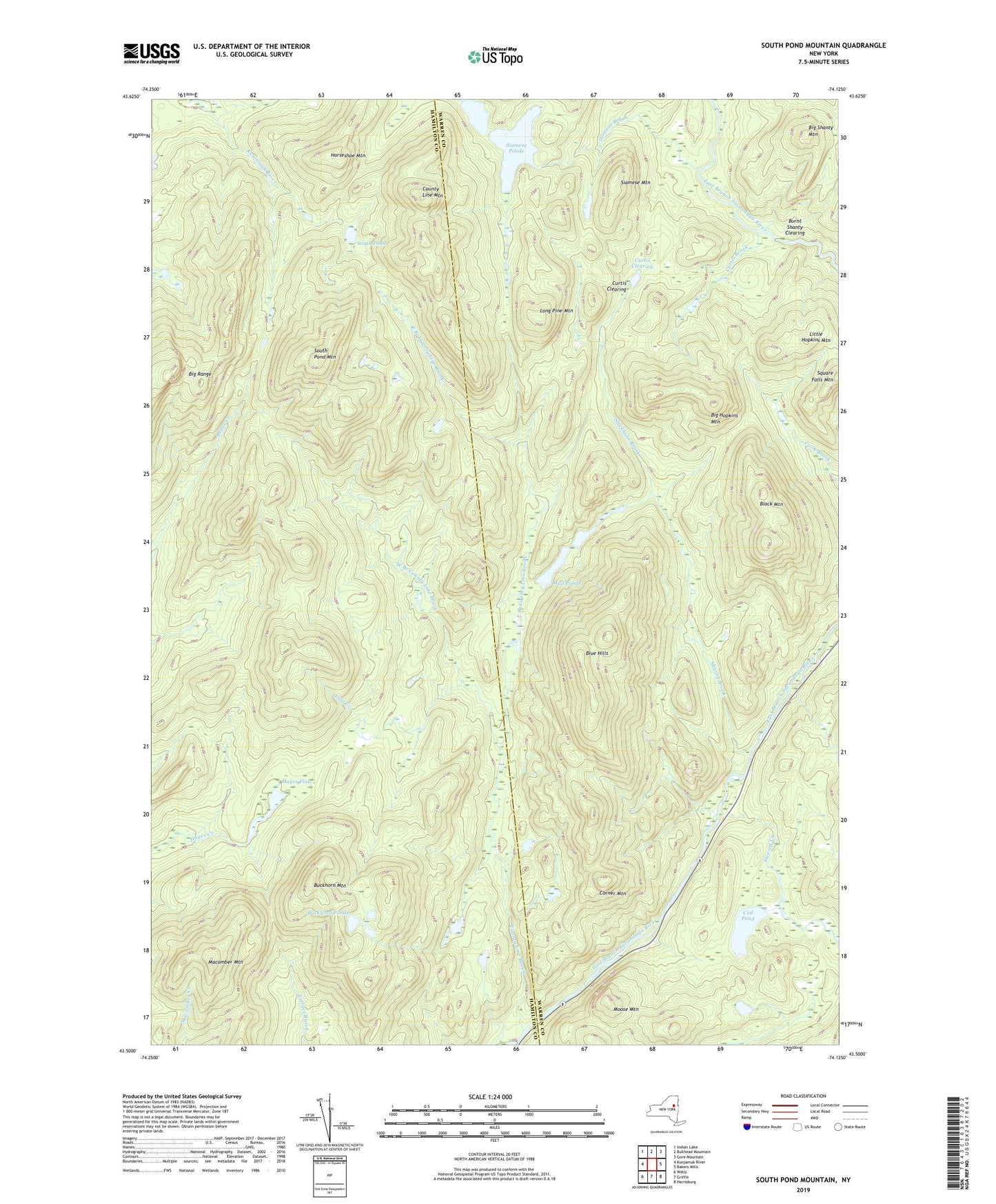
2019 topographic map quadrangle South Pond Mountain in the state of New York. Scale: 1:24000. Based on the newly updated USGS 7.5' US Topo map series, this map is in the following counties: Warren, Hamilton. The map contains contour data, water features, and other items you are used to seeing on USGS maps, but also has updated roads and other features. This is the next generation of topographic maps. Printed on high-quality waterproof paper with UV fade-resistant inks.
Quads adjacent to this one:
West: Kunjamuk River
Northwest: Indian Lake
North: Bullhead Mountain
Northeast: Gore Mountain
East: Bakers Mills
Southeast: Harrisburg
South: Griffin
Southwest: Wells
Contains the following named places: Big Hopkins Mountain, Big Shanty Mountain, Black Mountain, Blue Hills, Buckhorn Mountain, Buckhorn Ponds, Burnt Shanty Clearing, Cod Pond, Corner Mountain, County Line Brook, County Line Mountain, Curtis Brook, Curtis Clearing, East Branch County Line Brook, Hayes Flow, Horseshoe Mountain, Little Hopkins Mountain, Long Pine Mountain, Lost Creek, Macomber Mountain, Moose Mountain, Mud Ponds, Shanty Brook, Siamese Brook, Siamese Mountain, Siamese Ponds, South Pond, South Pond Mountain, Square Falls Mountain, Stewart Creek, Stockholm Brook, West Branch County Line Brook