MyTopo
Pawling New York US Topo Map
Couldn't load pickup availability
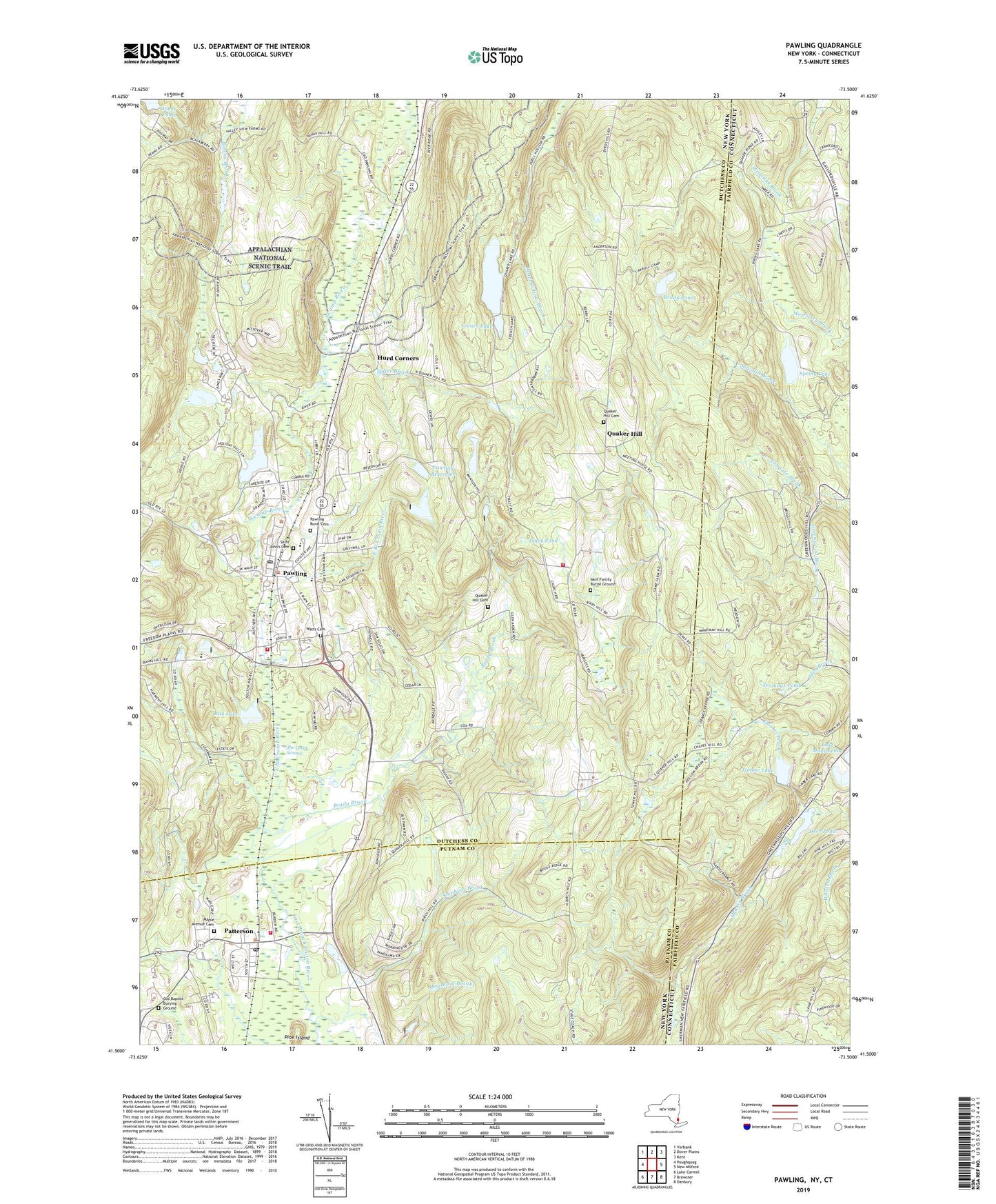
2023 topographic map quadrangle Pawling in the states of New York, Connecticut. Scale: 1:24000. Based on the newly updated USGS 7.5' US Topo map series, this map is in the following counties: Dutchess, Fairfield, Putnam. The map contains contour data, water features, and other items you are used to seeing on USGS maps, but also has updated roads and other features. This is the next generation of topographic maps. Printed on high-quality waterproof paper with UV fade-resistant inks.
Quads adjacent to this one:
West: Poughquag
Northwest: Verbank
North: Dover Plains
Northeast: Kent
East: New Milford
Southeast: Danbury
South: Brewster
Southwest: Lake Carmel
This map covers the same area as the classic USGS quad with code o41073e5.
Contains the following named places: Akin Family Burial Ground, Akins Corners, Baker Corner, Birch Hill, Brady Brook, Brady Pond, Branch Hill, Carroll Camp, Central Baptist Church of Pawling, Christ Church on Quaker Hill, Conger Hill, Corbin Hill, Cranberry Mountain, Deer Pond, Duane Lake Academy, Dutchess Golf Course, Edward R Murrow Park, French Lake, Green Mountain Lake, Greenwood Brook, Hammersly Ridge, Hiller Brook, Holy Trinity Episcopal Church, Hurd Corners, Jennings Pond, Jones Pond, Kingdom Hall of Jehovahs Witnesses, Lovely Hill Nursing Home, Lutheran Church of Christ, Maple Avenue Cemetery, Matthew Patterson Elementary School, Mizzen Top, Mount Tom, Observatory Hill, Old Baptist Burying Ground, Patterson, Patterson Library, Patterson Post Office, Patterson Town Hall, Patterson Volunteer Fire Department Station 1, Pawling, Pawling Elementary School, Pawling Fire Department Engine Company 1, Pawling Fire Department Mizzentop Engine Company 3, Pawling Free Library, Pawling High School, Pawling Middle School, Pawling Post Office, Pawling Reservoir, Pawling Rural Cemetery, Pawling Station, Pawling Town Hall, Pawling United Methodist Church, Pine Island, Purgatory Hill, Quaker Brook, Quaker Hill, Quaker Hill Cemetery, Quaker Hill Country Club, Quaker Lake, Ray Lake, Saint John's Cemetery, Saint John's Roman Catholic Church, School Number 2, Seeley Hill, Spring Lake, Spring Lake Dam, Stephens Brook, The Great Swamp, The Hill Farm, Timber Lake, Timber Lake Dam, Town of Pawling, Tracy Pond, Trinity-Pawling School, Turner Mountain, Valley Pond, Village of Pawling, Village of Pawling Municipal Building, Watts Cemetery, West Mountain, ZIP Code: 12564