MyTopo
Great Bend Pennsylvania US Topo Map
Couldn't load pickup availability
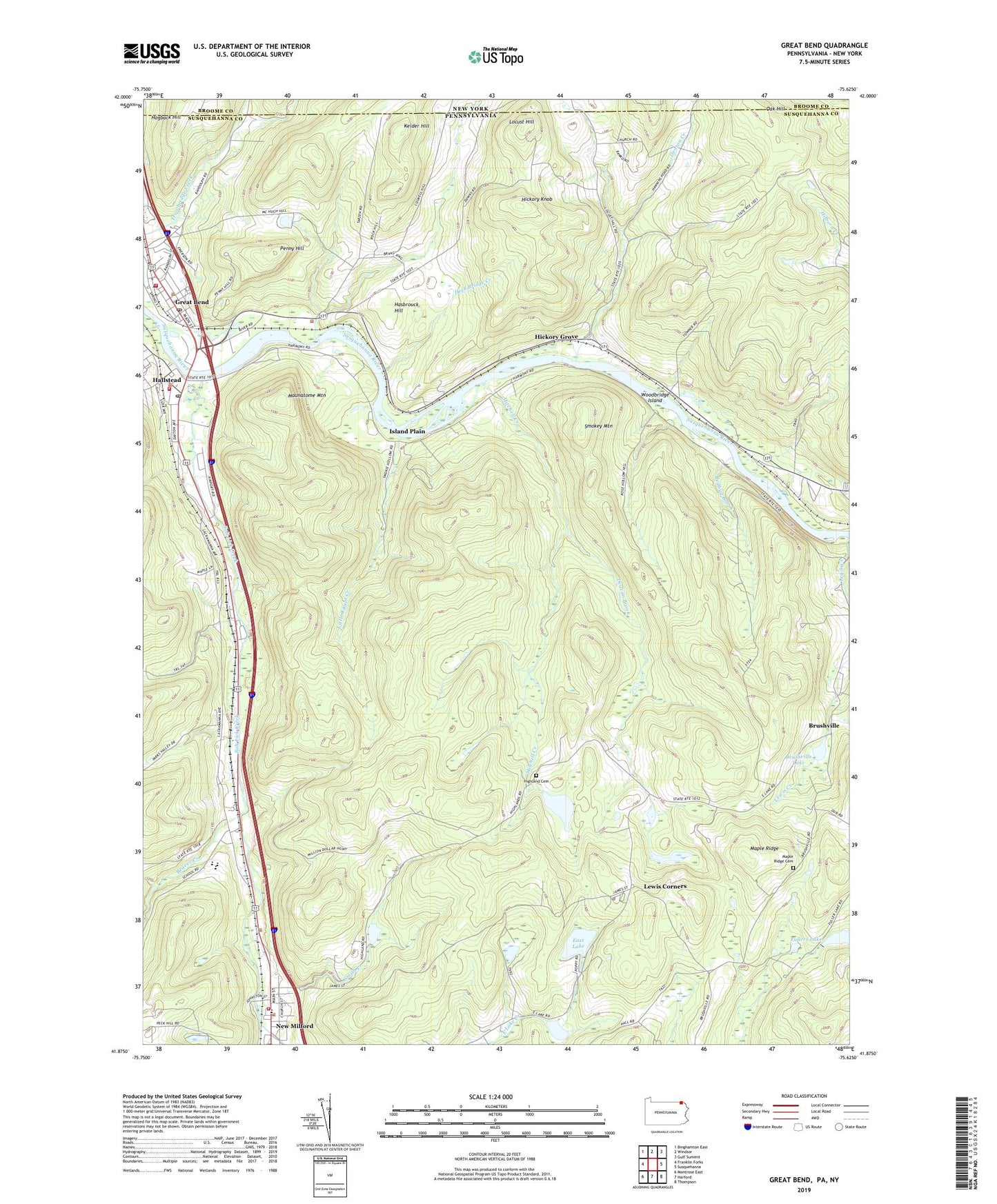
2023 topographic map quadrangle Great Bend in the states of Pennsylvania, New York. Scale: 1:24000. Based on the newly updated USGS 7.5' US Topo map series, this map is in the following counties: Susquehanna, Broome. The map contains contour data, water features, and other items you are used to seeing on USGS maps, but also has updated roads and other features. This is the next generation of topographic maps. Printed on high-quality waterproof paper with UV fade-resistant inks.
Quads adjacent to this one:
West: Franklin Forks
Northwest: Binghamton East
North: Windsor
Northeast: Gulf Summit
East: Susquehanna
Southeast: Thompson
South: Harford
Southwest: Montrose East
This map covers the same area as the classic USGS quad with code o41075h6.
Contains the following named places: Beaver Creek, Bedbug Brook, Borough of Great Bend, Borough of Hallstead, Borough of New Milford, Brushville, Brushville Lake, Brushville School, Columbia Hose Company 1, Deacon Brook, Denton Creek, Dranchak Dam, DuBois Creek, East Great Bend School, East Lake, Fullers Lake, Fulles Lake Dam, Great Bend, Great Bend Hallstead Volunteer Ambulance, Great Bend Hose Company 1, Great Bend Post Office, Hallstead, Hallstead Airport, Hallstead Fire Department, Hallstead Post Office, Hasbrouck Hill, Hickory Grove, Hickory Knob, High Bridge Creek, Highland Cemetery, Highland School, Hogback Hill, Island Plain, Kelder Hill, Kinney Johnson School, Lewis Corners, Little Egypt Creek, Locust Hill, Locust Hill Church, Maple Ridge, Maple Ridge Cemetery, Maple Ridge School, Maunatome Mountain, McKinney Airport, Meylert Creek, Mitchell Creek, Oak Hill, Oak Hill School, Penny Hill, Salt Lick Creek, Smith Creek, Smokey Mountain, State Game Lands Number 175, State Game Lands Number 35, Susquehanna Boy Scout Camp, Tingley, Township of Great Bend, Woodbridge Island, ZIP Code: 18821