MyTopo
Witherbee New York US Topo Map
Couldn't load pickup availability
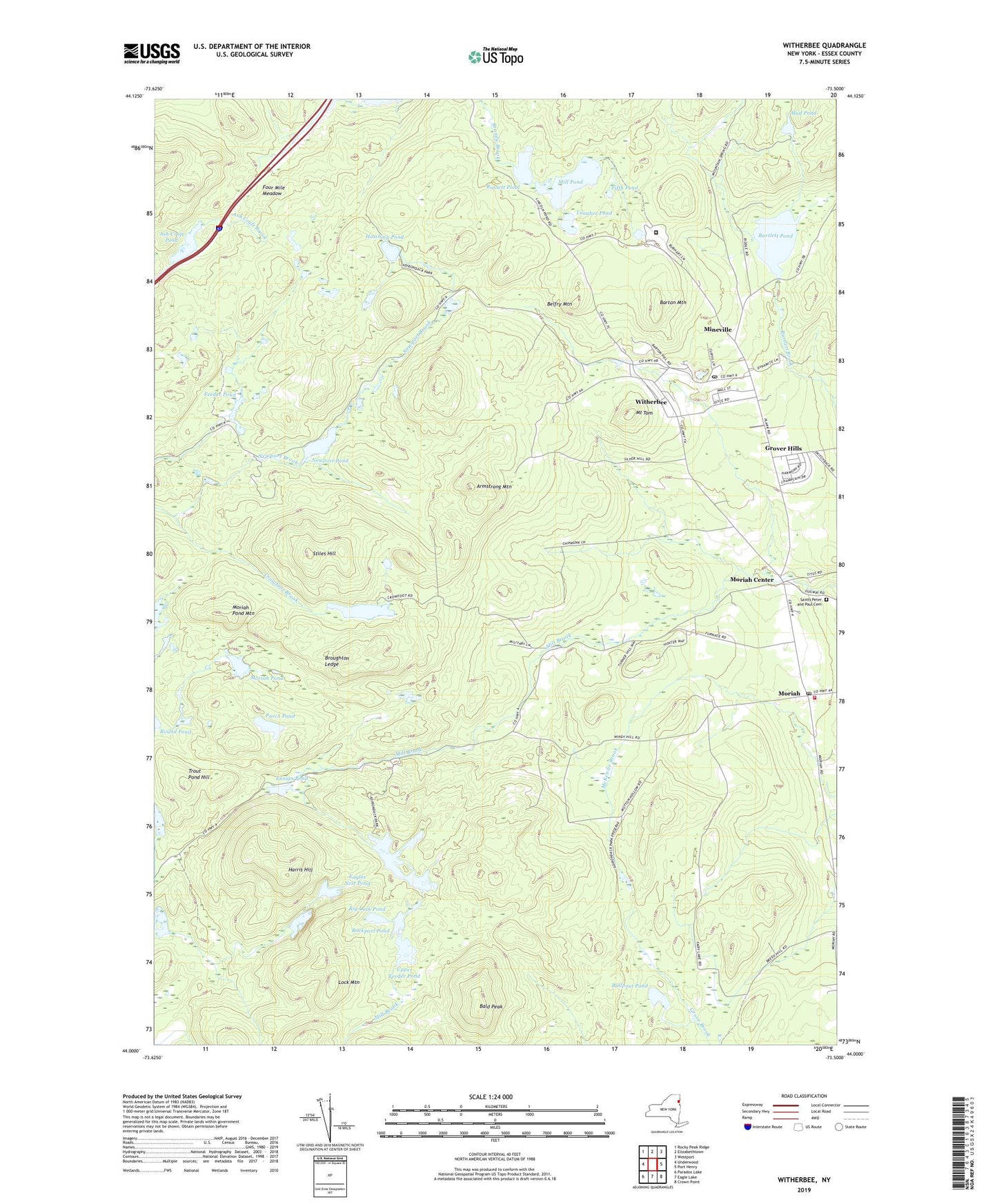
2019 topographic map quadrangle Witherbee in the state of New York. Scale: 1:24000. Based on the newly updated USGS 7.5' US Topo map series, this map is in the following counties: Essex. The map contains contour data, water features, and other items you are used to seeing on USGS maps, but also has updated roads and other features. This is the next generation of topographic maps. Printed on high-quality waterproof paper with UV fade-resistant inks.
Quads adjacent to this one:
West: Underwood
Northwest: Rocky Peak Ridge
North: Elizabethtown
Northeast: Westport
East: Port Henry
Southeast: Crown Point
South: Eagle Lake
Southwest: Paradox Lake
Contains the following named places: Armstrong Mountain, Ash Craft Pond, Bald Peak, Bartlett Pond, Barton Mountain, Belfry Mountain, Big Lock Pond, Broughton Ledge, Bullpout Pond, Church of All Saints, Eagles Nest Pond, Ensign Pond, Feeder Pond, Fifth Pond, Four Mile Meadow, Grover Hills, Harris Hill, Hatching Pond, Lock Mountain, Mill Pond, Mineville, Mineville Census Designated Place, Mineville Post Office, Mineville-Witherbee Census Designated Place, Moriah, Moriah Ambulance Squad, Moriah Center, Moriah Pond, Moriah Pond Mountain, Moriah Post Office, Moriah Shock Incarceration Correctional Facility, Moriah United Methodist Church, Moriah Volunteer Fire Department, Mount Tom, Mud Pond, Murrey Pond, Newport Brook, Newport Pond, Parch Pond, Pine Pond, Rockport Pond, Russett Pond, Saint Joseph the Worker School, Saints Peter and Paul Cemetery, Smith Pond, Stiles Hill, Tanaher Pond, Town of Moriah, Trout Pond, Trout Pond Hill, Tub Mill Pond, Upper Feeder Pond, Witherbee, Witherbee Census Designated Place, ZIP Codes: 12960, 12961, 12998