MyTopo
Anderson Creek North Carolina US Topo Map
Couldn't load pickup availability
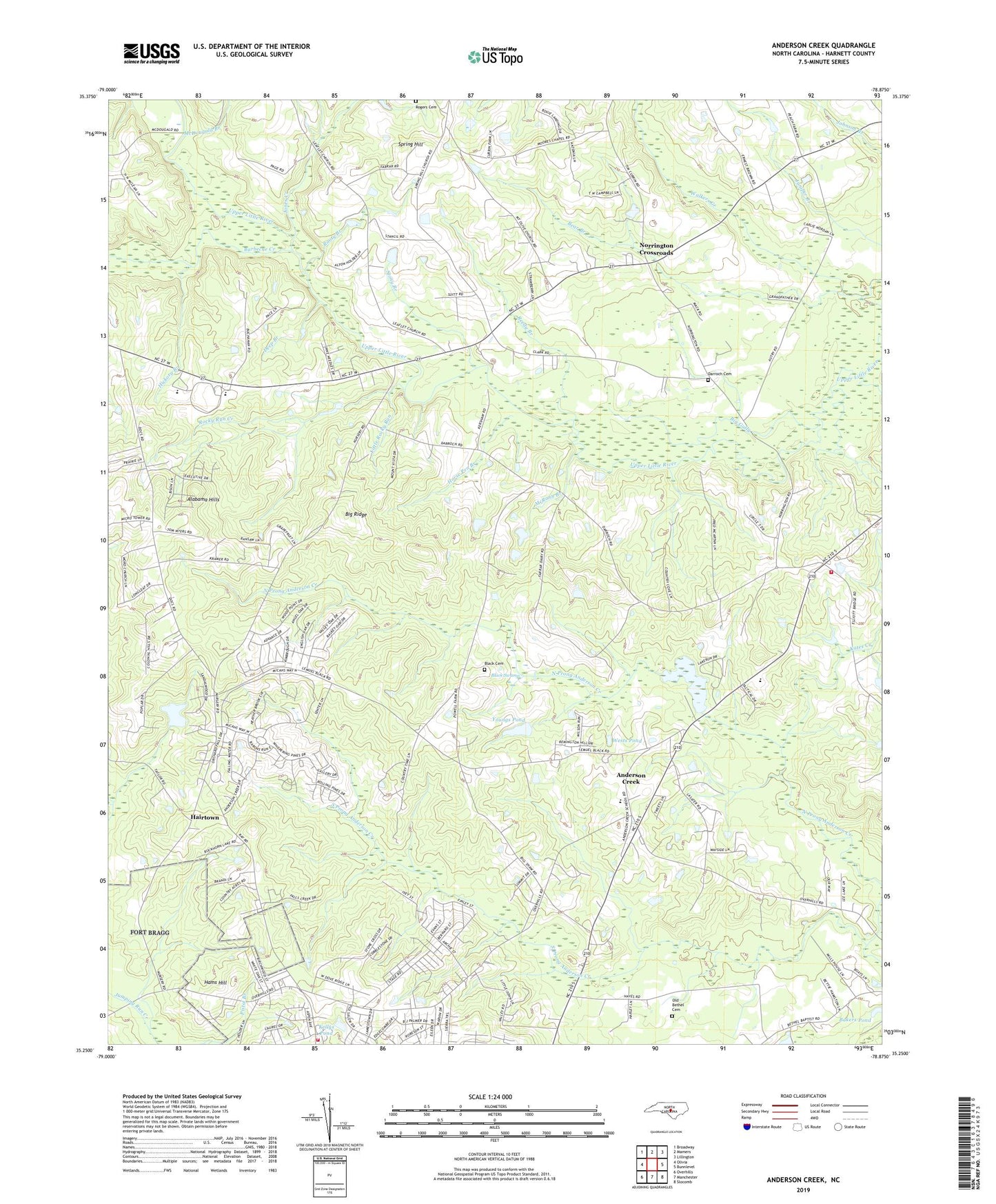
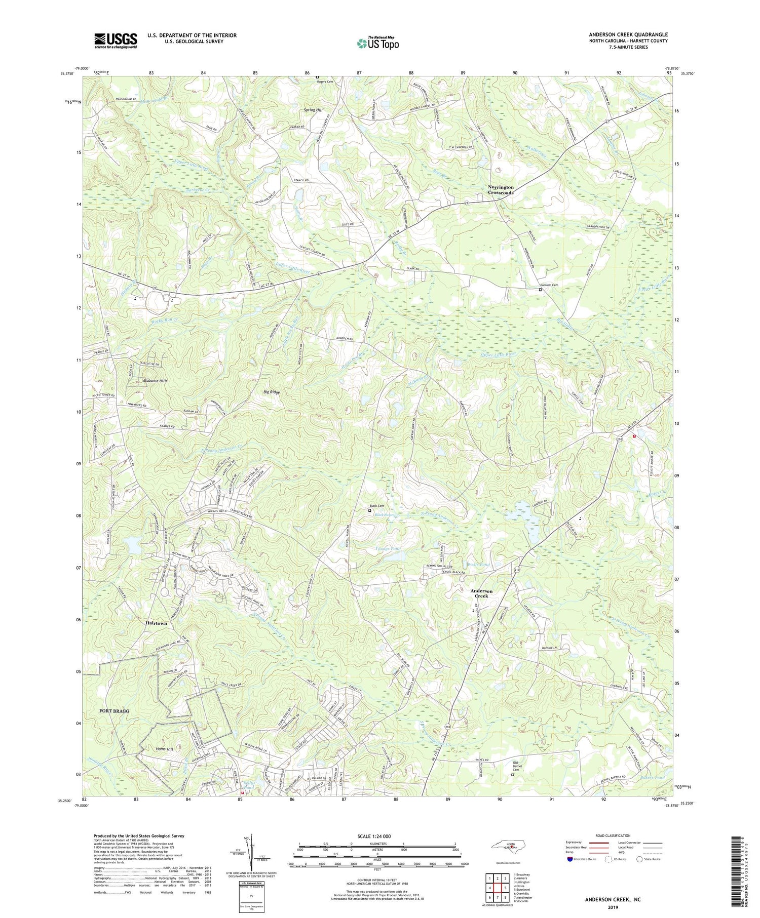
2019 topographic map quadrangle Anderson Creek in the state of North Carolina. Scale: 1:24000. Based on the newly updated USGS 7.5' US Topo map series, this map is in the following counties: Harnett. The map contains contour data, water features, and other items you are used to seeing on USGS maps, but also has updated roads and other features. This is the next generation of topographic maps. Printed on high-quality waterproof paper with UV fade-resistant inks.
Quads adjacent to this one:
West: Olivia
Northwest: Broadway
North: Mamers
Northeast: Lillington
East: Bunnlevel
Southeast: Slocomb
South: Manchester
Southwest: Overhills
Contains the following named places: Alabama Hills, Anderson Creek, Anderson Creek Census Designated Place, Anderson Creek Emergency Services, Anderson Creek School, Bakers Pond, Barbecue Creek, Bear Branch, Big Gully, Big Ridge, Black Cemetery, Black Swamp, Cambro Pond, Cambro Pond Dam, Darroch Cemetery, Deep Branch, Flat Branch, Flat Branch Volunteer Fire Department, Gourd Springs Church, Hairtown, Hams Hill, Harnett County Emergency Medical Service Quick Response Vehicle - Flatbranch Station, Hickory Branch, Horse Pen Branch, Jones Creek, Kellys Pond, Knights Spring Branch, Layton Chapel, Little Branch, Little Rocky Run, McDougald Branch, McRaes Chapel, McRany Branch, Mount Olive Church, Norrington Crossroads, Norrington School, North Prong Anderson Creek, Old Bethel Cemetery, Reedy Branch, Rice Patch Branch, Rocky Run Creek, Rooty Branch, Smith Lake Dam, South Harnett School, South Prong Anderson Creek, South Prong McLeod Creek, Spring Hill, Spring Hill Church, Stony Branch, Township of Anderson Creek, Union Church, Walkers Creek, Western Harnett High School, Wests Pond, White Oak Church, Youngs Pond