MyTopo
Aulander North Carolina US Topo Map
Couldn't load pickup availability
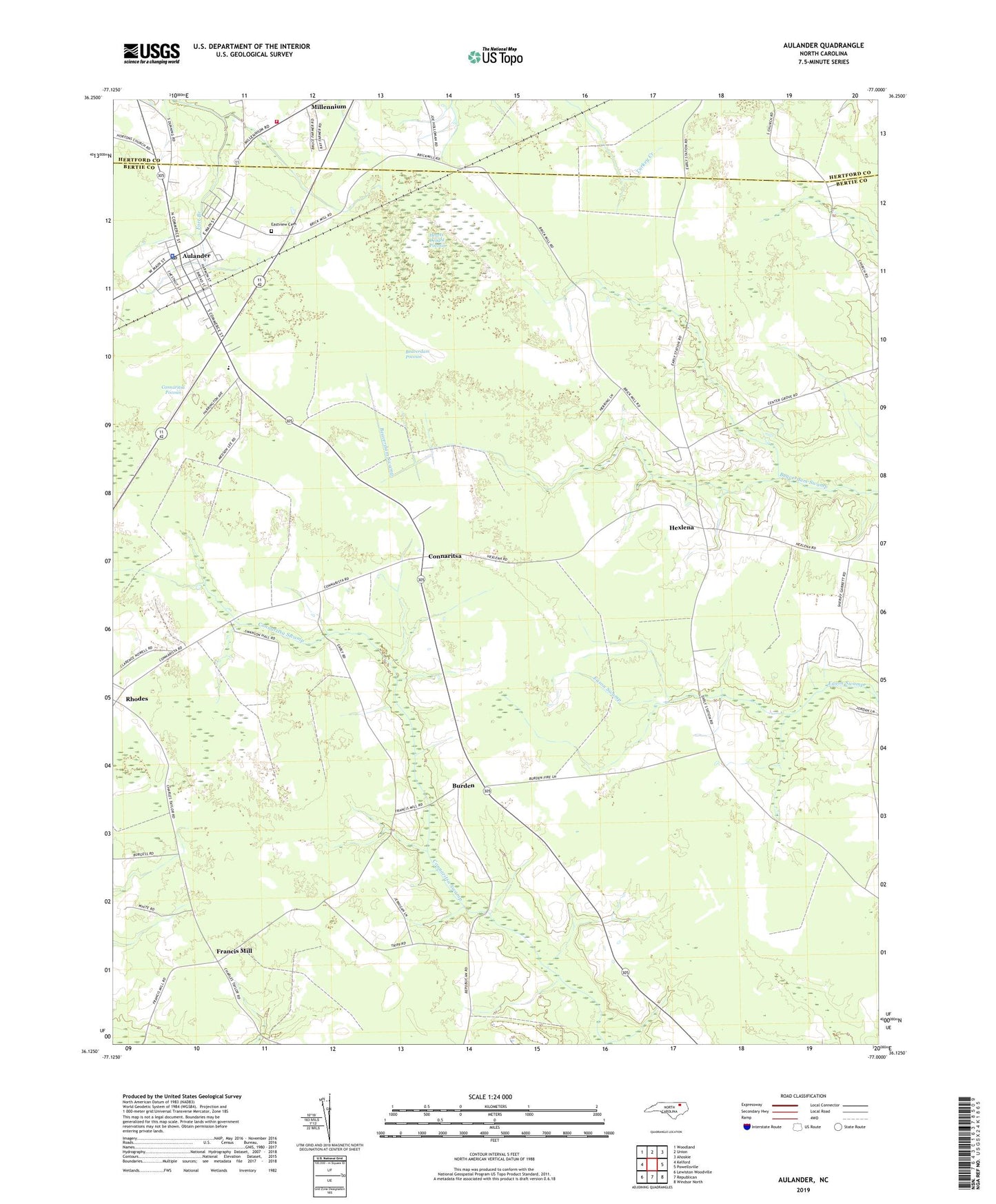
2019 topographic map quadrangle Aulander in the state of North Carolina. Scale: 1:24000. Based on the newly updated USGS 7.5' US Topo map series, this map is in the following counties: Bertie, Hertford. The map contains contour data, water features, and other items you are used to seeing on USGS maps, but also has updated roads and other features. This is the next generation of topographic maps. Printed on high-quality waterproof paper with UV fade-resistant inks.
Quads adjacent to this one:
West: Kelford
Northwest: Woodland
North: Union
Northeast: Ahoskie
East: Powellsville
Southeast: Windsor North
South: Republican
Southwest: Lewiston Woodville
Contains the following named places: Aulander, Aulander Church, Aulander Police Department, Aulander Post Office, Aulander Rescue Squad, Beaverdam Pocosin, Burden, Center Grove Church, Conconary Church, Connaritsa, Connaritsa Church, Connaritsa Pocosin, Eastview Cemetery, Francis Mill, Hearts Delight Pocosin, Hexlena, Metropolitan Interdenominational Church of God, Millennium, Millennium Church, Millennium Fire Department, Rhodes, South Aulander School, Town of Aulander, Township of Mitchell, ZIP Code: 27805