MyTopo
Buffalo City North Carolina US Topo Map
Couldn't load pickup availability
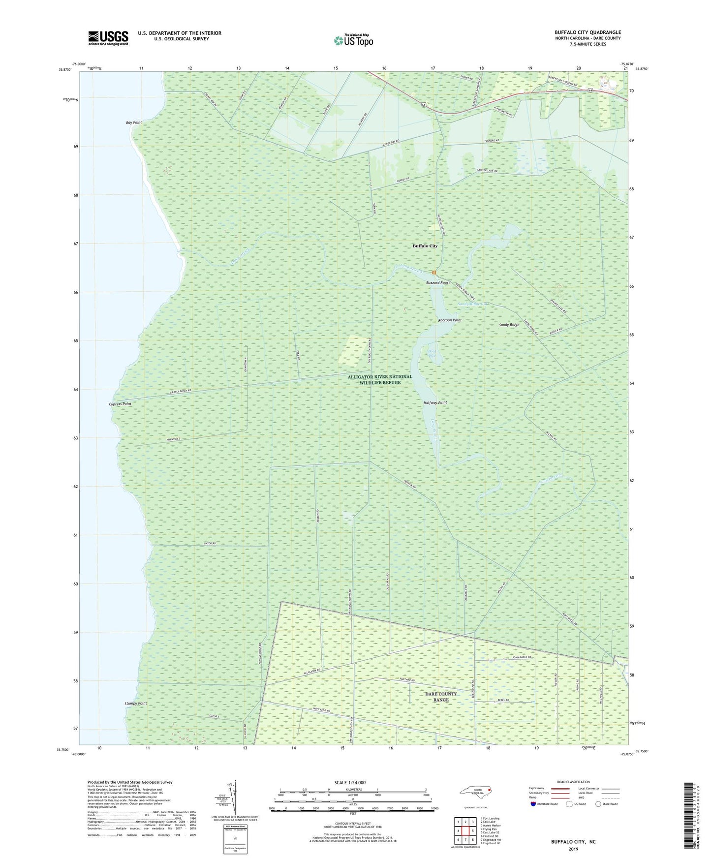
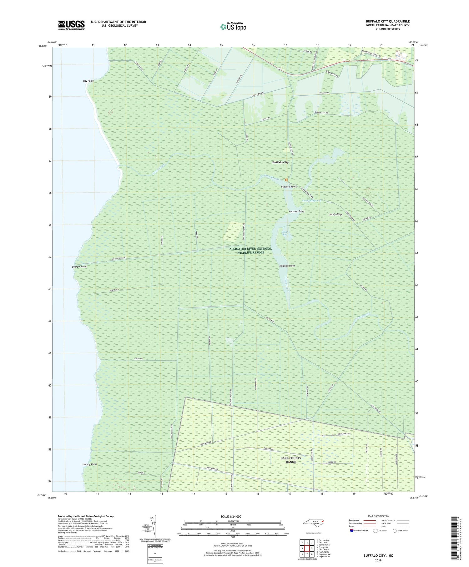
2019 topographic map quadrangle Buffalo City in the state of North Carolina. Scale: 1:24000. Based on the newly updated USGS 7.5' US Topo map series, this map is in the following counties: Dare. The map contains contour data, water features, and other items you are used to seeing on USGS maps, but also has updated roads and other features. This is the next generation of topographic maps. Printed on high-quality waterproof paper with UV fade-resistant inks.
Quads adjacent to this one:
West: Frying Pan
Northwest: Fort Landing
North: East Lake
Northeast: Manns Harbor
East: East Lake SE
Southeast: Engelhard NE
South: Engelhard NW
Southwest: Fairfield NE
Contains the following named places: Bay Point, Beach Land Landing, Boat Bay, Buffalo City, Buzzard Roost, Cypress Point, East Lake Church, Halfway Point, Long Stretch, Milltail Creek, Raccoon Point, Sandy Ridge, Sandy Ridge Gut, Sawyer Lake, Stumpy Point, Township of East Lake, ZIP Code: 27953