MyTopo
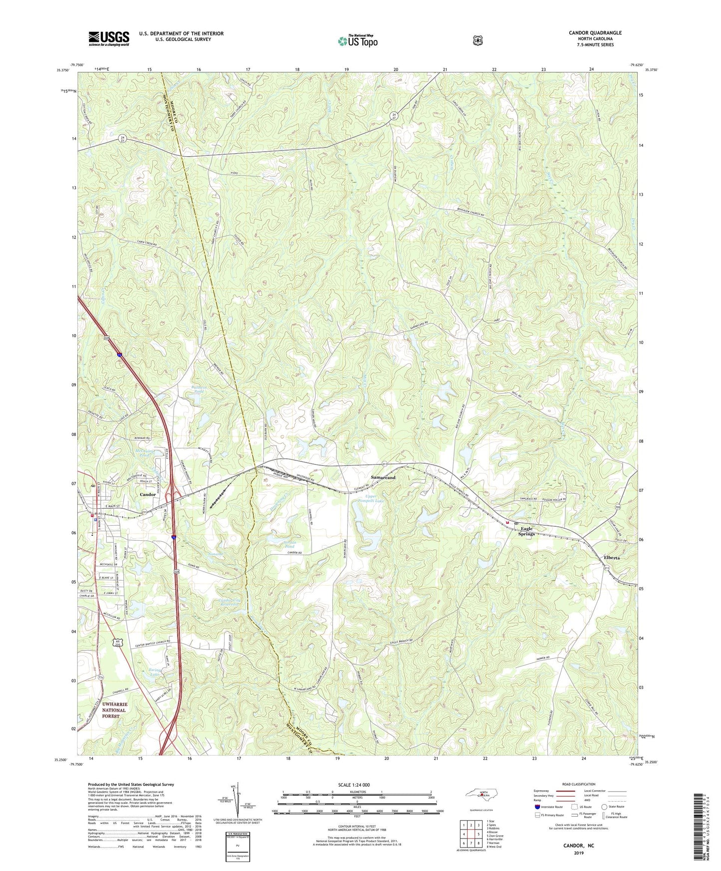
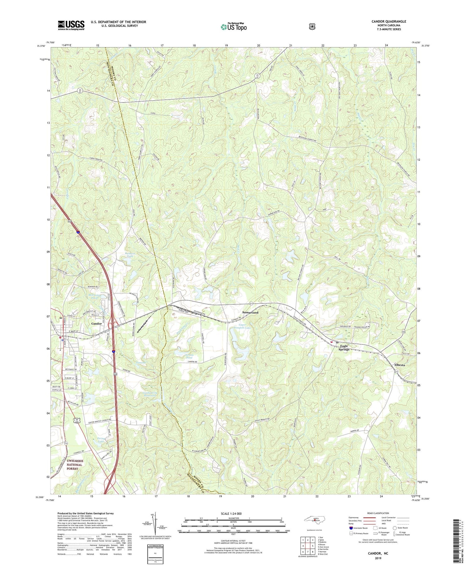
Candor North Carolina US Topo Map
Couldn't load pickup availability
2019 topographic map quadrangle Candor in the state of North Carolina. Scale: 1:24000. Based on the newly updated USGS 7.5' US Topo map series, this map is in the following counties: Moore, Montgomery. The map contains contour data, water features, and other items you are used to seeing on USGS maps, but also has updated roads and other features. This is the next generation of topographic maps. Printed on high-quality waterproof paper with UV fade-resistant inks.
Quads adjacent to this one:
West: Biscoe
Northwest: Star
North: Spies
Northeast: Robbins
East: Zion Grove
Southeast: West End
South: Norman
Southwest: Harrisville
Contains the following named places: Antioch Church, Archie McDuffie Dam, Arthur Williams and Son Number One Dam, Arthur Williams and Son Number Two Dam, Arthur Williams and Sons Dam Number Three, Arthur Williams Dam, Arthur Williams Dam Number Two, Baldwin Pond, Baldwin Pond Dam, Bengston Lake Dam Number Three, Bensalem Church, Big Oak Academy, Big Oak Church, Brutonville School, Candor, Candor City Reservoir, Candor City Reservoir Dam, Candor Elementary School, Candor Police Department, Candor Post Office, Candor Volunteer Fire Department, Center Church, Cunningham Lake, Cunningham Lake Dam, Eagle Springs, Eagle Springs Post Office, Eagle Springs Volunteer Fire Department, Ed Harris Dam, Ed Harris Dam Number One, Ed Harris Dam Number Two, Elberta, Ewing Lake, Ewing Lake Dam, Flint Hill Church, Jordan Pond, Jordan Pond Dam, Leaks Grove Church, McCauley Pond, McCauley Pond Dam, Mount Zion Church, Noname, Phillip Benston Dam Number Four, Samarcand, Samarcand Manor State Correctional Instituti, Sings Creek, Town of Candor, Township 2-Bensalem, Upper Pompelli Lake, Upper Pompelli Lake Dam, V W Burkhead Dam Number One, V W Burkhead Dam Number Two, W T Lewis Dam, ZIP Code: 27242