MyTopo
Castle Hayne North Carolina US Topo Map
Couldn't load pickup availability
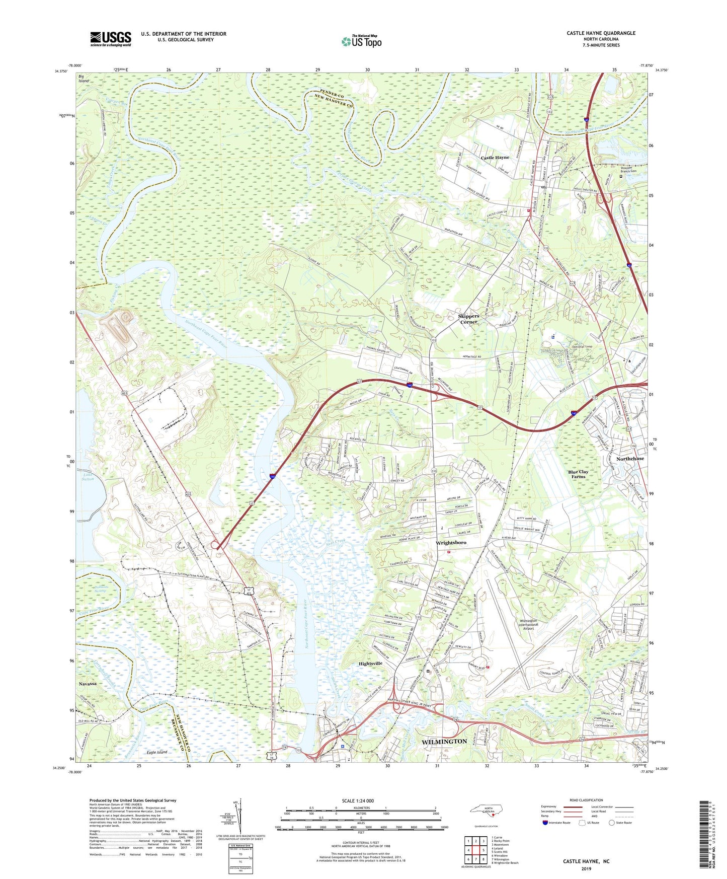
2022 topographic map quadrangle Castle Hayne in the state of North Carolina. Scale: 1:24000. Based on the newly updated USGS 7.5' US Topo map series, this map is in the following counties: New Hanover, Pender, Brunswick. The map contains contour data, water features, and other items you are used to seeing on USGS maps, but also has updated roads and other features. This is the next generation of topographic maps. Printed on high-quality waterproof paper with UV fade-resistant inks.
Quads adjacent to this one:
West: Leland
Northwest: Currie
North: Rocky Point
Northeast: Mooretown
East: Scotts Hill
Southeast: Wrightsville Beach
South: Wilmington
Southwest: Winnabow
This map covers the same area as the classic USGS quad with code o34077c8.
Contains the following named places: Alandale, Believers Destiny Church, Bible Church, Blue Clay Farms Census Designated Place, Britthaven of North Chase, Brookfield, Brookfield Church of God, Burnt Mill Creek, Cape Fear Marina, Cape Fear Shopping Center, Carrol C Mobile Home Park, Cartwheel Branch, Castle Hayne, Castle Hayne Census Designated Place, Castle Hayne Post Office, Catfish Creek, Colonial Mobile Home Court, Council Heights, Cowpen Branch, Cowpen Landing, D C Virgo Junior High School, Double D Mobile Home Park, Emma B Trask Elementary School, Fishing Creek, Glynnwood Mobile Home Park, Greystone Estates, Hermitage House Rest Home, Hightsville, Hightsville Census Designated Place, Island Park Industrial Park, Lagoon Creek, Love Grove, Maids Park, Mount Holly Church, Mount Roney Baptist Church, Ness Creek, New Covenant Full Gospel Church, New Hanover Correctional Center, New Hanover County Fire Rescue Station 13, New Hanover County Fire Station 11 Wrightsboro, New Hanover County Sheriff's Office, Northchase Census Designated Place, Oakley Mobile Home Park, Olivet Baptist Church, Park Place Mobile Home Park, Pine View Church, Point Harbor Marina, Prince George Creek, Riverside Mobile Home Park, Saint James Church, Saint Phillips Church, Saint Stanislaus Church, Sedgefield, Seitter Acres, Shady Haven Mobile Home Park, Shamrock Mobile Home Park, Shoulder Branch Cemetery, Shoulder Branch Church, Skippers Corner, Skippers Corner Census Designated Place, Smith Creek, Spring Branch, Sweeney Water Treatment Plant, The Palms Mobile Home Park, Tonys Creek, Township of Cape Fear, Virgo Junior High School, Walnut Hills, Watsons Mobile Home Park, Wilmington International Airport, Wilmington International Airport Rescue Base, Wilmington Police Department, Wrightsboro, Wrightsboro Acres, Wrightsboro Baptist Church, Wrightsboro Census Designated Place, Wrightsboro Elementary School, ZIP Codes: 28401, 28429