MyTopo
Winnabow North Carolina US Topo Map
Couldn't load pickup availability
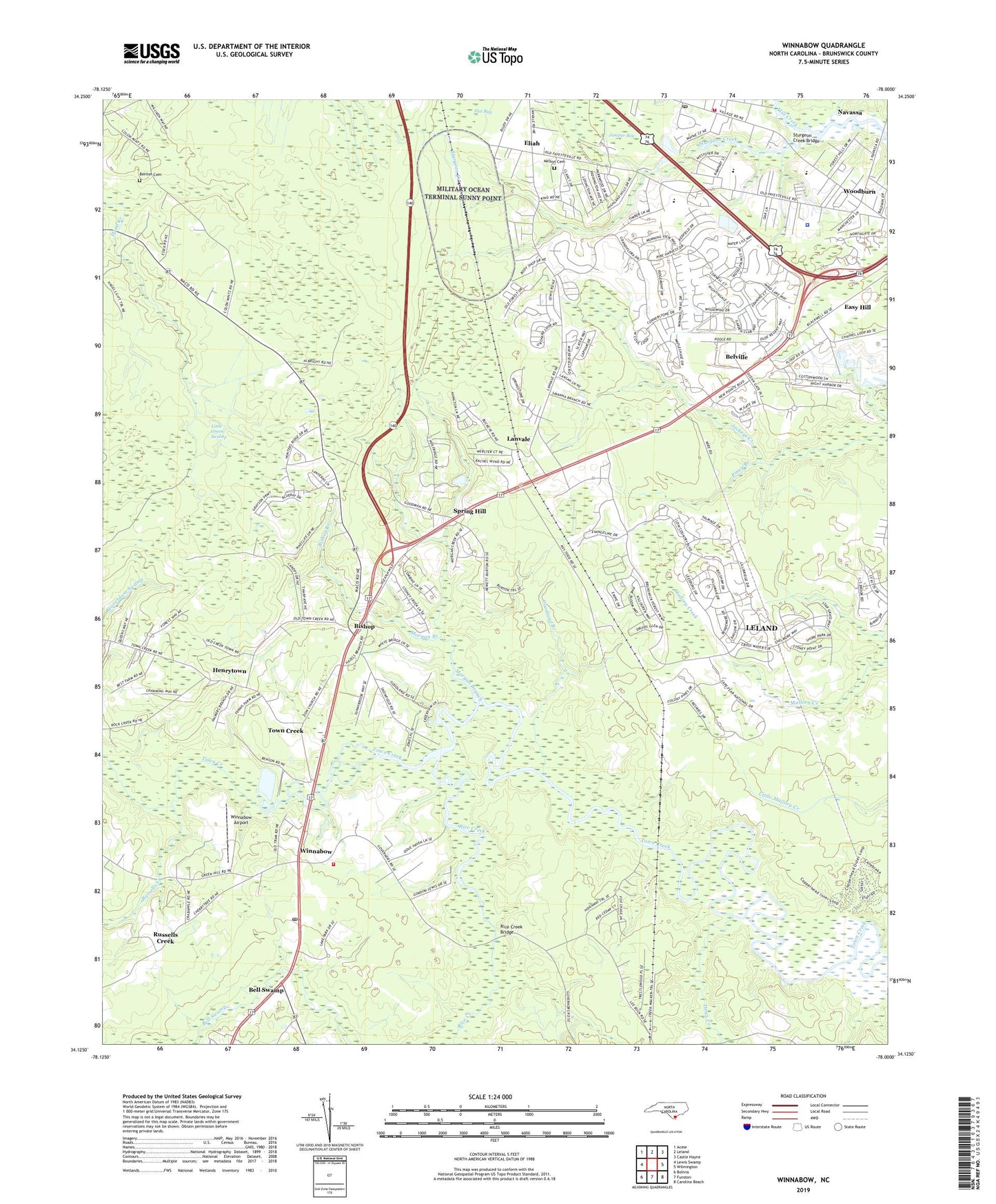
2022 topographic map quadrangle Winnabow in the state of North Carolina. Scale: 1:24000. Based on the newly updated USGS 7.5' US Topo map series, this map is in the following counties: Brunswick. The map contains contour data, water features, and other items you are used to seeing on USGS maps, but also has updated roads and other features. This is the next generation of topographic maps. Printed on high-quality waterproof paper with UV fade-resistant inks.
Quads adjacent to this one:
West: Lewis Swamp
Northwest: Acme
North: Leland
Northeast: Castle Hayne
East: Wilmington
Southeast: Carolina Beach
South: Funston
Southwest: Bolivia
This map covers the same area as the classic USGS quad with code o34078b1.
Contains the following named places: Ame Church, Bell Swamp, Bell Swamp School, Benton Cemetery, Bishop, Bishop Branch, Blackwell Chapel, Brunswick County Emergency Medical Services - Base Station 8, Brunswick County Library - Leland Branch, Damascus Road Church, Dews Creek, Easy Hill, El Paso, Eliah, Goodland Branch, Grove Church, Henrytown, Lanvale, Leland Fire and Rescue Station, Leland Middle School, Leland Police Department, Leland Post Office, Mill Creek, Morgan Branch, Nelson Cemetery, New Hope Church, North Brunswick High School, Piney Branch, Rice Creek, Rice Creek Bridge, Russells Creek, Saint James Church, Saint Mary Church, Shiloh Church, Spring Hill, Sturgeon Creek Bridge, Town Creek, Town Creek Church, Town Creek Park, Town of Leland, Township of Town Creek, Wayside Church, Winnabow, Winnabow Airport, Winnabow Fire Station 1, Winnabow Post Office, WKLM-AM (Leland), WKLM-AM (Wilmington), Woodburn, Woodburn Church, Zion Church, ZIP Code: 28451