MyTopo
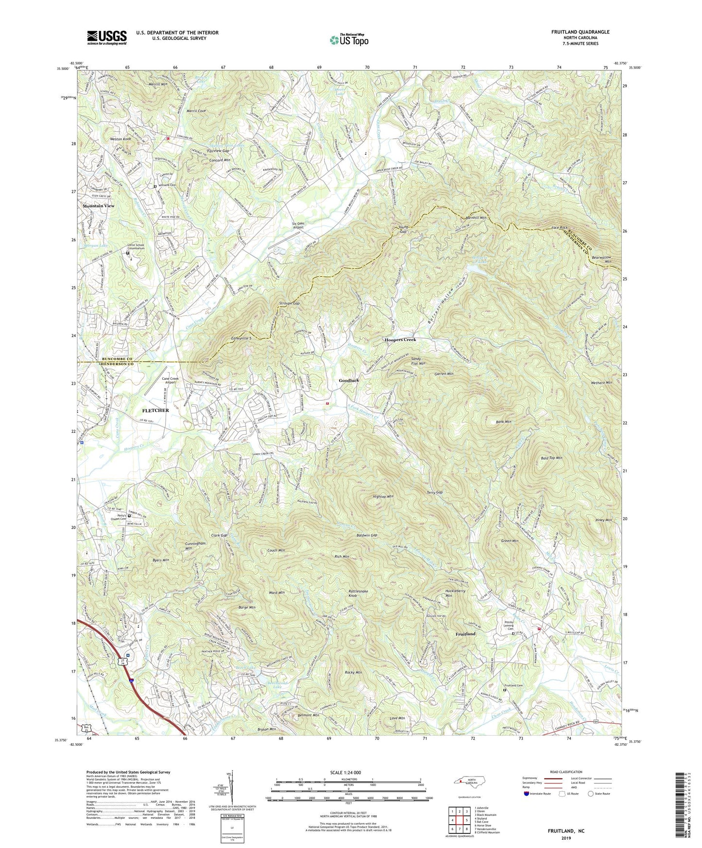
Fruitland North Carolina US Topo Map
Couldn't load pickup availability
2022 topographic map quadrangle Fruitland in the state of North Carolina. Scale: 1:24000. Based on the newly updated USGS 7.5' US Topo map series, this map is in the following counties: Henderson, Buncombe. The map contains contour data, water features, and other items you are used to seeing on USGS maps, but also has updated roads and other features. This is the next generation of topographic maps. Printed on high-quality waterproof paper with UV fade-resistant inks.
Quads adjacent to this one:
West: Skyland
Northwest: Asheville
North: Oteen
Northeast: Black Mountain
East: Bat Cave
Southeast: Cliffield Mountain
South: Hendersonville
Southwest: Horse Shoe
This map covers the same area as the classic USGS quad with code o35082d4.
Contains the following named places: Bald Top Mountain, Baldwin Gap, Bank Mountain, Barnhill Mountain, Beech Lake, Beech Lake Dam, Beechwood Lake, Belmont Mountain, Bethany Church, Brookwood Golf Club, Brown Lake, Brush Creek, Burge Mountain, Burrell Hollow, Byers Creek, Byers Mountain, Camp Judaea, Cane Creek Airport, Chapel Hill Church, Christ School, Christ School Columbarium, Clark Gap, Concord Mountain, Couch Mountain, Cunningham Mountain, Duncan Creek, Edneyville 5, Edneyville Fire and Rescue Station 2, Face Rock, Fairview Gap, Fletcher Academy, Fletcher Church, Fletcher Fire and Rescue Department Station 2, Fletcher Police Department, Flynn Branch, Fruitland, Fruitland Bible Institute, Fruitland Cemetery, Fruitland Census Designated Place, Gap Creek, Garren Mountain, Goodluck, Gravelly Creek, Green Mountain, Groves Lake, Harper Creek, Henderson Creek, Hightop Mountain, Hoopers Creek, Hoopers Creek Census Designated Place, Hoopers Creek Church, Hoopers Creek Dam, Hoopers Creek Lake, Huckleberry Camp, Huckleberry Mountain, Kyles Creek, Lanning Mill Creek, Laurel Branch, Lewis Creek, Locust Grove Church, Love Mountain, Merrill Cove Creek, Mill Creek, Moore Lake, Morgan Lake, Mountain Home Post Office, Mountain Sanitarium, Oak Forest Church, Oak Grove Church, Old Salem Church, Park Ridge Health Hospital, Patty's Chapel, Patty's Chapel Cemetery, Piney Mountain, Pinner Creek, Pittillo Lanning Cemetery, Pleasant Hill Church, Rattlesnake Knob, Rich Mountain, Robinson Creek, Rocky Mountain, Sandy Flat Mountain, Six Oaks Airport, Skelton Twin Lakes, Skyland Fire and Rescue Station 3, South Fork Hoopers Creek, Stroupe Gap, Sunnyview Church, Terry Gap, Township of Clear Creek, Township of Hoopers Creek, Trinity Church, Tweed Chapel, Tweed Creek, Ward Mountain, Weston Branch, Weston Knob, Wethero Mountain, Williams Cemetery, Wood Dam, Young Gap, ZIP Code: 28732