MyTopo
Colerain North Carolina US Topo Map
Couldn't load pickup availability
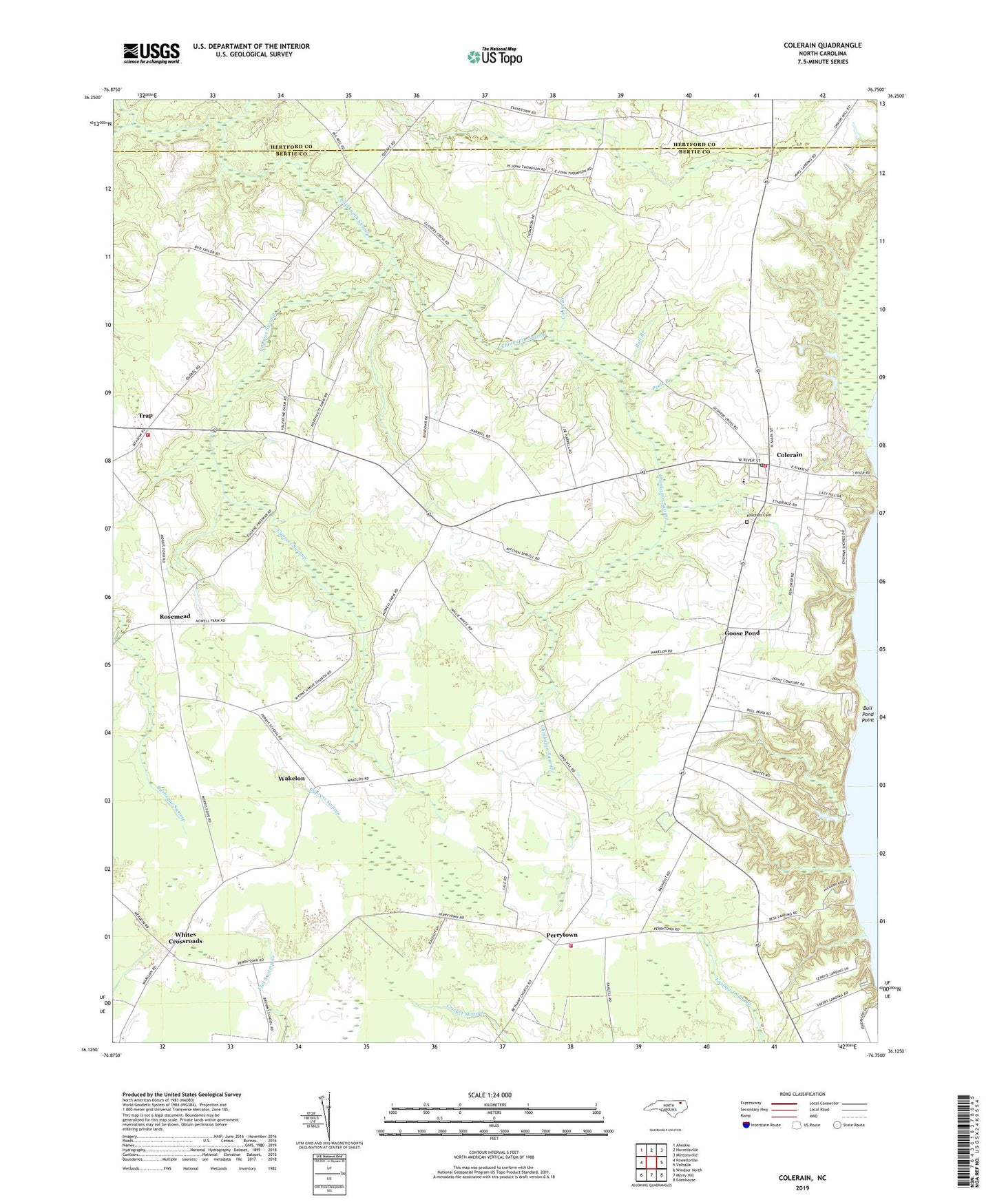
2019 topographic map quadrangle Colerain in the state of North Carolina. Scale: 1:24000. Based on the newly updated USGS 7.5' US Topo map series, this map is in the following counties: Bertie, Hertford. The map contains contour data, water features, and other items you are used to seeing on USGS maps, but also has updated roads and other features. This is the next generation of topographic maps. Printed on high-quality waterproof paper with UV fade-resistant inks.
Quads adjacent to this one:
West: Powellsville
Northwest: Ahoskie
North: Harrellsville
Northeast: Mintonsville
East: Valhalla
Southeast: Edenhouse
South: Merry Hill
Southwest: Windsor North
Contains the following named places: Barbeque Swamp, Bess Landing, Bethany Church, Bull Branch, Bull Pond Point, Cabin Branch, Colerain, Colerain Baptist Church, Colerain Beach, Colerain Post Office, Colerain Rescue Squad, Colerain Volunteer Fire Department, Cypress Swamp, Glovers Crossroads, Goose Pond, Goose Pond Landing, Hillcrest Cemetery, Long Branch, Mars Hill Church, Marys Beach, Mount Olive Church, Mount Olivet Church, New Holly Grove Church, Peele Branch, Perrytown, Perrytown Fire Department, Point Comfort Landing, Rosemead, Town of Colerain, Township of Colerain, Trap, Trap Volunteer Fire Department, Wakelon, Wakelon Church, West Colerain School, Whites Beach, Whites Crossroads, Wynns Grove Church, Zion Hill Church, ZIP Code: 27924