MyTopo
Coleridge North Carolina US Topo Map
Couldn't load pickup availability
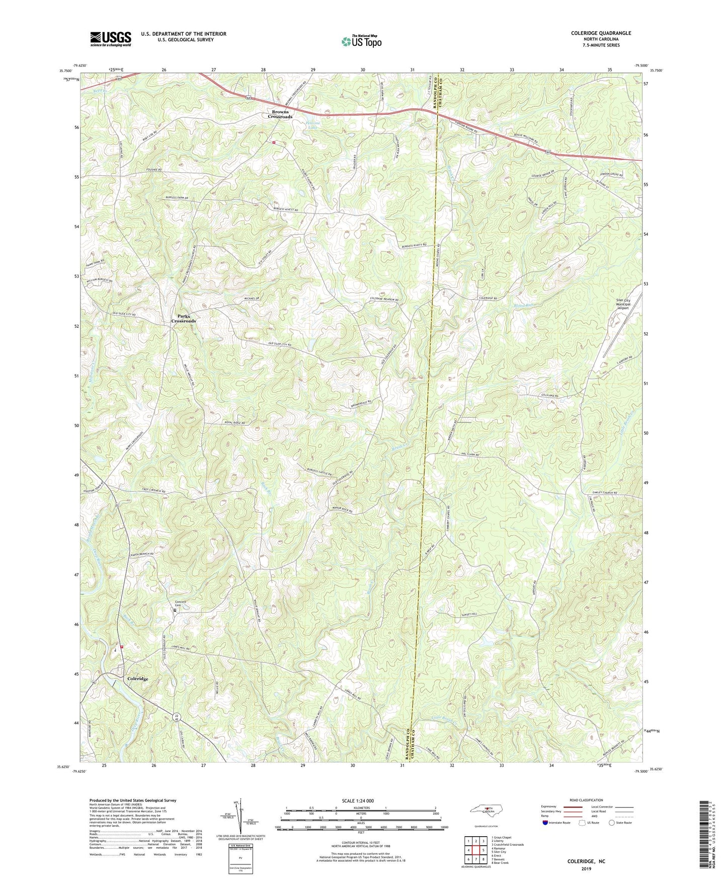
2019 topographic map quadrangle Coleridge in the state of North Carolina. Scale: 1:24000. Based on the newly updated USGS 7.5' US Topo map series, this map is in the following counties: Randolph, Chatham. The map contains contour data, water features, and other items you are used to seeing on USGS maps, but also has updated roads and other features. This is the next generation of topographic maps. Printed on high-quality waterproof paper with UV fade-resistant inks.
Quads adjacent to this one:
West: Ramseur
Northwest: Grays Chapel
North: Liberty
Northeast: Crutchfield Crossroads
East: Siler City
Southeast: Bear Creek
South: Bennett
Southwest: Erect
Contains the following named places: Allen Airport, Back Branch, Blood Run, Broad Mouth Branch, Browns Crossroads, Brush Creek Church, Caveness Field, Coleridge, Coleridge Elementary School, Coleridge Erect Fire Department Station 1, Concord Cemetery, Cox Chapel, D B Walker Shoe Company Dam, Jordan Grove Church, Kildee Wesleyan Church, Moons Chapel, New Lambert Chapel, Parks Crossroads, Peavine Lake, Peavine Lake Dam, Rehobeth Church, Siler City Municipal Airport, Staley Fire Department Station 27, Township of Coleridge