MyTopo
Costin North Carolina US Topo Map
Couldn't load pickup availability
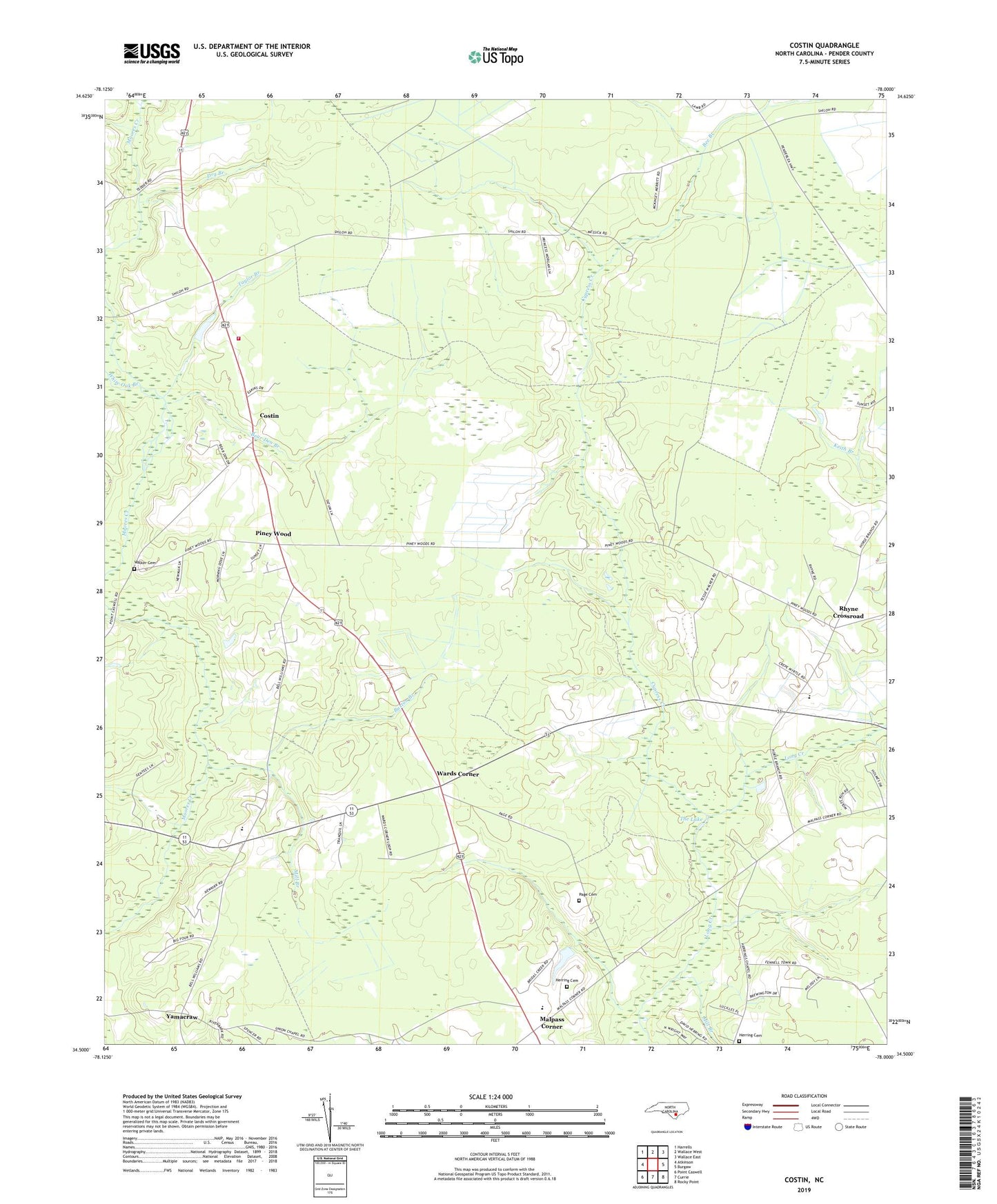
2019 topographic map quadrangle Costin in the state of North Carolina. Scale: 1:24000. Based on the newly updated USGS 7.5' US Topo map series, this map is in the following counties: Pender. The map contains contour data, water features, and other items you are used to seeing on USGS maps, but also has updated roads and other features. This is the next generation of topographic maps. Printed on high-quality waterproof paper with UV fade-resistant inks.
Quads adjacent to this one:
West: Atkinson
Northwest: Harrells
North: Wallace West
Northeast: Wallace East
East: Burgaw
Southeast: Rocky Point
South: Currie
Southwest: Point Caswell
Contains the following named places: Bear Den Branch, Bee Branch, Buxton Branch, Clear Branch School, Costin, Cypress Creek, Dry Branch, Herring Cemetery, Herring Chapel, Lake Chapel, Long Creek Church, Love Grove School, Malpass Corner, Mill Branch, Moores Creek Church, New Hope Church, North Carolina State Government Fire Tower, Page Cemetery, Pender High School, Piney Wood, Red Bank Branch, Rhyne Crossroad, Shiloh - Columbia Volunteer Fire Department Station 1900, Shiloh Church, Taylor Branch, The Lake, Township of Columbia, Union Chapel, Walker Cemetery, Wards Corner, Wells Chapel, West Pender Primary School, Westview Church, White Oak Branch, WVBS-FM (Burgaw)