MyTopo
Wallace East North Carolina US Topo Map
Couldn't load pickup availability
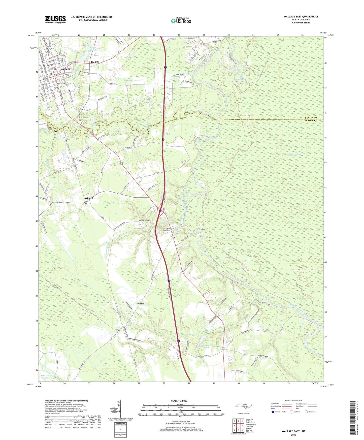
2022 topographic map quadrangle Wallace East in the state of North Carolina. Scale: 1:24000. Based on the newly updated USGS 7.5' US Topo map series, this map is in the following counties: Pender, Duplin. The map contains contour data, water features, and other items you are used to seeing on USGS maps, but also has updated roads and other features. This is the next generation of topographic maps. Printed on high-quality waterproof paper with UV fade-resistant inks.
Quads adjacent to this one:
West: Wallace West
Northwest: Rose Hill
North: Charity
Northeast: Chinquapin
East: Pin Hook
Southeast: Stag Park
South: Burgaw
Southwest: Costin
This map covers the same area as the classic USGS quad with code o34077f8.
Contains the following named places: Boney Mill Pond, Brian Center Health and Rehabilitation Center of Wallace, Camp Newkirk Pond, Camp Newkirk Pond Dam, Coastal Plain Experimental Station, Duplin County Emergency Medical Services Medic 2, Duplin County Mental Health Center, Lewis Creek, Little Rockfish Creek, Mill Branch, Mount Holly Church, Paget Branch, Pender Volunteer Emergency Medical Services and Rescue Station 5 - Union Rescue Squad, Penderlea Homesteads, Penderlea Lake, Pole Branch, Poston Church, Providence Manor, Riverview Memorial Park, Rockfish Creek, Sawyer Creek, Sills Creek, Stevecoknit Fabrics Manufacturing Plant, The Horseshoe, Tin City, Town of Wallace, Town of Watha, Township of Union, Union Rescue Squad, Wallace, Wallace Elementary School, Wallace Fire Department, Wallace Police Department, Wallace Post Office, Wallace Wastewater Treatment Plant, Wallace Wastewater Treatment Plant Number 2, Washington Creek, Watha, Willard, Willard Post Office, Willard Primary School, ZIP Code: 28466