MyTopo
Cove City North Carolina US Topo Map
Couldn't load pickup availability
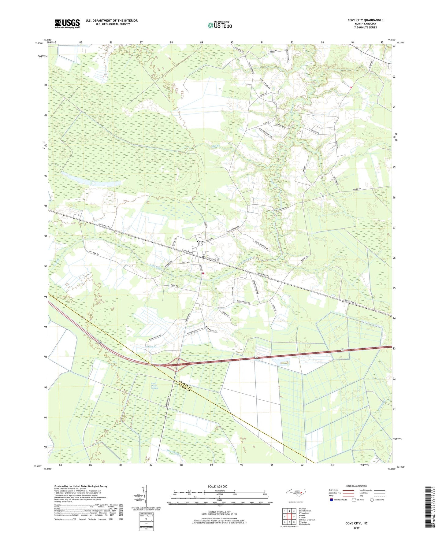
2019 topographic map quadrangle Cove City in the state of North Carolina. Scale: 1:24000. Based on the newly updated USGS 7.5' US Topo map series, this map is in the following counties: Craven, Jones. The map contains contour data, water features, and other items you are used to seeing on USGS maps, but also has updated roads and other features. This is the next generation of topographic maps. Printed on high-quality waterproof paper with UV fade-resistant inks.
Quads adjacent to this one:
West: Dover
Northwest: Grifton
North: Fort Barnwell
Northeast: Vanceboro
East: Jasper
Southeast: Pollocksville
South: Trenton
Southwest: Phillips Crossroads
Contains the following named places: Asbury Church, Bryants Chapel, Core Creek Church, Cove City, Cove City Fire Department - Station 32, Cove City Post Office, Cove City Rescue and Emergency Medical Services, Grape Creek, Great Dover Swamp, Number 9 Township Volunteer Fire Department Station 2, Perfection, Town of Cove City, Township 3, Wintergreen, Wintergreen Church, ZIP Code: 28523