MyTopo
Danbury North Carolina US Topo Map
Couldn't load pickup availability
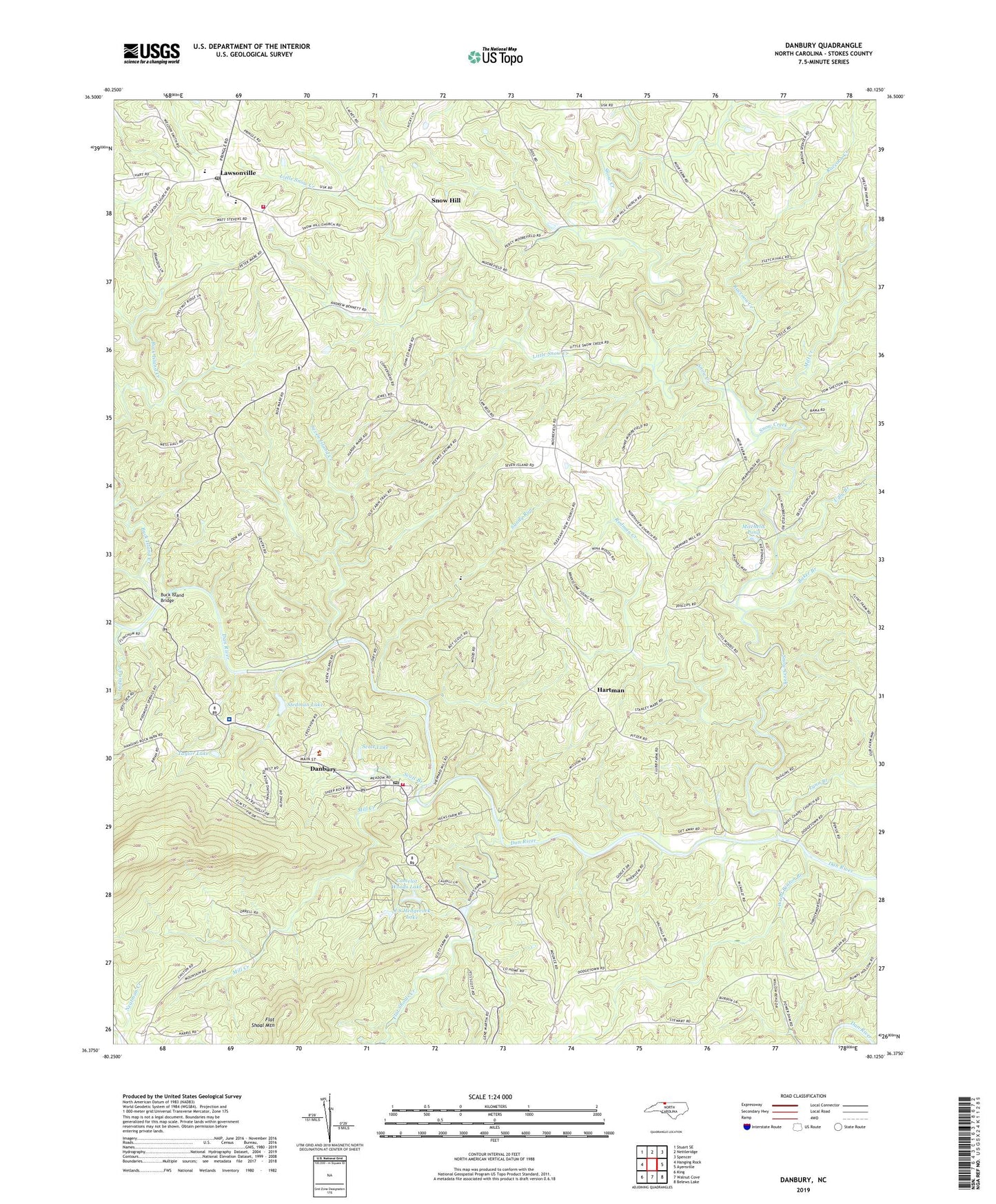
2022 topographic map quadrangle Danbury in the state of North Carolina. Scale: 1:24000. Based on the newly updated USGS 7.5' US Topo map series, this map is in the following counties: Stokes. The map contains contour data, water features, and other items you are used to seeing on USGS maps, but also has updated roads and other features. This is the next generation of topographic maps. Printed on high-quality waterproof paper with UV fade-resistant inks.
Quads adjacent to this one:
West: Hanging Rock
Northwest: Stuart SE
North: Nettleridge
Northeast: Spencer
East: Ayersville
Southeast: Belews Lake
South: Walnut Cove
Southwest: King
This map covers the same area as the classic USGS quad with code o36080d2.
Contains the following named places: Baker Branch, Boxwood, Buck Island Bridge, Buck Island Creek, Camelot Woods Dam, Camelot Woods Lake, Danbury, Danbury Courthouse Square, Danbury Historic District, Danbury Post Office, Danbury Volunteer Fire and Rescue Department, Davis Chapel Methodist Church, Davis Ford, Flat Shoal Mountain, Flat Shoals Creek, Hanging Rock State Park Site, Hartman, Indian Creek, J S Hedgecock Dam, J S Hedgecock Lake, James Martin Plantation, Lawsonville, Lawsonville Church, Lawsonville Elementary School, Lawsonville Fire and Rescue, Lawsonville Post Office, LifeBrite Community Hospital of Stokes, Little Snow Creek, Lynn Branch, Meadows Church, Mill Creek, Mitchells Pond, Mitchells Pond Lower Dam, Moores School, Moratuck Furnace, Moratuck Park, Moratuck Park Site, Newman Branch, North View Church, Pleasant View Primitive Baptist Church, Raccoon Creek, Redman Creek, Sandy Run, Scott Branch, Scott Lake, Scott Lake Dam, Seven Island Creek, Shepards Mill, Snow Creek, Snow Hill, Snow Hill United Methodist Church, Spencer-Hill Memorial Church, Stedman Lake, Stedman Lake Dam, Stokes County, Stokes County Courthouse, Stokes County Emergency Medical Services - Unit 5, Stokes County Sheriffs Office, Taylor Dam, Taylor Lake, Town of Danbury, Township of Danbury, Township of Peters Creek, Ugly Branch, Upper Sawra Town, Wood Benton Branch, Youngs School, ZIP Code: 27016