MyTopo
Nettleridge Virginia US Topo Map
Couldn't load pickup availability
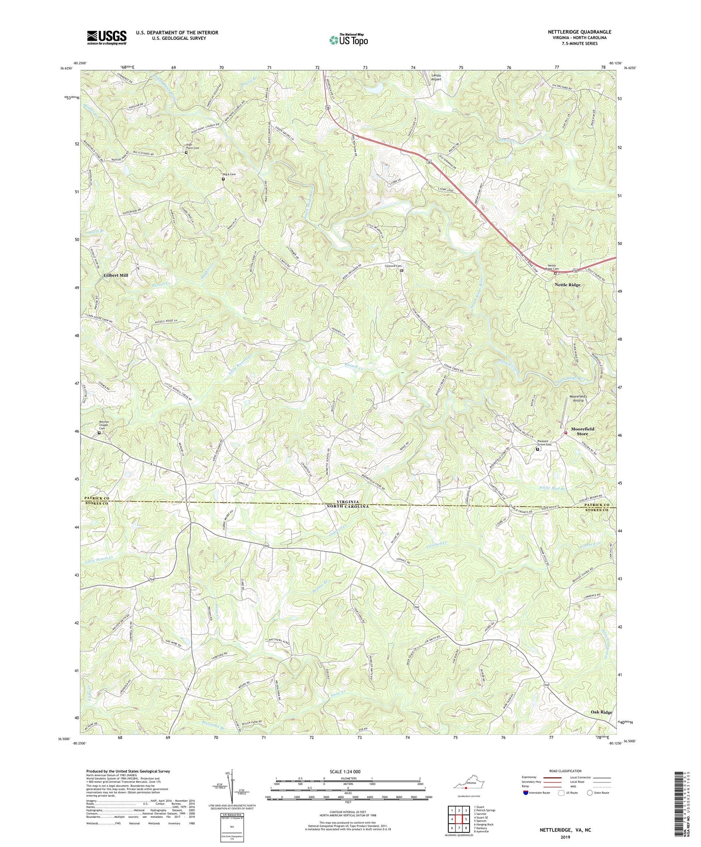
2022 topographic map quadrangle Nettleridge in the states of Virginia, North Carolina. Scale: 1:24000. Based on the newly updated USGS 7.5' US Topo map series, this map is in the following counties: Patrick, Stokes. The map contains contour data, water features, and other items you are used to seeing on USGS maps, but also has updated roads and other features. This is the next generation of topographic maps. Printed on high-quality waterproof paper with UV fade-resistant inks.
Quads adjacent to this one:
West: Stuart SE
Northwest: Stuart
North: Patrick Springs
Northeast: Sanville
East: Spencer
Southeast: Ayersville
South: Danbury
Southwest: Hanging Rock
This map covers the same area as the classic USGS quad with code o36080e2.
Contains the following named places: Anglin Branch, Ayers School, Banner Branch, Beasley School, Big A Cemetery, Big A Church, Big A School, Brown School, Cadwell Creek, Campbell, Campbell Post Office, Coleville, Coleville Post Office, Concord Cemetery, Concord Church, Gilbert Mill, Gilbert School, High Point Cemetery, High Point Church, High Point School, Hughes Creek, Indian Knob Church, Jim Boaz Dam, Jim Boaz Pond, Jute School, Lackey Store, Landis Airport, Little Peters Creek, Little Russell Creek, Macedonia School, Minnies Chapel, Minnies Chapel Cemetery, Moorefield Store, Moorefield Store Volunteer Fire Department, Moorefield's Airstrip, Mountain Branch, Nettle Ridge, Nettle Ridge Cemetery, Nettle Ridge Methodist Church, New Hope Church, Noels Branch, Oak Ridge, Oak Ridge Baptist Church, Palmetto, Palmetto School, Penn School, Peters Creek Baptist Church, Pleasant Grove Cemetery, Pleasant Grove Primitive Baptist Church, Russell Creek, Russell Creek Church, Shelton Store, Smith Chapel, Spoon Creek Church, Tatum Macedonia Church, Trinity Church, Tuggle Mill, ZIP Code: 27022