MyTopo
Walnut Cove North Carolina US Topo Map
Couldn't load pickup availability
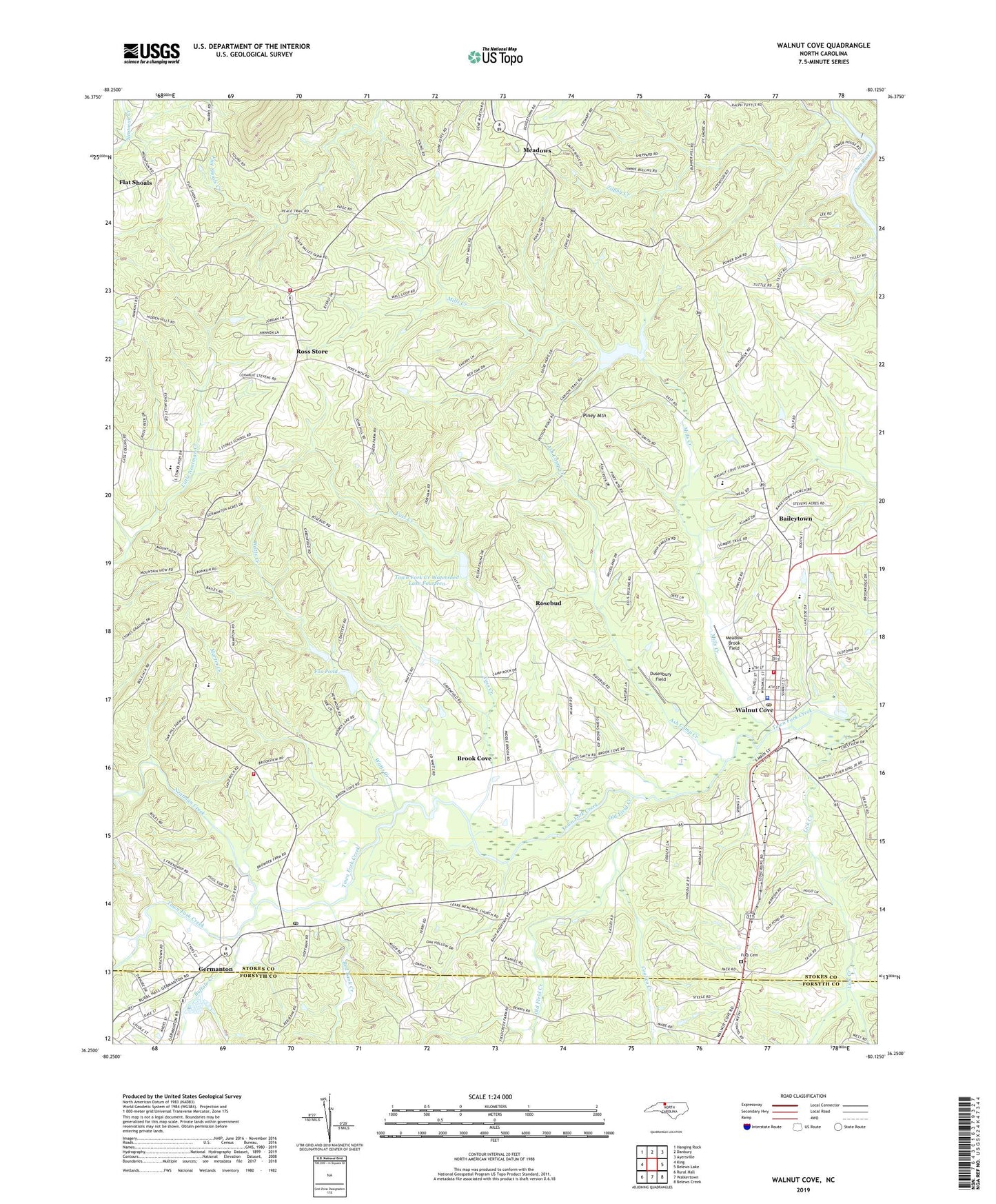
2022 topographic map quadrangle Walnut Cove in the state of North Carolina. Scale: 1:24000. Based on the newly updated USGS 7.5' US Topo map series, this map is in the following counties: Stokes, Forsyth. The map contains contour data, water features, and other items you are used to seeing on USGS maps, but also has updated roads and other features. This is the next generation of topographic maps. Printed on high-quality waterproof paper with UV fade-resistant inks.
Quads adjacent to this one:
West: King
Northwest: Hanging Rock
North: Danbury
Northeast: Ayersville
East: Belews Lake
Southeast: Belews Creek
South: Walkertown
Southwest: Rural Hall
This map covers the same area as the classic USGS quad with code o36080c2.
Contains the following named places: Ash Camp Creek, Baileytown, Bethel Baptist Church, Bethel Church, Brook Cove, Buffalo Creek, Coolico Creek, County Sheriff's Office Substation, Dusenbury Field, Flat Shoals, Fox Pond, Fox Pond Dam, Fulp, Fulp Cemetery, Fulp Memorial Church, Germanton, Germanton Census Designated Place, Germanton Post Office, Germanton United Methodist Church, Germantown Baptist Church, Germantown Courthouse Square, Germantown Elementary School, Germantown Park, Hartman Church, Isom Independent Missionary Baptist Church, Leak Memorial Church, Lick Creek, Little Neatman Creek, Martin Creek, Meadow Brook Field, Meadows, Mills Creek, Neatman Creek, New Hope Church, Old Field Creek, Palmyra United Methodist Church, Peniel Pentecostal Holiness Church, Piney Mountain, Red Bank Creek, Rosebud, Rosebud Christian Church, Ross Store, Saint Marks Church, Saint Philips Episcopal Church, Salem Chapel, South Stokes Fire and Rescue, South Stokes High School, South Stokes Volunteer Fire Department - Forest Hills Station - Station 19, Southeastern Junior High School, Stokes County Emergency Medical Services - Unit 1, Stokesburg, Stokesburg Methodist Church, Town Fork Creek Watershed Dam Number Fifteen, Town Fork Creek Watershed Dam Number Fourteen, Town Fork Creek Watershed Dam Number Thirteen, Town Fork Creek Watershed Lake Fifteen, Town Fork Creek Watershed Lake Fourteen, Town Fork Creek Watershed Lake Thirteen, Town Fork Settlement, Town of Walnut Cove, Township of Meadows, Union Church, Voss Creek, Walnut Cove, Walnut Cove Elementary School, Walnut Cove Fire and Rescue, Walnut Cove Intermediate School, Walnut Cove Lions Park, Walnut Cove Post Office, Watts Creek, Wayside Church, Willow Oak Missionary Baptist Church, Zilphy Creek, ZIP Codes: 27019, 27052